 Last additions - Oceania Islands IOTA QSL Album Last additions - Oceania Islands IOTA QSL Album |

OC-282.jpgOC-282 Vostok and Flint IslandsFlint Island is an uninhabited coral island in the central Pacific Ocean, part of the Southern Line Islands under the jurisdiction of Kiribati. Flint Island is located about 740 kilometres (400 nautical miles; 460 miles) northwest of Tahiti, 190 kilometres (100 nautical miles; 120 miles) south-southeast of Vostok Island, and 220 kilometres (120 nautical miles; 140 miles) southwest of Caroline Island. The island is now mostly covered with planted coconut palms.Jun 26, 2018
|
|

OC-281R.jpgOC-281 Caroline Island;Millennium IslandCaroline Island or Caroline Atoll (also known as Millennium Island and Beccisa Island), is the easternmost of the uninhabited coral atolls which comprise the southern Line Islands in the central Pacific Ocean, part of the Republic of Kiribati since the island nation's independence in 1979.
Caroline Island has remained relatively untouched and is considered one of the world's most pristine tropical islands. It is home to one of the world's largest populations of the coconut crab and is an important breeding site for seabirds, most notably the sooty tern.Jun 26, 2018
|
|
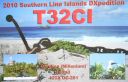
OC-281.jpgOC-281 Caroline Island;Millennium IslandCaroline Island or Caroline Atoll (also known as Millennium Island and Beccisa Island), is the easternmost of the uninhabited coral atolls which comprise the southern Line Islands in the central Pacific Ocean, part of the Republic of Kiribati since the island nation's independence in 1979.
Caroline Island has remained relatively untouched and is considered one of the world's most pristine tropical islands. It is home to one of the world's largest populations of the coconut crab and is an important breeding site for seabirds, most notably the sooty tern.Jun 26, 2018
|
|

OC-280R.jpgOC-280 Starbuck IslandStarbuck Island (or Volunteer Island) is an uninhabited coral island in the central Pacific, and is part of the Central Line Islands of Kiribati. The island boasts a large colony of sooty terns, estimated at 1.5 million pairs, together with Polynesian rats, feral cats, green turtles, and around fifteen other species of seabirds. There is no freshwater on the island, which is one of the drier atolls in the Line Island group.Jun 26, 2018
|
|

OC-280.jpgOC-280 Starbuck IslandStarbuck Island (or Volunteer Island) is an uninhabited coral island in the central Pacific, and is part of the Central Line Islands of Kiribati. The island boasts a large colony of sooty terns, estimated at 1.5 million pairs, together with Polynesian rats, feral cats, green turtles, and around fifteen other species of seabirds. There is no freshwater on the island, which is one of the drier atolls in the Line Island group.Jun 26, 2018
|
|

OC-279R.jpgOC-279 Malden IslandMalden Island, sometimes called Independence Island in the nineteenth century, is a low, arid, uninhabited atoll in the central Pacific Ocean, about 39 km2 (15 sq mi) in area. It is one of the Line Islands belonging to the Republic of Kiribati. The island is chiefly notable for its mysterious prehistoric ruins, its once-extensive deposits of phosphatic guano (exploited by Australian interests from c. 1860–1927), its former use as the site of the first British H-bomb tests (Operation Grapple, 1957), and its current importance as a protected area for breeding seabirds.Jun 26, 2018
|
|
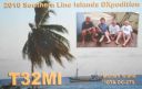
OC-279.jpgOC-279 Malden IslandMalden Island, sometimes called Independence Island in the nineteenth century, is a low, arid, uninhabited atoll in the central Pacific Ocean, about 39 km2 (15 sq mi) in area. It is one of the Line Islands belonging to the Republic of Kiribati. The island is chiefly notable for its mysterious prehistoric ruins, its once-extensive deposits of phosphatic guano (exploited by Australian interests from c. 1860–1927), its former use as the site of the first British H-bomb tests (Operation Grapple, 1957), and its current importance as a protected area for breeding seabirds.Jun 26, 2018
|
|

OC-278R.jpgOC-278 Ujelang AtollUjelang Atoll (Marshallese: Wūjlan̄, [u̯u͡izʲ(e)lʲæ͡ɑŋ][1]) is a coral atoll of 30 islands in the Pacific Ocean, in the Ralik Chain of the Marshall Islands. It is the westernmost island in the Marshall Islands, approximately 217 kilometres (135 mi) southeast of Enewetak, and approximately 600 kilometres (370 mi) west of the main Ralik Chain. In 1989 Ujelang became permanently uninhabited. Ujelang Atoll is currently owned by the Enewetak Council and is now very rarely visited.Jun 26, 2018
|
|

OC-278.jpgOC-278 Ujelang AtollUjelang Atoll (Marshallese: Wūjlan̄, [u̯u͡izʲ(e)lʲæ͡ɑŋ][1]) is a coral atoll of 30 islands in the Pacific Ocean, in the Ralik Chain of the Marshall Islands. It is the westernmost island in the Marshall Islands, approximately 217 kilometres (135 mi) southeast of Enewetak, and approximately 600 kilometres (370 mi) west of the main Ralik Chain. In 1989 Ujelang became permanently uninhabited. Ujelang Atoll is currently owned by the Enewetak Council and is now very rarely visited.Jun 26, 2018
|
|

OC-277R.jpgOC-277 Sorol AtollSorol is a coral atoll of nine islands in the central Caroline Islands in the Pacific Ocean, and forms a legislative district in Yap State in the Federated States of Micronesia. Sorol is located approximately 150 kilometres (93 mi) south of Ulithi and 250 kilometres (160 mi) southeast of the island of Yap.Jun 26, 2018
|
|

OC-277.jpgOC-277 Sorol AtollSorol is a coral atoll of nine islands in the central Caroline Islands in the Pacific Ocean, and forms a legislative district in Yap State in the Federated States of Micronesia. Sorol is located approximately 150 kilometres (93 mi) south of Ulithi and 250 kilometres (160 mi) southeast of the island of Yap.Jun 26, 2018
|
|
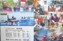
OC-276R.jpgOC-276 Mapia IslandsMapia Atoll (Indonesian: Kepulauan Mapia), historically known as the Freewill Islands or San David, is an atoll in the Pacific Ocean. It is located in Papua province of Indonesia, approximately 290 kilometers north of the city of Manokwari and 630 kilometers from the islands of Palau. Jun 26, 2018
|
|

OC-276.jpgOC-276 Mapia IslandsMapia Atoll (Indonesian: Kepulauan Mapia), historically known as the Freewill Islands or San David, is an atoll in the Pacific Ocean. It is located in Papua province of Indonesia, approximately 290 kilometers north of the city of Manokwari and 630 kilometers from the islands of Palau. Jun 26, 2018
|
|
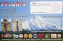
OC-275R.jpgOC-275 West Papua's Coastal Islands SouthPulau Yos Sudarso or Pulau Dolak is an island separated only by the narrow Muli Strait from the main island of New Guinea. It is part of the Merauke Regency, in the Indonesian province of Papua. The island is leaf-shaped, about 165 km (103 mi) long with an area of 11,740 km2 (4,530 sq mi). It was known as Frederik Hendrik Island until 1963. Local and alternative names of the island include Dolok, Kimaam and Kolepom. The island has a pop of 11,000 approx,Jun 26, 2018
|
|

OC-275.jpgOC-275 West Papua's Coastal Islands SouthPulau Yos Sudarso or Pulau Dolak is an island separated only by the narrow Muli Strait from the main island of New Guinea. It is part of the Merauke Regency, in the Indonesian province of Papua. The island is leaf-shaped, about 165 km (103 mi) long with an area of 11,740 km2 (4,530 sq mi). It was known as Frederik Hendrik Island until 1963. Local and alternative names of the island include Dolok, Kimaam and Kolepom. The island has a pop of 11,000 approx,Jun 26, 2018
|
|
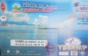
OC-274.jpgOC-274 Lucipara and Penyu IslandsPenyu Islands are part of the Molucca Islands, located at the south of Strait of Manipa near Ceram, Indonesia. To the west are the Lucipara Islands, to the east the Banda Islands and the south the Barat Daya Islands.Jun 26, 2018
|
|
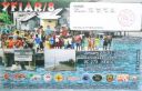
OC-273R.jpgOC-273 Gorong and Watubela IslandsGorong archipelago is a group of islands between Watubela archipelago and Ceram in the Maluku Islands, Indonesia. Gorom, is the biggest island, with the villages of Miran (Miren) on the east coast, Ondor (Ondur) in the northwest and Hur on its southwestern coast.Jun 26, 2018
|
|

OC-273.jpgOC-273 Gorong and Watubela IslandsGorong archipelago is a group of islands between Watubela archipelago and Ceram in the Maluku Islands, Indonesia. Gorom, is the biggest island, with the villages of Miran (Miren) on the east coast, Ondor (Ondur) in the northwest and Hur on its southwestern coast.Jun 26, 2018
|
|

OC-272R.jpgOC-272 Barat Daya IslandsKisar, also known as Yotowawa, is a small island in the Southwestern Moluccas in Indonesia. It is included within the Southernmost Islands District (Kecamatan Pulau-Pulau Terselatan) within the Southwest Islands Regency of the Maluku Province; the District also includes the larger (but less populated) Romang Island further north. It is one of the 92 officially listed outlying islands of Indonesia. The principal town is Wonreli, with 6,652 inhabitants at the 2010 CensusJun 26, 2018
|
|

OC-272.jpgOC-272 Barat Daya IslandsKisar, also known as Yotowawa, is a small island in the Southwestern Moluccas in Indonesia. It is included within the Southernmost Islands District (Kecamatan Pulau-Pulau Terselatan) within the Southwest Islands Regency of the Maluku Province; the District also includes the larger (but less populated) Romang Island further north. It is one of the 92 officially listed outlying islands of Indonesia. The principal town is Wonreli, with 6,652 inhabitants at the 2010 CensusJun 26, 2018
|
|
OC-271R.jpgOC-271 Babar IslandsThe Babar Islands (Indonesian: Kepulauan Babar) are located in Maluku Province, Indonesia. Tepa (a town with a population of about 2,000 people) is the administrative center of the Babar Islands municipality. The topography of all the Babar islands is distinctive for their marked stepped appearance, the result of a combination of periodic uplifting of the tectonic plate. Small freighters that have contracts to carry passengers service the islands. Jun 26, 2018
|
|

OC-271.jpgOC-271 Babar IslandsThe Babar Islands (Indonesian: Kepulauan Babar) are located in Maluku Province, Indonesia. Tepa (a town with a population of about 2,000 people) is the administrative center of the Babar Islands municipality. The topography of all the Babar islands is distinctive for their marked stepped appearance, the result of a combination of periodic uplifting of the tectonic plate. Small freighters that have contracts to carry passengers service the islands. Jun 26, 2018
|
|

OC-270R.jpgOC-270 Simeulue and Banyak IslandsSimeulue is an island of Indonesia, 150 kilometres (93 mi) off the west coast of Sumatra. Its capital is Sinabang. The SW facing portion of the island holds multiple world class waves and a handful of surf resorts have popped up in recent years.Jun 26, 2018
|
|

OC-270.jpgOC-270 Simeulue and Banyak IslandsSimeulue is an island of Indonesia, 150 kilometres (93 mi) off the west coast of Sumatra. Its capital is Sinabang. The SW facing portion of the island holds multiple world class waves and a handful of surf resorts have popped up in recent years.Jun 26, 2018
|
|

OC-269R.jpgOC-269 Karimata IslandsThe Karimata Islands are a chain of small islands off the west coast of Indonesian Borneo, the largest of which is (Pulau) Karimata, being about 20 km (12 mi) across (east-west), and situated at 1°37′S 108°53′E. It is part of Kayong Utara in Indonesia. A number of small villages are situated on the coast, the largest of which is Padang, on the eastern tip of the island. The island is renowned by inhabitants of the west coast of Kalimantan to have a serious malaria problem.Jun 26, 2018
|
|
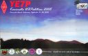
OC-269.jpgOC-269 Karimata IslandsThe Karimata Islands are a chain of small islands off the west coast of Indonesian Borneo, the largest of which is (Pulau) Karimata, being about 20 km (12 mi) across (east-west), and situated at 1°37′S 108°53′E. It is part of Kayong Utara in Indonesia. A number of small villages are situated on the coast, the largest of which is Padang, on the eastern tip of the island. The island is renowned by inhabitants of the west coast of Kalimantan to have a serious malaria problem.Jun 26, 2018
|
|

OC-268R.jpgOC-268 Laut Kecil IslandsLaut Kecil Islands is an archipelago in the south of Borneo. Administratively, the islands belong to South Kalimantan province of Indonesia. The main islands include Matasiri, Kalambau, and Kadapongan.Jun 26, 2018
|
|
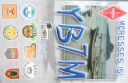
OC-268.jpgOC-268 Laut Kecil IslandsLaut Kecil Islands is an archipelago in the south of Borneo. Administratively, the islands belong to South Kalimantan province of Indonesia. The main islands include Matasiri, Kalambau, and Kadapongan.Jun 26, 2018
|
|

OC-267.jpgOC-267 Coral Sea Islands Territory NorthMarion Island is part of the Coral Islands North West Group in northern Queensland, Australia. Marion Reef is al arge circular atoll formation that is composed of three main units located on the Eastern side: Marion, Long and Wansfell; and a number of smaller reefs on the west. The formation sits atop a submarine feature known as the Marion Plateau which is separated from the larger Coral Sea Plateau to the north by the Townsville Trough. The island is uninhabitedJun 26, 2018
|
|

OC-266.jpgOC-266 Western Australia State (North Coast) Centre groupViney is an uninhabited island located in the remote north west of Western Australia north east of the town of Derby and the Dampier Peninsula.Jun 26, 2018
|
|

OC-265R.jpgOC-265 Coral Sea Islands Territory SouthCato Island 23°15′S 155°32′E, is a small oval-shaped island lying approximately 375 km (233 mi) east of Gladstone, Queensland and about 270 km (170 mi) east-southeast of the southern end of the Great Barrier Reef. This island is approximately 115 km (71 mi) south of Bird Islet, part of the east end of Wreck Reefs. The island is a mound of coral debris and grit 5.8 m (19 ft) high, covered in grass and creepers up to 1 m (3.3 ft) high. An automatic weather station, with two radio masts and a silver-painted hut, stands on the northeast end of the islandJun 26, 2018
|
|

OC-265.jpgOC-265 Coral Sea Islands Territory SouthCato Island 23°15′S 155°32′E, is a small oval-shaped island lying approximately 375 km (233 mi) east of Gladstone, Queensland and about 270 km (170 mi) east-southeast of the southern end of the Great Barrier Reef. This island is approximately 115 km (71 mi) south of Bird Islet, part of the east end of Wreck Reefs. The island is a mound of coral debris and grit 5.8 m (19 ft) high, covered in grass and creepers up to 1 m (3.3 ft) high. An automatic weather station, with two radio masts and a silver-painted hut, stands on the northeast end of the islandJun 26, 2018
|
|

OC-264R.jpgOC-264 Maria IslandÎles Maria or simply Maria, also known as Hull Island, is a small coral atoll in the Pacific Ocean. Its original name is Nororotu. The nearest island is Rimatara situated 205 kilometres (127 miles) to the ESE. The atoll consists of four islets (îles), with a dense atoll forest and a very shallow lagoon, supporting numerous bird species. The atoll is uninhabited now, but at one time was the site of a penal colony. Copra is occasionally harvested at the island.Jun 26, 2018
|
|

OC-264.jpgOC-264 Maria IslandÎles Maria or simply Maria, also known as Hull Island, is a small coral atoll in the Pacific Ocean. Its original name is Nororotu. The nearest island is Rimatara situated 205 kilometres (127 miles) to the ESE. The atoll consists of four islets (îles), with a dense atoll forest and a very shallow lagoon, supporting numerous bird species. The atoll is uninhabited now, but at one time was the site of a penal colony. Copra is occasionally harvested at the island.Jun 26, 2018
|
|

OC-263P.jpgOC-263 Taongi Atoll;Bokaak AtollBokak Atoll or Taongi Atoll is an uninhabited coral atoll in the Ratak Chain of the Marshall Islands, in the North Pacific Ocean. It is located 685 km (426 mi) north of Majuro Atoll, the capital of the Marshall Islands, and 280 km (170 mi) northeast of Bikar Atoll, the closest atoll, making it the most northerly and most isolated atoll of the country. Wake Island is 348 mi (560 km) north-northwest. The land area is 3.2 km2 (1.2 sq mi), and the lagoon measures 78 km2 (30 sq mi). It consists of 36 islets. The total area is 129 km2 (50 sq mi) (including reef flat).Jun 26, 2018
|
|
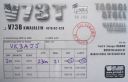
OC-263S.jpgOC-263 Taongi Atoll;Bokaak AtollBokak Atoll or Taongi Atoll is an uninhabited coral atoll in the Ratak Chain of the Marshall Islands, in the North Pacific Ocean. It is located 685 km (426 mi) north of Majuro Atoll, the capital of the Marshall Islands, and 280 km (170 mi) northeast of Bikar Atoll, the closest atoll, making it the most northerly and most isolated atoll of the country. Wake Island is 348 mi (560 km) north-northwest. The land area is 3.2 km2 (1.2 sq mi), and the lagoon measures 78 km2 (30 sq mi). It consists of 36 islets. The total area is 129 km2 (50 sq mi) (including reef flat).Jun 26, 2018
|
|
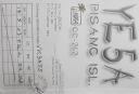
OC-262R.jpgOC-262 Sumatra's Coastal Islands SouthPulau Pisang or “Banana Island†lies just 45 minutes off the coast of Krui, Sumatra, and is also home to some of the best white sand beaches, snorkeling and fishing in the Krui area. The island is home to less than 100 people,Jun 26, 2018
|
|

OC-262.jpgOC-262 Sumatra's Coastal Islands SouthPulau Pisang or “Banana Island†lies just 45 minutes off the coast of Krui, Sumatra, and is also home to some of the best white sand beaches, snorkeling and fishing in the Krui area. The island is home to less than 100 people,Jun 26, 2018
|
|

OC-261R.jpgOC-261 South Australia State West Centre groupWaldegrave Islands is an island group in the Australian state of South Australia located in the Investigator Group about 2.5 kilometres (1.6 miles) northwest by west of Cape Finniss on the west coast of Eyre Peninsula. The group consists of Waldegrave Island, Little Waldegrave Island and according to some sources, a pair of rocks known as the Watchers. The group is notable as a breeding site for Australian sea lions and Cape Barren geese. The group has enjoyed protected area status since the 1960s and as of 1972 has been part of the Waldegrave Islands Conservation Park.Jun 26, 2018
|
|

OC-261.jpgOC-261 South Australia State West Centre groupWaldegrave Islands is an island group in the Australian state of South Australia located in the Investigator Group about 2.5 kilometres (1.6 miles) northwest by west of Cape Finniss on the west coast of Eyre Peninsula. The group consists of Waldegrave Island, Little Waldegrave Island and according to some sources, a pair of rocks known as the Watchers. The group is notable as a breeding site for Australian sea lions and Cape Barren geese. The group has enjoyed protected area status since the 1960s and as of 1972 has been part of the Waldegrave Islands Conservation Park.Jun 26, 2018
|
|
| 478 files on 12 page(s) |
2 |  |
|
|
|
|
|
|
|
|
|
 Contact
