 Last additions - Europe Islands IOTA QSL Album (all 192 islands confirmed) Last additions - Europe Islands IOTA QSL Album (all 192 islands confirmed) |

EU-150R.jpgEU-150 Portugal Minho / Douro Litoral / Beira Litoral Province groupFortress of Insua Island (Portugal), of the XVII century, located in the Minho River estuary, between the coast of Caminha (Portugal) and La Guardia (Spain). Inside the fort is the Franciscan convent of Saint Mary of Insua, built in 1471.Jun 25, 2018
|
|

EU-150.jpgEU-150 Portugal Minho / Douro Litoral / Beira Litoral Province groupFortress of Insua Island (Portugal), of the XVII century, located in the Minho River estuary, between the coast of Caminha (Portugal) and La Guardia (Spain). Inside the fort is the Franciscan convent of Saint Mary of Insua, built in 1471.Jun 25, 2018
|
|

EU-149.jpgEU-149 Estonia Tallinn & Harjumaa / Virumaa County groupMohni island (area 62.5 ha) is situated on the territory of Lahemaa National Park, north-east of Eru Bay, 4.5 kilometres from the coastline of Viinistu. The island’s landmarks feature a lighthouse and remains of a Soviet era border guard station’s auxiliary buildings. Jun 25, 2018
|
|

EU-148R.jpgEU-148 France Languedoc-Roussillon Region groupThe island of Brescou is in the territory of the town of Agde ( Hérault ), about half a nautical mile from the entrance of port Richelieu (Cap d'Agde) and a little less than three miles from the sea. mouth of the Hérault . Of volcanic origin, it has an area of 0.5 hectares .On this island is a disused fort , which includes an old lantern, still visible, and a modern lighthouse .Jun 25, 2018
|
|
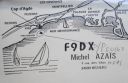
EU-148.jpgEU-148 France Languedoc-Roussillon Region groupThe island of Brescou is in the territory of the town of Agde ( Hérault ), about half a nautical mile from the entrance of port Richelieu (Cap d'Agde) and a little less than three miles from the sea. mouth of the Hérault . Of volcanic origin, it has an area of 0.5 hectares .On this island is a disused fort , which includes an old lantern, still visible, and a modern lighthouse .Jun 25, 2018
|
|

EU-147.jpgEU-147 Russia White Sea Coast groupOstrov Sonostrov, Karelia island is located in the White Sea and is north of Sonostrov and southeast of Mys Voroniy. Jun 25, 2018
|
|
EU-146R.jpgEU-146 Netherlands Zuid Holland / Zeeland Province groupGoeree-Overflakkee is the southernmost delta island of the province of South Holland, Netherlands. It is separated from Voorne-Putten and Hoeksche Waard by the Haringvliet, from the mainland of North Brabant by the Volkerak, and from Schouwen-Duiveland by Lake Grevelingen.Jun 25, 2018
|
|
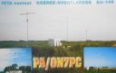
EU-146.jpgEU-146 Netherlands Zuid Holland / Zeeland Province groupGoeree-Overflakkee is the southernmost delta island of the province of South Holland, Netherlands. It is separated from Voorne-Putten and Hoeksche Waard by the Haringvliet, from the mainland of North Brabant by the Volkerak, and from Schouwen-Duiveland by Lake Grevelingen.Jun 25, 2018
|
|

EU-145.jpgEU-145 Portugal Algarve Province groupCulatra Island is an island in the Algarve, Portugal. It is divided into three parts: Farol, Hângares and Culatra. The island is a short distant east from the Algarve capital of Faro and the island is 6 kilometres (3.7 miles) in length and 100 to 900 metres (330 to 2,950 feet) width, with no roads or vehicles, but interlaced with wooden walkways. There are about 1,000 inhabitants on the island year round.Jun 25, 2018
|
|

EU-144.jpgEU-144 Italy Calabria / Basilicata region groupCirella Island is located in the Tyrrhenian Sea alongside the Italian town of Diamante.Jun 25, 2018
|
|
EU-143R.jpgEU-143 Spain Cadiz / Huelva Province groupThe Islote de Sancti Petri is a small barren island belonging to the municipality of San Fernando, Cádiz in the province of Cádiz and the autonomous region of Andalusia, Spain. For many years, the island was a restricted military zone, but it is now under the control of the Spanish Environment Ministry.Jun 25, 2018
|
|
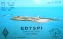
EU-143.jpgEU-143 Spain Cadiz / Huelva Province groupThe Islote de Sancti Petri is a small barren island belonging to the municipality of San Fernando, Cádiz in the province of Cádiz and the autonomous region of Andalusia, Spain. For many years, the island was a restricted military zone, but it is now under the control of the Spanish Environment Ministry.Jun 25, 2018
|
|

EU-142R.jpgEU-142 Spain Oviedo / Santander Province groupMouro Island, originally Mogro Island, is a small uninhabited island in the Bay of Biscay, located off the Magdalena Peninsula. It lies close to the entrance to the Bay of Santander near the city of Santander, Cantabria along the north coast of SpainJun 25, 2018
|
|

EU-142.jpgEU-142 Spain Oviedo / Santander Province groupMouro Island, originally Mogro Island, is a small uninhabited island in the Bay of Biscay, located off the Magdalena Peninsula. It lies close to the entrance to the Bay of Santander near the city of Santander, Cantabria along the north coast of SpainJun 25, 2018
|
|

EU-141R.jpgEU-141 Norway Finnmark County East groupVardo is an island in Finnmark county in the extreme northeastern part of Norway. The administrative centre of the municipality is also the town of Vardø. The island is connected to the mainland via the undersea Vardø Tunnel (Norway's first such structure). Jun 25, 2018
|
|
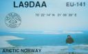
EU-141.jpgEU-141 Norway Finnmark County East groupVardo is an island in Finnmark county in the extreme northeastern part of Norway. The administrative centre of the municipality is also the town of Vardø. The island is connected to the mainland via the undersea Vardø Tunnel (Norway's first such structure). Jun 25, 2018
|
|
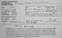
EU-140R.jpgEU-140 Finland Etela-Suomi (Kymi) Province groupKuutsalo is an island and village on the Gulf of Finland in the city of Kotka . The island is located three kilometers southeast of the city center of Kotka Island . The village of Kuutsalo also includes several other islands, the largest of which is Kirkonmaa , located to the south of it. Kuutsalo has 27 inhabitants and Rankki-Kirkonmaa has 17 inhabitants (31.12.2012).Jun 25, 2018
|
|

EU-140.jpgEU-140 Finland Etela-Suomi (Kymi) Province groupKuutsalo is an island and village on the Gulf of Finland in the city of Kotka . The island is located three kilometers southeast of the city center of Kotka Island . The village of Kuutsalo also includes several other islands, the largest of which is Kirkonmaa , located to the south of it. Kuutsalo has 27 inhabitants and Rankki-Kirkonmaa has 17 inhabitants (31.12.2012).Jun 25, 2018
|
|

EU-139R.jpgEU-139 Norway Norrbotten County groupSeskarö is a locality situated in Haparanda Municipality, Norrbotten County, Sweden with 491 inhabitants in 2010. It is located on the island with the same name which is about 20 km2 and situated in the Haparanda Archipelago. Since 1978, it has been connected to the mainland through a bridge, via some intermediate islands.
Jun 25, 2018
|
|
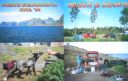
EU-139.jpgNA-139 Norway Norrbotten County groupSeskarö is a locality situated in Haparanda Municipality, Norrbotten County, Sweden with 491 inhabitants in 2010. It is located on the island with the same name which is about 20 km2 and situated in the Haparanda Archipelago. Since 1978, it has been connected to the mainland through a bridge, via some intermediate islands.Jun 25, 2018
|
|

EU-138.jpgEU-138 Sweden Blekinge County groupHanö is an island off Listerlandet peninsula, western Blekinge, Sweden.
Between 1810 and 1812 the Royal Navy of the United Kingdom used the island as its base during its operations in the Baltic Sea. The "English Seaman's Graveyard" is situated on the island, and still today British warships visit the island to pay tribute to the fifteen sailors who rest there.Jun 25, 2018
|
|
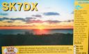
EU-137.jpgEU-137 Sweden Skane County groupVen is a small Swedish island in the Øresund strait, between Scania and Zealand. It is part of Landskrona Municipality, Skåne County. The island has 371 inhabitants and an area of 7.5 km². During the 1930s, the population was at its peak, with approximately 1,300 inhabitants.Jun 25, 2018
|
|
EU-136R.jpgEU-136 Croatia Kvarner groupLošinj is a Croatian island in the northern Adriatic Sea, in the Kvarner Gulf. It is almost due south of the city of Rijeka and part of the Primorje-Gorski Kotar County.Jun 25, 2018
|
|

EU-136.jpgEU-136 Croatia Kvarner groupLošinj is a Croatian island in the northern Adriatic Sea, in the Kvarner Gulf. It is almost due south of the city of Rijeka and part of the Primorje-Gorski Kotar County.Jun 25, 2018
|
|
EU-135R.jpgEU-135 Sweden Vasterbotten County groupHolmöarna is an island group in the Kvarken narrows of the Gulf of Bothnia between Sweden and Finland. The islands form part of Umeå Municipality in Västerbotten County. The islands have 75 year-round inhabitants[and the largest islands are Holmön, Ängesön, Grossgrunden, Holmögadd and Lilla and Stora Fjäderägg. Large areas of the islands have been set aside as nature reserves.Jun 25, 2018
|
|
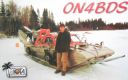
EU-135.jpgEU-135 Sweden Vasterbotten County groupHolmöarna is an island group in the Kvarken narrows of the Gulf of Bothnia between Sweden and Finland. The islands form part of Umeå Municipality in Västerbotten County. The islands have 75 year-round inhabitants[and the largest islands are Holmön, Ängesön, Grossgrunden, Holmögadd and Lilla and Stora Fjäderägg. Large areas of the islands have been set aside as nature reserves.Jun 25, 2018
|
|
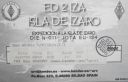
EU-134R.jpgEU-134 Spain Bilbao / San Sebastian (Basque Country) Province groupÃzaro is an island of Spain in the waters of the Cantabrian Sea, located on the coast of the province of Vizcaya , in front of the towns of Bermeo and Mundaca at a distance of 3 km from the first and 2.2 km from the second. However, the territory belongs to the town of Bermeo . The island occupies the center of the estuary of the Mundaca estuary, and is flanked by the capes of Ogoño and Machichaco . It is included in the natural area of Urdaibai .Jun 25, 2018
|
|

EU-134.jpgEU-134 Spain Bilbao / San Sebastian (Basque Country) Province groupÃzaro is an island of Spain in the waters of the Cantabrian Sea, located on the coast of the province of Vizcaya , in front of the towns of Bermeo and Mundaca at a distance of 3 km from the first and 2.2 km from the second. However, the territory belongs to the town of Bermeo . The island occupies the center of the estuary of the Mundaca estuary, and is flanked by the capes of Ogoño and Machichaco . It is included in the natural area of Urdaibai .Jun 25, 2018
|
|

EU-133R.jpgEU-133 Russia Gulf of Finland South groupGogland or Hogland is an island in the Gulf of Finland in the eastern Baltic Sea, about 180 km west from Saint Petersburg and 35 km from the coast of Finland (near Kotka). Hogland has an area of approximately 21 km2 (8.1 sq mi); its highest point is 173 m (568 ft). It belongs to Russia's Kingiseppsky District in the Leningrad Oblast.Jun 25, 2018
|
|
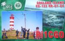
EU-133.jpgEU-133 Russia Gulf of Finland South groupGogland or Hogland is an island in the Gulf of Finland in the eastern Baltic Sea, about 180 km west from Saint Petersburg and 35 km from the coast of Finland (near Kotka). Hogland has an area of approximately 21 km2 (8.1 sq mi); its highest point is 173 m (568 ft). It belongs to Russia's Kingiseppsky District in the Leningrad Oblast.Jun 25, 2018
|
|

EU-132R.jpgEU-132 Poland Szczecin / Koszalin Province groupWolin is the name both of a Polish island in the Baltic Sea, just off the Polish coast, and a town on that island. Administratively the island belongs to the West Pomeranian Voivodeship. Wolin is separated from the island of Usedom (Uznam) by the Strait of Åšwina, and from mainland Pomerania by the Strait of Dziwna. The island has an area of 265 km2 (102 sq mi) and its highest point is Mount Grzywacz at 116 m above sea level. Jun 25, 2018
|
|
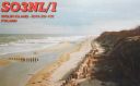
EU-132.jpgEU-132 Poland Szczecin / Koszalin Province groupWolin is the name both of a Polish island in the Baltic Sea, just off the Polish coast, and a town on that island. Administratively the island belongs to the West Pomeranian Voivodeship. Wolin is separated from the island of Usedom (Uznam) by the Strait of Åšwina, and from mainland Pomerania by the Strait of Dziwna. The island has an area of 265 km2 (102 sq mi) and its highest point is Mount Grzywacz at 116 m above sea level. Jun 25, 2018
|
|

EU-131.jpgEU-131 Italy Veneto Region groupPellestrina is an island in northern Italy, forming a barrier between the southern Venetian Lagoon and the Adriatic Sea, lying south west of the Lido. The island is 11 kilometres long and has since the eighteenth century been bounded to its seaward side by large embankments.Jun 25, 2018
|
|

EU-130.jpgEU-130 Italy Friuli-Venezia Giulia Region groupGrado is a town and comune in the north-eastern Italian region of Friuli-Venezia Giulia, located on an island and adjacent peninsula of the Adriatic Sea between Venice and Trieste. Once mainly a fishing center, today it is a popular tourist destination.Jun 25, 2018
|
|

EU-129R.jpgEU-129 Germany Usedom Island;Uznam IslandUsedom is a Baltic Sea island in Pomerania, divided since 1945 between Germany and Poland. It is the second biggest Pomeranian island after Rügen. It is situated north of the Szczecin Lagoon estuary of the River Oder. Jun 25, 2018
|
|
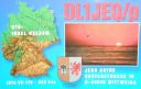
EU-129.jpgEU-129 Germany Usedom Island;Uznam IslandUsedom is a Baltic Sea island in Pomerania, divided since 1945 between Germany and Poland. It is the second biggest Pomeranian island after Rügen. It is situated north of the Szczecin Lagoon estuary of the River Oder. Jun 25, 2018
|
|
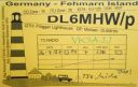
EU-128.jpgEU-128 Germany Schleswig-Holstein State East groupFehmarn s an island in the Baltic Sea, off the eastern coast of Schleswig-Holstein, Germany, and c. 18 kilometers south of the Danish island of Lolland. It belongs to the district of Ostholstein, Germany. Since 1963, Fehmarn has been connected to the German mainland by a road and rail bridge crossing the Fehmarn Sound Bridge. It is 963.40 m (3160.76 ft.) long and 69 m high.Jun 25, 2018
|
|
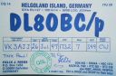
EU-127.jpgEU-127 Germany Schleswig-Holstein State South West groupHeligoland is a small archipelago in the North Sea. Today a part of the German state of Schleswig-Holstein, the islands have historically been possessions of Denmark and later the United Kingdom. The islands are located in the Heligoland Bight (part of the German Bight) in the southeastern corner of the North Sea and had a population of 1,127 at the end of 2016.Jun 25, 2018
|
|

EU-126R.jpgEU-126 Finland Lappi Province groupKuljunkari Island lies in the Bothnian Bay in northern Finland. If an island is defined as an area of land more than 20 square metres (220 sq ft) that is surrounded by water, the Bay of Bothnia has 4,001 islands. Many of the islands are uninhabited and in a natural state. In the winter the larger islands may be accessed via ice roads. Some of them are inhabited or have seasonal fishing villages used by people from the mainlandJun 25, 2018
|
|

EU-126.jpgEU-126 Finland Lappi Province groupKuljunkari Island lies in the Bothnian Bay in northern Finland. If an island is defined as an area of land more than 20 square metres (220 sq ft) that is surrounded by water, the Bay of Bothnia has 4,001 islands. Many of the islands are uninhabited and in a natural state. In the winter the larger islands may be accessed via ice roads. Some of them are inhabited or have seasonal fishing villages used by people from the mainlandJun 25, 2018
|
|
|
|
 Contact

