 Last additions - Europe Islands IOTA QSL Album (all 192 islands confirmed) |

EU-176.jpgEU-176 Sweden Gavleborg County groupKlacksörarna, is an uninhabited island in Gävleborg County close to the south eastern coast of Sweden in the Baltic Sea.Jun 25, 2018
|
|

EU-175.jpgEU-175 Central Azores groupTerceira is an volcanic island in the Azores archipelago, in the middle of the North Atlantic Ocean. It is one of the larger islands of the archipelago, with a population of 56,000 inhabitants in an area of approximately 396.75 square kilometres. Jun 25, 2018
|
|

EU-174R.jpgEU-174 Greece Makedonia / Thraki Region groupThasos or Thassos is a Greek island, geographically part of the North Aegean Sea, but administratively part of the Kavala regional unit. It is the northernmost major Greek island, and 12th largest by area. Thasos is also the name of the largest town of the island (officially known as Limenas Thasou, "Port of Thasos"), situated at the northern side, opposite the mainland and about 10 kilometres (6 miles) from Keramoti.Jun 25, 2018
|
|
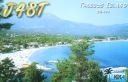
EU-174.jpgEU-174 Greece Makedonia / Thraki Region groupThasos or Thassos is a Greek island, geographically part of the North Aegean Sea, but administratively part of the Kavala regional unit. It is the northernmost major Greek island, and 12th largest by area. Thasos is also the name of the largest town of the island (officially known as Limenas Thasou, "Port of Thasos"), situated at the northern side, opposite the mainland and about 10 kilometres (6 miles) from Keramoti.Jun 25, 2018
|
|

EU-173R.jpgEU-173 Finland Lansi-Suomi (Pori) Province groupSandström reef is an island like that about 4 kilometers from mainland (loc KP01RH, OH county Luvia, OHC 147). It is located about 20 kilometers south of city of Pori on southwest coast of Finland. The island does not have a historical significance and there has never been regular settlement. The size of the island is only about 100x50 meters. Jun 25, 2018
|
|

EU-173.jpgEU-173 Finland Lansi-Suomi (Pori) Province groupSandström reef is an island like that about 4 kilometers from mainland (loc KP01RH, OH county Luvia, OHC 147). It is located about 20 kilometers south of city of Pori on southwest coast of Finland. The island does not have a historical significance and there has never been regular settlement. The size of the island is only about 100x50 meters. Jun 25, 2018
|
|

EU-172R.jpgEU-172 Denmark Jylland East and Fyn groupÆrø is a narrow Danish island in the Baltic Sea. Ærø measures roughly 20 km from northwest to southeast and varies in width from around 4 to 8 km. There are three small towns on the island: the largest is Marstal with a population of 2,266. Ærøskøbing has 925 inhabitants and Søby 496. Fourteen villages and a number of farms complete the island's pattern of settlement.Jun 25, 2018
|
|
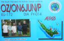
EU-172.jpgEU-172 Denmark Jylland East and Fyn groupÆrø is a narrow Danish island in the Baltic Sea. Ærø measures roughly 20 km from northwest to southeast and varies in width from around 4 to 8 km. There are three small towns on the island: the largest is Marstal with a population of 2,266. Ærøskøbing has 925 inhabitants and Søby 496. Fourteen villages and a number of farms complete the island's pattern of settlement.Jun 25, 2018
|
|

EU-171.jpgEU-171 Denmark Jylland North groupThe North Jutlandic Island is in the northernmost part of Denmark and of Jutland. The area was not surrounded by water until a storm in February 1825, which caused a connection between the North Sea and the fjord Limfjorden.Jun 25, 2018
|
|

EU-170.jpgEU-170 Croatia Dalmatia North groupPag is a Croatian island in the Adriatic Sea. It’s known for its barren, moonlike landscape, lace production and Pag cheese. Pebble and sand beaches ring the island. The 15th-century Church of St. George was part of Pag town’s defensive walls.Jun 25, 2018
|
|

EU-169R.jpgEU-169 Albania groupSazan is an island inside the Mediterranean Sea in southern Albania. It is the largest island in Albania and strategically located between the Strait of Otranto and the entrance to the Bay of Vlorë, forming the border between the Adriatic and Ionian Sea.Jun 25, 2018
|
|

EU-169.jpgEU-169 Albania groupSazan is an island inside the Mediterranean Sea in southern Albania. It is the largest island in Albania and strategically located between the Strait of Otranto and the entrance to the Bay of Vlorë, forming the border between the Adriatic and Ionian Sea.Jun 25, 2018
|
|
EU-168R.jpgEU-168 Iceland's Coastal IslandsFlatey is an island of the western islands, a cluster of about forty large and small islands and islets located in Breiðafjörður on the northwestern part of Iceland. Flatey and its surrounding islands are, as a creation, believed to have forged from under the weight of a great glacier during the previous Ice age.Jun 25, 2018
|
|
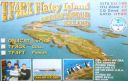
EU-168.jpgEU-168 Iceland's Coastal IslandsFlatey is an island of the western islands, a cluster of about forty large and small islands and islets located in Breiðafjörður on the northwestern part of Iceland. Flatey and its surrounding islands are, as a creation, believed to have forged from under the weight of a great glacier during the previous Ice age.Jun 25, 2018
|
|
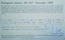
EU-167R.jpgEU-167 Portugal Baixo Alentejo Province groupPessegueiro Island (Portuguese: Ilha do Pessegueiro), literally island of the Peachtree, is a small island/islet located along the southwest coast of the civil parish of Porto Covo in the municipality of Sines. The island and the adjacent coast are part of Southwest Alentejo and Vicentine Coast Natural Park, but Pessegueiro island is also notable for the 15th-16th century fort located at its centre and Roman ruins along the coast.Jun 25, 2018
|
|

EU-167.jpgEU-167 Portugal Baixo Alentejo Province groupPessegueiro Island (Portuguese: Ilha do Pessegueiro), literally island of the Peachtree, is a small island/islet located along the southwest coast of the civil parish of Porto Covo in the municipality of Sines. The island and the adjacent coast are part of Southwest Alentejo and Vicentine Coast Natural Park, but Pessegueiro island is also notable for the 15th-16th century fort located at its centre and Roman ruins along the coast.Jun 25, 2018
|
|
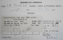
EU-166R.jpgEU-166 Sicily's Coastal IslandsLa Scuola Island lies in the Stagnone Lagoon, a part of the Mediterranean Sea in front of Marsala City (Trapani province, autonomous region of Sicily); the Lagoon is delimited by an island called Isola Lunga (formerly stinco di Capra). The water level in the lagoon varies from a few centimetres to a maximum of 2 metres. Jun 25, 2018
|
|

EU-166.jpgEU-166 Sicily's Coastal IslandsLa Scuola Island lies in the Stagnone Lagoon, a part of the Mediterranean Sea in front of Marsala City (Trapani province, autonomous region of Sicily); the Lagoon is delimited by an island called Isola Lunga (formerly stinco di Capra). The water level in the lagoon varies from a few centimetres to a maximum of 2 metres. Jun 25, 2018
|
|

EU-165R.jpgEU-165 Sardinia's Coastal IslandsSan Pietro Island is an island approximately 7 kilometres off the South western Coast of Sardinia, Italy, facing the Sulcis peninsula. With 51 square kilometres it is the sixth largest island of Italy by area.Jun 25, 2018
|
|
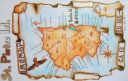
EU-165.jpgEU-165 Sardinia's Coastal IslandsSan Pietro Island is an island approximately 7 kilometres off the South western Coast of Sardinia, Italy, facing the Sulcis peninsula. With 51 square kilometres it is the sixth largest island of Italy by area.Jun 25, 2018
|
|

EU-164.jpgEU-164 Corsica's Coastal IslandsThe Archipelago of Lavezzi is a collection of small granite islands and reefs in the Strait of Bonifacio that separates Corsica from Sardinia in the Mediterranean Sea. They are administered from the town of Bonifacio on Corsica.Jun 25, 2018
|
|

EU-163R.jpgEU-163 Montenegro group;Crna Gora groupSveti Nikola Island is an island in the Adriatic Sea, in the Montenegrin municipality of Budva. Sveti Nikola island is located opposite to the town of Budva, 1 kilometre (0.6 miles) from Budva's old town. The island is 2 kilometres (1 mile) long, and it has an area of 36 hectares (89 acres). The highest point on the island is a cliff that rises 121 metres (397 feet) above the sea.Jun 25, 2018
|
|

EU-163.jpgEU-163 Montenegro group;Crna Gora groupSveti Nikola Island is an island in the Adriatic Sea, in the Montenegrin municipality of Budva. Sveti Nikola island is located opposite to the town of Budva, 1 kilometre (0.6 miles) from Budva's old town. The island is 2 kilometres (1 mile) long, and it has an area of 36 hectares (89 acres). The highest point on the island is a cliff that rises 121 metres (397 feet) above the sea.Jun 25, 2018
|
|

EU-162R.jpgEU-162 Russia White Sea Coast groupGlov Island is located in the Kandalaksha Nature Reserve on the south shore of Kandalaksha Bay in the Murmansk and Karelia regions on the opening to the White Sea, RussiaJun 25, 2018
|
|
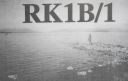
EU-162.jpgEU-162 Russia White Sea Coast groupGlov Island is located in the Kandalaksha Nature Reserve on the south shore of Kandalaksha Bay in the Murmansk and Karelia regions on the opening to the White Sea, RussiaJun 25, 2018
|
|
EU-161.jpgEU-161 Russia Barents Sea Coast East groupThe Sem’ Ostrovov (Seven Islands) lie near the northern coast of the Kola Peninsula. Kharlov Island is the largest one in the archipelago. A lighthouse and a weather station were built on the island in the early 20th century. The station recorded the highest wind speed in Russia, 187 kph (116 mph). The station was shut down in 2009, and on November 23, 2009 Ostrov Kharlov (Kharlov Island) became uninhabitedJun 25, 2018
|
|

EU-160.jpgEU-160 Russia Barents Sea Coast groupKorga Island is located in the territory of the Nenets Autonomus area, the Arctic circle, RussiaJun 25, 2018
|
|
EU-159R.jpgEU-159 France Aquitaine Region groupThe Banc d'Arguin is a sand bank lying in the mouth of the Gironde estuary, near the Cordouan lighthouse, which is the only remaining manned maritime lighthouse in France, the oldest lighthouse still in operation and the only one in the world open to visitors!Jun 25, 2018
|
|
EU-159.jpgEU-159 France Aquitaine Region groupThe Banc d'Arguin is a sand bank lying in the mouth of the Gironde estuary, near the Cordouan lighthouse, which is the only remaining manned maritime lighthouse in France, the oldest lighthouse still in operation and the only one in the world open to visitors!Jun 25, 2018
|
|
EU-158R.jpgEU-158 Greece Peloponnisos (Messinia) Region groupProti Island of Messenia is an island in the Ionian Sea, on the west coast of the Peloponnese; it is counted as one of the Ionian Islands, though administratively, it is part of the municipality of Gargalianoi, in the regional unit of Messenia. The 2001 census reported a population of four inhabitants.Jun 25, 2018
|
|

EU-158.jpgEU-158 Greece Peloponnisos (Messinia) Region groupProti Island of Messenia is an island in the Ionian Sea, on the west coast of the Peloponnese; it is counted as one of the Ionian Islands, though administratively, it is part of the municipality of Gargalianoi, in the regional unit of Messenia. The 2001 census reported a population of four inhabitants.Jun 25, 2018
|
|

EU-157R.jpgEU-157 France Bretagne (Cotes-d'Armor East / Ille et Vilaine) Region groupCézembre is an island in Brittany, in the Ille-et-Vilaine département of France, near Saint-Malo. The island is uninhabited, with a surface area of approximately 18 hectares (44 acres), a length of 750 metres (2,461 ft), and a maximum width of 250 metres (820 ft).The island features a fine sandy beach facing Saint-Malo on the south, and a steep and rocky coast around the rest of the island. As elsewhere in northern Brittany, the tidal range is among the highest in the world. Jun 25, 2018
|
|

EU-157.jpgEU-157 France Bretagne (Cotes-d'Armor East / Ille et Vilaine) Region groupCézembre is an island in Brittany, in the Ille-et-Vilaine département of France, near Saint-Malo. The island is uninhabited, with a surface area of approximately 18 hectares (44 acres), a length of 750 metres (2,461 ft), and a maximum width of 250 metres (820 ft).The island features a fine sandy beach facing Saint-Malo on the south, and a steep and rocky coast around the rest of the island. As elsewhere in northern Brittany, the tidal range is among the highest in the world. Jun 25, 2018
|
|
EU-156R.jpgEU-156 France Basse-Normandie (Manche West) Region groupTombelaine is a small tidal island off the coast of Normandy in France. It lies a few kilometres north of Mont Saint-Michel. At low tide the island can be reached on foot (with a guide) from the coast of Cotentin, 3.5 kilometres (2.2 miles) to the northeast, and from Mont Saint-Michel.[The island lies just to the south of the course of the Sélune river, which has to be forded to access the island from Cotentin. The island is 250 m (820 ft) by 150 m (490 ft), and 45 m (148 ft) high.Jun 25, 2018
|
|

EU-156.jpgEU-156 France Basse-Normandie (Manche West) Region groupTombelaine is a small tidal island off the coast of Normandy in France. It lies a few kilometres north of Mont Saint-Michel. At low tide the island can be reached on foot (with a guide) from the coast of Cotentin, 3.5 kilometres (2.2 miles) to the northeast, and from Mont Saint-Michel.[The island lies just to the south of the course of the Sélune river, which has to be forded to access the island from Cotentin. The island is 250 m (820 ft) by 150 m (490 ft), and 45 m (148 ft) high.Jun 25, 2018
|
|

eu-155.jpgEU-155 Italy (DELETED: SCANNO DI PIALLAZZA island)Island appears to no longer exist - refer - http://www.yf1ar.com/2011/10/eu-155-neverland.htmlJun 25, 2018
|
|

EU-153.jpgEU-153 Russia White Sea Coast West groupLyasomin Island is located in Gremikha Bay on the northeastern portion of the Kola Peninsula in the far northwest of Russia, near the closed town of Ostrovnoy, in the Murmansk Oblast.Jun 25, 2018
|
|

EU-152.jpgEU-152 Spain Almeria / Grande / Malaga Province groupThe Terreros Island and Negra Island Natural Monument is located on the eastern part of the AlmerÃa coast, on the border with the province of Murcia, facing the village of San Juan de Terreros, PulpÃ.Jun 25, 2018
|
|

EU-151R.jpgEU-151 Spain Castellon / Valencia Province groupLa Peñeta del Moro is a tiny rocky ledge almost 2 meters wide and 6 long in the Mediterranean Sea approximately 1 kilometer in front of San Antonio beach , on the coast of Cullera , in the province of Valencia ( Spain ). It has never even been considered an island , but rather a set of natural rocks on which a small cast iron lighthouse sits about 5 meters high placed there in the mid- nineteenth century.Jun 25, 2018
|
|

EU-151.jpgEU-151 Spain Castellon / Valencia Province groupLa Peñeta del Moro is a tiny rocky ledge almost 2 meters wide and 6 long in the Mediterranean Sea approximately 1 kilometer in front of San Antonio beach , on the coast of Cullera , in the province of Valencia ( Spain ). It has never even been considered an island , but rather a set of natural rocks on which a small cast iron lighthouse sits about 5 meters high placed there in the mid- nineteenth century.Jun 25, 2018
|
|
|
|
 Contact


