 Last additions - Europe Islands IOTA QSL Album (all 192 islands confirmed) Last additions - Europe Islands IOTA QSL Album (all 192 islands confirmed) |

eu-189R.jpgEU-189, Isle of RockallRockall is an uninhabitable granite islet in the North Atlantic Ocean. The United Kingdom claims that Rockall lies within its territorial sea. Rockall's approximate distances from the closest islands in each direction are as follows: It is 301.3 kilometres (west of Soay, Scotland; 423.2 km northwest of Tory Island, Ireland; and 700 kilometres south of Iceland.The nearest permanently inhabited place is North Uist, an island in the Outer Hebrides of Scotland, 370 kilometres to the east.Sep 09, 2023
|
|

EU-189.jpgEU-189, Isle of RockallRockall is an uninhabitable granite islet in the North Atlantic Ocean. The United Kingdom claims that Rockall lies within its territorial sea. Rockall's approximate distances from the closest islands in each direction are as follows: It is 301.3 kilometres (west of Soay, Scotland; 423.2 km northwest of Tory Island, Ireland; and 700 kilometres south of Iceland.The nearest permanently inhabited place is North Uist, an island in the Outer Hebrides of Scotland, 370 kilometres to the east.Sep 09, 2023
|
|

EU-063S.jpgEU-063 Spitsbergen's Coastal Islands;Svalbard's Coastal IslandsPrins Karls Forland or Forlandet, occasionally anglicized as Prince Charles Foreland, is an island off the west coast of Oscar II Land on Spitsbergen in the Arctic archipelago of Svalbard, Norway. The entire island and the surrounding sea area constitutes Forlandet National Park.
Jul 25, 2019
|
|
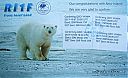
EU-190R.jpgEU-190 Russia Viktoriya IslandVictoria Island (Russian: ОÑтров ВикториÑ; Ostrov Viktoriya) is a small Arctic island of the Russian Federation. It is located at 80°9′N 36°46′E, halfway between the Norwegian archipelago of Svalbard and the Russian archipelago of Franz Josef Land. This westernmost of all Russian Arctic islands is administered as part of Franz Josef Land and belongs to the Arkhangelsk Oblast administrative division of the Russian Federation.Jul 22, 2019
|
|

EU-190.jpgEU-190 Russia Viktoriya IslandVictoria Island (Russian: ОÑтров ВикториÑ; Ostrov Viktoriya) is a small Arctic island of the Russian Federation. It is located at 80°9′N 36°46′E, halfway between the Norwegian archipelago of Svalbard and the Russian archipelago of Franz Josef Land. This westernmost of all Russian Arctic islands is administered as part of Franz Josef Land and belongs to the Arkhangelsk Oblast administrative division of the Russian Federation.Jul 22, 2019
|
|

EU-138R.jpgEU-138 Sweden Blekinge County groupHanö is an island off Listerlandet peninsula, western Blekinge, Sweden.
Between 1810 and 1812 the Royal Navy of the United Kingdom used the island as its base during its operations in the Baltic Sea. The "English Seaman's Graveyard" is situated on the island, and still today British warships visit the island to pay tribute to the fifteen sailors who rest there.Jul 22, 2019
|
|

EU-137R.jpgEU-137 Sweden Skane County groupVen is a small Swedish island in the Øresund strait, between Scania and Zealand. It is part of Landskrona Municipality, Skåne County. The island has 371 inhabitants and an area of 7.5 km². During the 1930s, the population was at its peak, with approximately 1,300 inhabitants.Jul 22, 2019
|
|

EU-098R.jpgEU-098 Germany (DELETED - MECKLEMBURG-VORPOMMERN STATE W GR)Poel or Poel Island, is an island in the Baltic Sea. It forms the natural northern and eastern boundaries of the Bay of Wismar on the German coast. The northern coast of the island is also on the south side of the large gulf known as the Bay of Mecklenburg, which Wismar Bay enters into.Jul 22, 2019
|
|

EU-098.jpgEU-098 Germany (DELETED - MECKLEMBURG-VORPOMMERN STATE W GR)Poel or Poel Island, is an island in the Baltic Sea. It forms the natural northern and eastern boundaries of the Bay of Wismar on the German coast. The northern coast of the island is also on the south side of the large gulf known as the Bay of Mecklenburg, which Wismar Bay enters into.Jul 22, 2019
|
|

eu-020A.jpgEU-020 Sweden Gotland County (Gotland Island) groupGotland is a province, county, municipality, and diocese of Sweden. It is Sweden's largest island.The province includes the islands of Fårö and Gotska Sandön to the north, as well as the Karlsö Islands (Lilla and Stora) to the west. The population is 58,595, of which about 23,600 live in Visby, the main town.Jul 19, 2019
|
|

EU-010R.jpgEU-010 Outer Hebrides;Western IslesThe Outer Hebrides, also known as the Western Isles, Innse Gall ("islands of the strangers") or the Long Isle/Long Island (Scottish Gaelic: An t-Eilean Fada), is an island chain off the west coast of mainland Scotland. The islands are geographically coextensive with Comhairle nan Eilean Siar, one of the 32 unitary council areas of Scotland.Jul 19, 2019
|
|

eu-192r.jpgEU-192 Finland / Sweden Kataja/Inakari IslandKataja, the easternmost point of Sweden, is an islet south of Haparanda in Norrbotten. It is part of the Haparanda archipelago. The islet has an area of 71 hectares (180 acres). It is about 2 kilometres (1.2 mi) long and 200 to 500 metres (660 to 1,640 ft) wide. The name "Kataja" is Finnish for juniper. The island is divided between Sweden and Finland. The border was established in 1809 between two islands, a larger Swedish one called Kataja and a smaller Finnish one called Inakari.Apr 18, 2019
|
|

eu-192.jpgEU-192 Finland / Sweden Kataja/Inakari IslandKataja, the easternmost point of Sweden, is an islet south of Haparanda in Norrbotten. It is part of the Haparanda archipelago. The islet has an area of 71 hectares (180 acres). It is about 2 kilometres (1.2 mi) long and 200 to 500 metres (660 to 1,640 ft) wide. The name "Kataja" is Finnish for juniper. The island is divided between Sweden and Finland. The border was established in 1809 between two islands, a larger Swedish one called Kataja and a smaller Finnish one called Inakari.Apr 18, 2019
|
|

EU-191R.jpgEU-191 Romania Fericirii/Nova Zemlya IslandThe K or Nova Zemlya Island, sometimes referred to as the Island of Happiness (Romanian: Insula Fericirii), is a young island of the Black Sea. The island is divided between Romania (40%) and Ukraine (60%).
The island is 7 km long and 80 m wide. It started forming in the early 2000s, is made out of sand, but in the recent years, forms of vegetation have appeared. The K Island and the Sacalin Island are Romania's newest territories and are in permanent growthJun 25, 2018
|
|

EU-191.jpgEU-191 Romania Fericirii/Nova Zemlya IslandThe K or Nova Zemlya Island, sometimes referred to as the Island of Happiness (Romanian: Insula Fericirii), is a young island of the Black Sea. The island is divided between Romania (40%) and Ukraine (60%).
The island is 7 km long and 80 m wide. It started forming in the early 2000s, is made out of sand, but in the recent years, forms of vegetation have appeared. The K Island and the Sacalin Island are Romania's newest territories and are in permanent growthJun 25, 2018
|
|

EU-188R.jpgEU-188 Russia Pechorskoye Sea Coast West groupSengeyskiy Island is an uninhabited island located in the Barent Sea just offshore from the small settlement of Sengeyskiy, RussiaJun 25, 2018
|
|

EU-188.jpgEU-188 Russia Pechorskoye Sea Coast West groupSengeyskiy Island is an uninhabited island located in the Barent Sea just offshore from the small settlement of Sengeyskiy, RussiaJun 25, 2018
|
|

EU-187R.jpgEU-187 Crete's Coastal IslandsChrissi is an uninhabited Greek island approximately 15 kilometres south of Crete close to Ierapetra in the South Cretan Sea. Approximately 700 metres east of the island is the island of Mikronisi. Administratively these islands fall within the Ierapetra municipality in Lasithi.Jun 25, 2018
|
|

EU-187.jpgEU-187 Crete's Coastal IslandsChrissi is an uninhabited Greek island approximately 15 kilometres south of Crete close to Ierapetra in the South Cretan Sea. Approximately 700 metres east of the island is the island of Mikronisi. Administratively these islands fall within the Ierapetra municipality in Lasithi.Jun 25, 2018
|
|

EU-186R.jpgEU-186 Turkey groupImbros or İmroz, officially changed to Gökçeada since 29 July 1970, is the largest island of Turkey and the seat of Gökçeada District of Çanakkale Province. It is located in the Aegean Sea, at the entrance of Saros Bay and is also the westernmost point of Turkey.Jun 25, 2018
|
|

EU-186.jpgEU-186 Turkey groupImbros or İmroz, officially changed to Gökçeada since 29 July 1970, is the largest island of Turkey and the seat of Gökçeada District of Çanakkale Province. It is located in the Aegean Sea, at the entrance of Saros Bay and is also the westernmost point of Turkey.Jun 25, 2018
|
|

EU-185R.jpgEU-185 Russia Black Sea Coast groupKrupinin island located in the northern part of the Taman Bay of the Black Sea. Administratively it belongs to the Krasnodar Territory of Russia. The island is formed of limestone and sand.Jun 25, 2018
|
|

EU-185.jpgEU-185 Russia Black Sea Coast groupKrupinin island located in the northern part of the Taman Bay of the Black Sea. Administratively it belongs to the Krasnodar Territory of Russia. The island is formed of limestone and sand.Jun 25, 2018
|
|

EU-184R.jpgEU-184 Finland Oulu Province groupHailuoto is located on an island of the same name opposite the city of Oulu in the Gulf of Bothnia. A ferry operates regularly between Hailuoto and Oulunsalo. In winter an official ice road connects the island to the mainland.Jun 25, 2018
|
|

EU-184.jpgEU-184 Finland Oulu Province groupHailuoto is located on an island of the same name opposite the city of Oulu in the Gulf of Bothnia. A ferry operates regularly between Hailuoto and Oulunsalo. In winter an official ice road connects the island to the mainland.Jun 25, 2018
|
|

EU-183R.jpgEU-183 Romania Sacalinu Mare IslandSacalin Island is a newly formed island in the Black Sea, right off the coast of the Romanian Danube Delta, off the Sfântu Gheorghe branch. Initially Sacalin was made up of two smaller islands, Sacalinu Mare and Sacalinu Mic. In time, however, the two merged into one continuous landmass.Jun 25, 2018
|
|

EU-183.jpgEU-183 Romania Sacalinu Mare IslandSacalin Island is a newly formed island in the Black Sea, right off the coast of the Romanian Danube Delta, off the Sfântu Gheorghe branch. Initially Sacalin was made up of two smaller islands, Sacalinu Mare and Sacalinu Mic. In time, however, the two merged into one continuous landmass.Jun 25, 2018
|
|

EU-182R.jpgEU-182 Ukraine Black Sea Coast groupOchakovskiy Island, Ukrainian Danube Biosphere Reserve., Danube Delta down the Ankudinovo Branch (near Vylkove, Odessa Oblast, Ukraine)Jun 25, 2018
|
|

EU-182.jpgEU-182 Ukraine Black Sea Coast groupOchakovskiy Island, Ukrainian Danube Biosphere Reserve., Danube Delta down the Ankudinovo Branch (near Vylkove, Odessa Oblast, Ukraine)Jun 25, 2018
|
|

EU-181R.jpgEU-181 Bulgaria groupSt. Peter Island is a Bulgarian island in the Black Sea, with an area of 0.025 square kilometres (0.010 square miles) and a height of 9 metres (30 feet) above sea level. Also known as Bird Island, it is located in the Bay of Sozopol, close to the St. Ivan and St. Cyricus Islands. As it was not mentioned in any sources until the mid-19th century, it is presumed to have separated from the larger St. Ivan Island (which is a few hundred meters to the west) as a consequence of some kind of natural phenomenon around that timeJun 25, 2018
|
|

EU-181.jpgEU-181 Bulgaria groupSt. Peter Island is a Bulgarian island in the Black Sea, with an area of 0.025 square kilometres (0.010 square miles) and a height of 9 metres (30 feet) above sea level. Also known as Bird Island, it is located in the Bay of Sozopol, close to the St. Ivan and St. Cyricus Islands. As it was not mentioned in any sources until the mid-19th century, it is presumed to have separated from the larger St. Ivan Island (which is a few hundred meters to the west) as a consequence of some kind of natural phenomenon around that timeJun 25, 2018
|
|

EU-180F.jpgEU-180 Ukraine Black Sea Coast groupTuzla Island, is a sandy islet in the form of a spit located in the middle of the Strait of Kerch between the Kerch Peninsula in the west and the Taman Peninsula in the east. The Strait of Kerch connects the Sea of Azov and the Black Sea. Administratively, Tuzla is part of Kerch in eastern Crimea.Jun 25, 2018
|
|

EU-180r.jpgEU-180 Ukraine Black Sea Coast groupTuzla Island, is a sandy islet in the form of a spit located in the middle of the Strait of Kerch between the Kerch Peninsula in the west and the Taman Peninsula in the east. The Strait of Kerch connects the Sea of Azov and the Black Sea. Administratively, Tuzla is part of Kerch in eastern Crimea.Jun 25, 2018
|
|

EU-179R.jpgEU-179 Ukraine Black Sea Coast groupKalanchakskiye islands, located in Karkinits'ka bay, Black sea, Located in the province of Khersons'ka Oblast , in the southern part of the country, 500 km south of Kiev, UkraineJun 25, 2018
|
|

EU-179.jpgEU-179 Ukraine Black Sea Coast groupKalanchakskiye islands, located in Karkinits'ka bay, Black sea, Located in the province of Khersons'ka Oblast , in the southern part of the country, 500 km south of Kiev, UkraineJun 25, 2018
|
|

EU-178F.jpgEU-178 Estonia Parnumaa County / Saaremaa County South groupManilaid is a 1.87 km2 (0.72 sq mi) Estonian islet in the Gulf of Riga, located between the island of Kihnu and the mainland's Tõstamaa peninsula. Together with the neighbouring smaller uninhabited islets Sorgu and Annilaid, Manilaid forms the village of Manija. On January 1, 2011, Manilaid's population was 47. Manilaid has a ferry connection with the Munalaiu harbour on the mainland. In the winter, when the Gulf of Riga is covered with ice, the island is reachable by ice bridge.
Jun 25, 2018
|
|

EU-178r.jpgEU-178 Estonia Parnumaa County / Saaremaa County South groupManilaid is a 1.87 km2 (0.72 sq mi) Estonian islet in the Gulf of Riga, located between the island of Kihnu and the mainland's Tõstamaa peninsula. Together with the neighbouring smaller uninhabited islets Sorgu and Annilaid, Manilaid forms the village of Manija. On January 1, 2011, Manilaid's population was 47. Manilaid has a ferry connection with the Munalaiu harbour on the mainland. In the winter, when the Gulf of Riga is covered with ice, the island is reachable by ice bridge.Jun 25, 2018
|
|

EU-177R.jpgEU-177 Sweden Sodermanland / Ostergotland County groupUtö is a small island in the East of Stockholm archipelago, known for its nature. Utö has the oldest iron-ore mines in Sweden. A landmark of Utö is its windmill, which is over 200 years old, and from which there is a good view of the bay Mysingen. On the island of Ålö - connected to Utö with a bridge - there is a popular restaurant with entertainment during the summer.Jun 25, 2018
|
|

EU-177.jpgEU-177 Sweden Sodermanland / Ostergotland County groupUtö is a small island in the East of Stockholm archipelago, known for its nature. Utö has the oldest iron-ore mines in Sweden. A landmark of Utö is its windmill, which is over 200 years old, and from which there is a good view of the bay Mysingen. On the island of Ålö - connected to Utö with a bridge - there is a popular restaurant with entertainment during the summer.Jun 25, 2018
|
|

EU-176R.jpgEU-176 Sweden Gavleborg County groupKlacksörarna, is an uninhabited island in Gävleborg County close to the south eastern coast of Sweden in the Baltic Sea.Jun 25, 2018
|
|
|
|
 Contact
