Oceania Islands IOTA QSL Album
|
|
|
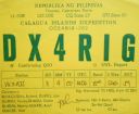
OC-202.jpgOC-202 Calagua IslandsCalaguas, also known as Calaguas Islands, is a group of islands located in the Philippine province of Camarines Norte. It includes the major islands of Tinaga Island and Guintinua Island, the minor Maculabo Island, as well as several other minor.The islands are around 200 km away from the capital city of Manila and can be accessed through the ports at Daet, Camarines Norte.
|
|

OC-203.jpgOC-203 South Island's Coastal IslandsStewart Island, officially named Stewart Island/Rakiura, is the third-largest island of New Zealand. It lies 30 kilometres south of the South Island, across the Foveaux Strait. Its permanent population is 381 people as of the 2013 census, most of whom live in the settlement of Oban on the eastern side of the island.
|
|

OC-203R.jpgOC-203 South Island's Coastal IslandsStewart Island, officially named Stewart Island/Rakiura, is the third-largest island of New Zealand. It lies 30 kilometres south of the South Island, across the Foveaux Strait. Its permanent population is 381 people as of the 2013 census, most of whom live in the settlement of Oban on the eastern side of the island.
|
|

OC-204.JPGOC-204 Enggano IslandEnggano Island is about 100 km (60 mi) southwest of Sumatra, Indonesia. It is one of the 92 officially listed outlying islands of Indonesia. Enggano is about 35 kilometres (22 miles) long from east to west and about 16 kilometres (9.9 miles) wide from north to south. The three largest towns on the island are Barhau, Kabuwe and Kayaapu
|
|

OC-204R.jpgOC-204 Enggano IslandEnggano Island is about 100 km (60 mi) southwest of Sumatra, Indonesia. It is one of the 92 officially listed outlying islands of Indonesia. Enggano is about 35 kilometres (22 miles) long from east to west and about 16 kilometres (9.9 miles) wide from north to south. The three largest towns on the island are Barhau, Kabuwe and Kayaapu
|
|

OC-205.jpgOC-205 Woodlark group;Muyua groupWoodlark Island, known to its inhabitants simply as Woodlark or Muyua, is the main island of the Woodlark Islands archipelago, located in Milne Bay Province and the Solomon Sea, Papua New Guinea. Although no formal census has been conducted since 1990, the current population is estimated at approximately 6000 people. The wider Woodlark Islands group also consists of Madau and Nusam to the west, Nubara to the east, and the Marshall Bennett group to the southwest.
|
|
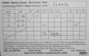
OC-205R.jpgOC-205 Woodlark group;Muyua groupWoodlark Island, known to its inhabitants simply as Woodlark or Muyua, is the main island of the Woodlark Islands archipelago, located in Milne Bay Province and the Solomon Sea, Papua New Guinea. Although no formal census has been conducted since 1990, the current population is estimated at approximately 6000 people. The wider Woodlark Islands group also consists of Madau and Nusam to the west, Nubara to the east, and the Marshall Bennett group to the southwest.
|
|

OC-206.jpgOC-206 Western Australia State (S.W. Coast) North groupDirk Hartog Island is an island off the Gascoyne coast of Western Australia, within the Shark Bay World Heritage Area. It is about 80 kilometres (50 miles) long and between 3 and 15 kilometres (1.9 and 9.3 miles) wide and is Western Australia's largest and most western island. It covers an area of 620 square kilometres (240 square miles) and is approximately 850 kilometres (530 miles) north of Perth. It was named after Dirk Hartog, a Dutch sea captain, who first encountered the Western Australian coastline close to the 26th parallel south latitude, which runs through the island.
|
|

OC-206R.jpgOC-206 Western Australia State (S.W. Coast) North groupDirk Hartog Island is an island off the Gascoyne coast of Western Australia, within the Shark Bay World Heritage Area. It is about 80 kilometres (50 miles) long and between 3 and 15 kilometres (1.9 and 9.3 miles) wide and is Western Australia's largest and most western island. It covers an area of 620 square kilometres (240 square miles) and is approximately 850 kilometres (530 miles) north of Perth. It was named after Dirk Hartog, a Dutch sea captain, who first encountered the Western Australian coastline close to the 26th parallel south latitude, which runs through the island.
|
|

OC-207.jpgOC-207 Cagayan IslandsThe Cagayan group is situated roughly 120km west of Sipalay and consists of 31 islands, of which only a few are inhabited. Their topography is flat and covered with only bushes and palm trees. The Cagayan islands are located on the 500km long and 30km wide Cagayan ridge, which connects Cagayancillo with the Tubbataha Reef and Borneo.
|
|

OC-207R.jpgOC-207 Cagayan IslandsThe Cagayan group is situated roughly 120km west of Sipalay and consists of 31 islands, of which only a few are inhabited. Their topography is flat and covered with only bushes and palm trees. The Cagayan islands are located on the 500km long and 30km wide Cagayan ridge, which connects Cagayancillo with the Tubbataha Reef and Borneo.
|
|

OC-208.jpgOC-208 Banggai IslandsThe Banggai Archipelago (Indonesian: Kepulauan Banggai) is a group of islands, which are located at the far eastern end of Central Sulawesi, Indonesia. The archipelago is surrounded by the Banda Sea's Gulf of Tolo (Teluk Tolo), and the Molucca Sea. The Peleng Straits (Selat Peleng) separate it from mainland Sulawesi.
|
|

OC-208R.jpgOC-208 Banggai IslandsThe Banggai Archipelago (Indonesian: Kepulauan Banggai) is a group of islands, which are located at the far eastern end of Central Sulawesi, Indonesia. The archipelago is surrounded by the Banda Sea's Gulf of Tolo (Teluk Tolo), and the Molucca Sea. The Peleng Straits (Selat Peleng) separate it from mainland Sulawesi.
|
|
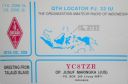
OC-209.jpgOC-209 Talaud IslandsTalaud Islands (Indonesian: Kepulauan Talaud) is a group of islands located north of Sulawesi island in Indonesia, north-east of the Sangihe Islands. The Talaud Islands are also the northernmost region of Eastern Indonesia, bordering south of the Philippines' Davao Region. The group, with a total area of 495 square miles (1,281 square km), includes Karakelong (the largest), Salebabu, Kaburuang, and numerous islets. The coast of Karakelong Island is steep except on the southern shore, which is fringed by a wide reef. The seven tiny Nanusa Islands lie north-east of Karakelong. They are forested and with hills rising to 2,231 feet (680 metres).
|
|
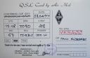
OC-209R.jpgOC-209 Talaud IslandsTalaud Islands (Indonesian: Kepulauan Talaud) is a group of islands located north of Sulawesi island in Indonesia, north-east of the Sangihe Islands. The Talaud Islands are also the northernmost region of Eastern Indonesia, bordering south of the Philippines' Davao Region. The group, with a total area of 495 square miles (1,281 square km), includes Karakelong (the largest), Salebabu, Kaburuang, and numerous islets. The coast of Karakelong Island is steep except on the southern shore, which is fringed by a wide reef. The seven tiny Nanusa Islands lie north-east of Karakelong. They are forested and with hills rising to 2,231 feet (680 metres).
|
|

OC-210.jpgOC-210 Sangihe IslandsThe Sangihe Islands are a group of islands which constitute two regencies within the province of North Sulawesi, in northern Indonesia, the Sangihe Islands Regency (Kabupaten Kepulauan Sangihe) and the Sitaro Islands Regency (Kabupaten Siau Tagulandang Biaro). They are located north-east of Sulawesi between the Celebes Sea and the Molucca Sea, roughly halfway between Sulawesi and Mindanao, in the Philippines.
|
|
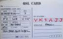
OC-210R.jpgOC-210 Sangihe IslandsThe Sangihe Islands are a group of islands which constitute two regencies within the province of North Sulawesi, in northern Indonesia, the Sangihe Islands Regency (Kabupaten Kepulauan Sangihe) and the Sitaro Islands Regency (Kabupaten Siau Tagulandang Biaro). They are located north-east of Sulawesi between the Celebes Sea and the Molucca Sea, roughly halfway between Sulawesi and Mindanao, in the Philippines.
|
|

OC-211.jpgOC-211 Houtman AbrolhosThe Houtman Abrolhos (often informally called the Abrolhos Islands) is a chain of 122 islands, and associated coral reefs, in the Indian Ocean off the west coast of Australia. Nominally located at 28°43′S 113°47′E, it lies about eighty kilometres (50 mi) west of Geraldton, Western Australia. It is the southernmost true coral reef in the Indian Ocean, and one of the highest latitude reef systems in the world. it has a small seasonal population of fishermen, and a limited number of tourists.
|
|

OC-211R.jpgOC-211 Houtman AbrolhosThe Houtman Abrolhos (often informally called the Abrolhos Islands) is a chain of 122 islands, and associated coral reefs, in the Indian Ocean off the west coast of Australia. Nominally located at 28°43′S 113°47′E, it lies about eighty kilometres (50 mi) west of Geraldton, Western Australia. It is the southernmost true coral reef in the Indian Ocean, and one of the highest latitude reef systems in the world. it has a small seasonal population of fishermen, and a limited number of tourists.
|
|

OC-212.jpgOC-212 New South Wales State Centre groupBroughton Island is an island 14 km north-east of Port Stephens, New South Wales, Australia. It is part of the Myall Lakes National Park.
|
|
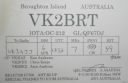
OC-212R.jpgOC-212 New South Wales State Centre groupBroughton Island is an island 14 km north-east of Port Stephens, New South Wales, Australia. It is part of the Myall Lakes National Park.
|
|

OC-213.jpgOC-213 Togian IslandsThe Togian Islands are an archipelago of 56 islands and islets, in the Gulf of Tomini, off the coast of Central Sulawesi, in Indonesia. The three largest islands are Batudaka, Togean, and Talakatoh. There are 37 villages on the islands, with one settled by the Bajau people, more commonly known as the sea gypsies
|
|

OC-214.jpgOC-214 Western Australia State (N.W. Coast) East groupThe Lacepede Islands, sometimes referred to simply as the Lacepedes, are a group of four islands lying off the Kimberley coast of Western Australia, about 120 kilometres (75 miles) north of Broome. They are all small, low spits of coarse sand and coral rubble, lying atop a platform coral reef. They are treeless but support low vegetation.
|
|

OC-214R.jpgOC-214 Western Australia State (N.W. Coast) East groupThe Lacepede Islands, sometimes referred to simply as the Lacepedes, are a group of four islands lying off the Kimberley coast of Western Australia, about 120 kilometres (75 miles) north of Broome. They are all small, low spits of coarse sand and coral rubble, lying atop a platform coral reef. They are treeless but support low vegetation.
|
|
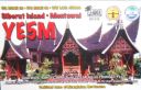
OC-215.jpgOC-215 Mentawai IslandsThe Mentawai Islands Regency are a chain of about seventy islands and islets approximately 150 kilometres off the western coast of Sumatra in Indonesia. Siberut at 4,030 square kilometres is the largest of the islands. The other major islands are Sipura, North Pagai and South Pagai.
|
|
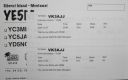
OC-215R.jpgOC-215 Mentawai IslandsThe Mentawai Islands Regency are a chain of about seventy islands and islets approximately 150 kilometres off the western coast of Sumatra in Indonesia. Siberut at 4,030 square kilometres is the largest of the islands. The other major islands are Sipura, North Pagai and South Pagai.
|
|
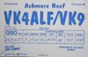
OC-216.jpgOC-216 Ashmore and Cartier IslandsThe Territory of Ashmore and Cartier Islands[1] is an uninhabited external territory of Australia consisting of four low-lying tropical islands in two separate reefs, and the 12 nautical mile territorial sea generated by the islands.[3] The territory is located in the Indian Ocean situated on the edge of the continental shelf, about 320 km (199 mi) off the northwest coast of Australia and 144 km (89 mi) south of the Indonesian island of Rote
|
|
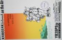
OC-217.jpgOC-217 Kangean IslandsThere are 38 Kangean Islands altogether with 6 inhabited, forming an archipelago that is part of Indonesia covering a total space of 668 square km. They are located in the Java Sea approximately 120 km north of Bali and 120 km east of Madura Island.
|
|
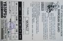
OC-217R.jpgOC-217 Kangean IslandsThere are 38 Kangean Islands altogether with 6 inhabited, forming an archipelago that is part of Indonesia covering a total space of 668 square km. They are located in the Java Sea approximately 120 km north of Bali and 120 km east of Madura Island.
|
|
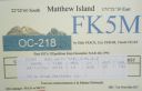
OC-218.jpgOC-218 Matthew and Hunter IslandsThe Matthew Island and Hunter Island are two small and uninhabited high islands in the South Pacific, located 300 kilometres (190 mi) east of New Caledonia and south-east of Vanuatu archipelago. Hunter Island and Matthew Island, 70 km (43 mi) apart, are claimed by Vanuatu as part of Tafea Province, and considered by the people of Aneityum part of their custom ownership, and as of 2007 were claimed by France as part of New Caledonia.
|
|
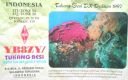
oc-219.jpgOC-219 Tukangbesi Islands; Wakatobi IslandsTukangbesi Islands, is a group of islands off the coast of Sulawesi immediately east of Buton island in the Banda Sea region, and part of Sulawesi Tenggara. "Tukang Besi" literally means "iron worker" or "blacksmith" in Indonesian. There is a Tukang Besi language. Separating Buton and the group is the Gulf of Kolowana Watabo.
|
|
oc-219r.jpgOC-219 Tukangbesi Islands; Wakatobi IslandsTukangbesi Islands, is a group of islands off the coast of Sulawesi immediately east of Buton island in the Banda Sea region, and part of Sulawesi Tenggara. "Tukang Besi" literally means "iron worker" or "blacksmith" in Indonesian. There is a Tukang Besi language. Separating Buton and the group is the Gulf of Kolowana Watabo.
|
|

OC-220.jpgOC-220 South Australia State West groupSt Peter Island (originally in Dutch: Eyland St. Pierre) is an island in the Nuyts Archipelago on the west coast of Eyre Peninsula in South Australia near Ceduna. It is the second largest island in South Australia and about 13 km (8.1 mi) long.
|
|

OC-220R.jpgOC-220 South Australia State West groupSt Peter Island (originally in Dutch: Eyland St. Pierre) is an island in the Nuyts Archipelago on the west coast of Eyre Peninsula in South Australia near Ceduna. It is the second largest island in South Australia and about 13 km (8.1 mi) long.
|
|

OC-221.jpgOC-221 Kai IslandsThe Kai Islands (also Kei Islands) of Indonesia are a group of islands in the southeastern part of the Maluku Islands, located in the province of Maluku. The islands are on the edge of the Banda Sea, south of the Bird's Head Peninsula of New Guinea, west of the Aru Islands, and northeast of the Tanimbar Islands.
|
|
OC-222.jpgOC-222 Obi IslandsThe Obi Islands (also known as Ombirah, Indonesian: Kepulauan Obi) are a group of islands in the Indonesian province of North Maluku. They lie north of Buru and Ceram. The largest in the group is Obi Island.
|
|

OC-223.jpgOC-223 New South Wales State South groupMontague Island is a continental island contained within the Montague Island Nature Reserve, a protected nature reserve that is located offshore from the South Coast region of New South Wales, in eastern Australia. The nearest town located onshore from the 81-hectare (200-acre) reserve and island is Narooma, situated approximately 9 kilometres (5.6 mi) to the northwest. Montague Island is a popular tourist destination, known for its lighthouse, wildlife, most especially little penguins
|
|

OC-223R.jpgOC-223 New South Wales State South groupMontague Island is a continental island contained within the Montague Island Nature Reserve, a protected nature reserve that is located offshore from the South Coast region of New South Wales, in eastern Australia. The nearest town located onshore from the 81-hectare (200-acre) reserve and island is Narooma, situated approximately 9 kilometres (5.6 mi) to the northwest. Montague Island is a popular tourist destination, known for its lighthouse, wildlife, most especially little penguins
|
|

OC-224.jpgOC-224 Tanimbar IslandsThe Tanimbar Islands, also called Timur Laut, are a group of about 65 islands in the Maluku province of Indonesia, including Fordata, Larat, Maru, Molu, Nuswotar, Selaru, Selu, Seira, Wotap, Wuliaru and Yamdena. The Indonesian phrase timur laut means "east of the sea" or "northeast". Geographically, the northeast islands are still part of the Lesser Sunda Islands. The Aru Islands and Kai Islands lie to the northeast, and Babar Island and Timor lie to the west. The islands separate the Banda Sea and the Arafura Sea. The total land area of the Islands is 5440 km² (2100 sq mi).
|
|

OC-225.jpgOC-225 Turtle IslandsTurtle Islands, officially the Municipality of Turtle Islands, is a 5th class municipality in the province of Tawi-Tawi, Philippines. According to the 2015 census, it has a population of 4,727 people. It is also known as Philippine Turtle Islands to distinguish it from its Malaysian counterpart; while locals call it Taganak.
|
|
| 478 files on 12 page(s) |
 |
|
|
|
|
|
|
9 | |
|
|
 Contact
