Oceania Islands IOTA QSL Album
|
|
|
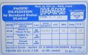
OC-178.jpgOC-178 Tikopia and Anuta IslandsTikopia is a small high island in the southwestern Pacific Ocean. It is part of the Solomon Islands of Melanesia, but is culturally Polynesian.
Tikopia's location is relatively remote. It is sometimes grouped with the Santa Cruz Islands. Administratively, Tikopia belongs to Temotu Province as the southernmost of the Solomon Islands.
|
|

oc-179.jpgOC-179 Duff IslandsThe Duff Islands are a small island group lying to the northeast of the Santa Cruz Islands in the Solomon Islands province of Temotu. They are also sometimes known as the Wilson Islands. The Duff Islands were settled by the Lapita people about 900 BC. They were followed by Melanesians and then Polynesians in the mid-1400s. The modern inhabitants of the Duff Islands are Polynesians, and their language, Pileni, is a member of the Samoic branch of Polynesian languages. On the islands of Duff live about 500.
|
|

oc-179r.jpgOC-179 Duff IslandsThe Duff Islands are a small island group lying to the northeast of the Santa Cruz Islands in the Solomon Islands province of Temotu. They are also sometimes known as the Wilson Islands. The Duff Islands were settled by the Lapita people about 900 BC. They were followed by Melanesians and then Polynesians in the mid-1400s. The modern inhabitants of the Duff Islands are Polynesians, and their language, Pileni, is a member of the Samoic branch of Polynesian languages. On the islands of Duff live about 500.
|
|

OC-180.jpgOC-180 Ngulu AtollNgulu Atoll is a coral atoll of three islands in the Caroline Islands in the Pacific Ocean, and forms a legislative district in Yap State in the Federated States of Micronesia. Ngulu extends for 36 kilometres (22 mi) by 22 kilometres (14 mi) with 18 reef segments enclosing a deep central lagoon of 382 square kilometres (147 sq mi). The eastern portion of the reef is deeply submerged. Its total land area of the nine islets is only 0.4 square kilometres (0.15 sq mi). Nugulu is located approximately 104 kilometres (65 mi) south-southwest of Yap and is the westernmost atoll in the Federated States of Micronesia. The population of Ngulu was 26 in 2000.
|
|

OC-180R.jpgOC-180 Ngulu AtollNgulu Atoll is a coral atoll of three islands in the Caroline Islands in the Pacific Ocean, and forms a legislative district in Yap State in the Federated States of Micronesia. Ngulu extends for 36 kilometres (22 mi) by 22 kilometres (14 mi) with 18 reef segments enclosing a deep central lagoon of 382 square kilometres (147 sq mi). The eastern portion of the reef is deeply submerged. Its total land area of the nine islets is only 0.4 square kilometres (0.15 sq mi). Nugulu is located approximately 104 kilometres (65 mi) south-southwest of Yap and is the westernmost atoll in the Federated States of Micronesia. The population of Ngulu was 26 in 2000.
|
|
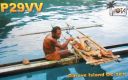
OC-181.jpgOC-181 Witu IslandsThe Vitu Islands /ˈviËtuË/ are a volcanic group with an area of 37 sq mi (96 km²) located in the Bismarck Sea off New Britain, in the southwestern Pacific Ocean. They are not technically part of the Bismarck Archipelago. Administratively they are part of Papua New Guinea. Formerly called the French Islands, the group is sometimes known as the Witu Islands.
|
|

OC-181R.jpgOC-181 Witu IslandsThe Vitu Islands /ˈviËtuË/ are a volcanic group with an area of 37 sq mi (96 km²) located in the Bismarck Sea off New Britain, in the southwestern Pacific Ocean. They are not technically part of the Bismarck Archipelago. Administratively they are part of Papua New Guinea. Formerly called the French Islands, the group is sometimes known as the Witu Islands.
|
|

oc-182.jpgOC-182 Ducie IslandDucie Island is an uninhabited atoll in the Pitcairn Islands. It lies 575 kilometres east of Pitcairn Island, and 300 kilometres east of Henderson Island, and has a total area of 1.5 square miles, which includes the lagoon. It is 1.5 miles long, measured northeast to southwest, and about 1 mile wide
|
|
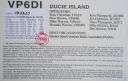
oc-182r.jpgOC-182 Ducie IslandDucie Island is an uninhabited atoll in the Pitcairn Islands. It lies 575 kilometres east of Pitcairn Island, and 300 kilometres east of Henderson Island, and has a total area of 1.5 square miles, which includes the lagoon. It is 1.5 miles long, measured northeast to southwest, and about 1 mile wide
|
|

OC-183.jpgOC-183 Western Australia State (S.W. Coast) Centre groupWedge Island is located north of Lancelin and south of Cervantes on the Western Australian coast. The island occupies an area 4.03 hectares (9.96 acres) and is situated 200 metres (656 ft) from the mainland. The island has a maximum elevation of 21 m (69 ft). It lies within the Turquoise Coast islands nature reserve group, a chain of 40 islands spread over a distance of 150 kilometres (93 mi) from north to south.
|
|

OC-183R.jpgOC-183 Western Australia State (S.W. Coast) Centre groupWedge Island is located north of Lancelin and south of Cervantes on the Western Australian coast. The island occupies an area 4.03 hectares (9.96 acres) and is situated 200 metres (656 ft) from the mainland. The island has a maximum elevation of 21 m (69 ft). It lies within the Turquoise Coast islands nature reserve group, a chain of 40 islands spread over a distance of 150 kilometres (93 mi) from north to south.
|
|

OC-184.jpgOC-184 Brunei's Coastal IslandsPulau Muara Besar is an island connected to the Brunei mainland via a dual-carriageway bridge which connects the island in Brunei Bay, with the mainland of Brunei via Serasa in Brunei-Muara District. The bridge is part of the road infrastructure that will serve the petrochemical refinery plant on the island, which is currently under construction, and is a Chinese foreign direct investment
|
|

OC-184R.jpgOC-184 Brunei's Coastal IslandsPulau Muara Besar is an island connected to the Brunei mainland via a dual-carriageway bridge which connects the island in Brunei Bay, with the mainland of Brunei via Serasa in Brunei-Muara District. The bridge is part of the road infrastructure that will serve the petrochemical refinery plant on the island, which is currently under construction, and is a Chinese foreign direct investment
|
|

OC-185.jpgOC-185 Northern Territory (Arafura Sea Coast) East groupElcho Island, known to its traditional owners as Galiwin'ku,[1] is an island off the coast of Arnhem Land, Northern Territory, Australia. It is located at the southern end of the Wessel Islands group located in the East Arnhem Region. Galiwin'ku is also the name of the settlement where the island's largest community lives. Elcho island formed part of the traditional lands of the Yan-nhaŋu, according to Norman Tindale. According to J. C. Jennison, the Aboriginal inhabitants were the Dhuwal, who he said called themselves the Kokalango Mala (mala=clan.)
|
|
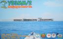
OC-186.jpgOC-186 Karimunjawa IslandsKarimun Java or Crimon Java (id: "Karimun Jawa") is a chain of 27 islands north of Jepara Town, off the coast of Central Java, Indonesia.
Designated as a national marine park. Karimunjava consists of many small islands, with the two main ones being Karimunjawa island and Kemujan Island, and the smaller ones being Menjangan Besar Island, and Menjangan Kecil Island and some other even smaller, uninhabited islands.
|
|

OC-186R.jpgOC-186 Karimunjawa IslandsKarimun Java or Crimon Java (id: "Karimun Jawa") is a chain of 27 islands north of Jepara Town, off the coast of Central Java, Indonesia.
Designated as a national marine park. Karimunjava consists of many small islands, with the two main ones being Karimunjawa island and Kemujan Island, and the smaller ones being Menjangan Besar Island, and Menjangan Kecil Island and some other even smaller, uninhabited islands.
|
|
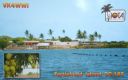
OC-187.jpgOC-187 Queensland State (North Coast) North groupTurtle Head Island is an island of the Torres Strait Islands archipelago, located in the Great Barrier Reef Marine Park, east of Cape York Peninsula, in Queensland, Australia. The island is located in Newcastle Bay at the mouth of Escape River and Middle River, not far from Jackey Jackey Creek and adjacent to the Jardine River National Park. The island lies approximately 30 km (19 mi) southeast of Bamaga.
|
|

OC-187R.jpgOC-187 Queensland State (North Coast) North groupTurtle Head Island is an island of the Torres Strait Islands archipelago, located in the Great Barrier Reef Marine Park, east of Cape York Peninsula, in Queensland, Australia. The island is located in Newcastle Bay at the mouth of Escape River and Middle River, not far from Jackey Jackey Creek and adjacent to the Jardine River National Park. The island lies approximately 30 km (19 mi) southeast of Bamaga.
|
|

OC-188.jpgOC-188 Pangutaran groupPangutaran Island is located in the west-central part of the Sulu archipelago near Mindanao, Philippines
|
|
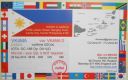
OC-188R.jpgOC-188 Pangutaran groupPangutaran Island is located in the west-central part of the Sulu archipelago near Mindanao, Philippines
|
|
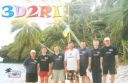
OC-189.jpgOC-189 Ringgold IslandsThe Ringgold Isles are an archipelago in Fiji, forming an outlier group to Vanua Levu. The Budd, Nukusemanu, and Heemskercq Reefs form part of the group. The group is mostly uninhabited, but Qelelevu has a small village.
|
|
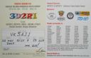
OC-189R.jpgOC-189 Ringgold IslandsThe Ringgold Isles are an archipelago in Fiji, forming an outlier group to Vanua Levu. The Budd, Nukusemanu, and Heemskercq Reefs form part of the group. The group is mostly uninhabited, but Qelelevu has a small village.
|
|

OC-191.jpgOC-191 Niuatoputapu IslandNiuatoputapu is a high island in the island nation of Tonga, Pacific Ocean, its highest point being at 157 m. Its name means sacred island. Older European names for the island are Traitors island or Keppel island. Niuatoputapu is located in the north of the country, 300 kilometres (190 miles) away from Vavaʻu near the border with Samoa. Its closest neighbours are the small island of Tafahi, only 9 km (5.6 mi) to the north-northeast, and the island of Niuafo'ou.
|
|

oc-191r.jpgOC-191 Niuatoputapu IslandNiuatoputapu is a high island in the island nation of Tonga, Pacific Ocean, its highest point being at 157 m. Its name means sacred island. Older European names for the island are Traitors island or Keppel island. Niuatoputapu is located in the north of the country, 300 kilometres (190 miles) away from Vavaʻu near the border with Samoa. Its closest neighbours are the small island of Tafahi, only 9 km (5.6 mi) to the north-northeast, and the island of Niuafo'ou.
|
|

OC-192.jpgOC-192 Ontong Java AtollOntong Java Atoll or Luangiuais one of the largest atolls on earth. It is sometimes referred to as Lord Howe Atoll, not to be confused with Lord Howe Island. Administratively Ontong Java belongs to the Solomon Islands As an outlying part of Malaita Province. Approximately 2000 people live on the atoll. There are two main villages where the population is concentrated with 1,386 on the island of Luaniua in the eastern end and 689 on Pelau in the northeast.
|
|
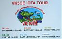
oc-193.jpgOC-193 Western Australia State (South Coast) West Centre groupCheyne Island lies off the south west coast of Western Australia near Bremer Bay and is around 16 hectares in size. The island is uninhabited
|
|
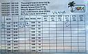
oc-193r.jpgOC-193 Western Australia State (South Coast) West Centre groupCheyne Island lies off the south west coast of Western Australia near Bremer Bay and is around 16 hectares in size. The island is uninhabited
|
|

OC-194.jpgOC-194 New South Wales State North groupSouth Solitary Island is an island within the Solitary Islands Marine Park, about 15 kilometres (9.3 mi) northeast of Coffs Harbour, New South Wales, Australia. The lighthouse located on the summit of the island is considered the most isolated lighthouse on the New South Wales coast. The island is uninhabited
|
|

OC-194R.jpgOC-194 New South Wales State North groupSouth Solitary Island is an island within the Solitary Islands Marine Park, about 15 kilometres (9.3 mi) northeast of Coffs Harbour, New South Wales, Australia. The lighthouse located on the summit of the island is considered the most isolated lighthouse on the New South Wales coast. The island is uninhabited
|
|

OC-195.jpgOC-195 Furneaux groupThe Furneaux Group (indigenous name: Tayaritja[1][2]) is a group of approximately 100 islands located at the eastern end of Bass Strait, between Victoria and Tasmania, Australia. The largest islands in the group are Flinders Island, Cape Barren Island, and Clarke Island. The group contains five settlements: Killiecrankie, Emita, Lady Barron, Cape Barren Island, and Whitemark on Flinders Island, which serves as the administrative centre of the Flinders Council. There are also some small populated ranches on the remote islands.
|
|
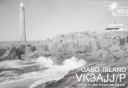
OC-196.jpgOC-196 Victoria State East groupGabo Island is a 154-hectare (380-acre) island located off the coast of eastern Victoria, Australia, between Mallacoota and Cape Howe on the border with New South Wales. It is separated from the mainland by a 500-metre (1,600 ft) wide channel. Gabo Island is a shipping reference commonly referred to in Victorian weather warnings issued by the Australian Bureau of Meteorology. Gabo Island is well known for its historic lighthouse. This lighthouse, Australia's second tallest, was completed in 1862 and made from pink granite quarried from the island itself.
|
|
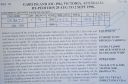
OC-196R.jpgOC-196 Victoria State East groupGabo Island is a 154-hectare (380-acre) island located off the coast of eastern Victoria, Australia, between Mallacoota and Cape Howe on the border with New South Wales. It is separated from the mainland by a 500-metre (1,600 ft) wide channel. Gabo Island is a shipping reference commonly referred to in Victorian weather warnings issued by the Australian Bureau of Meteorology. Gabo Island is well known for its historic lighthouse. This lighthouse, Australia's second tallest, was completed in 1862 and made from pink granite quarried from the island itself.
|
|
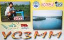
OC-197.jpgOC-197 Bawean IslandBawean (Indonesian: Pulau Bawean) is an island of Indonesia located approximately 150 km north of Surabaya in the Java Sea, off the coast of Java. It is administered by Gresik Regency of East Java province. It is approximately 15 km in diameter and is circumnavigated by a single narrow road. Bawean is dominated by an extinct volcano at its center that rises to 655 m above sea level. Its population as of the 2010 Census is about 70,000 people
|
|
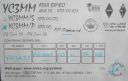
OC-197R.jpgOC-197 Bawean IslandBawean (Indonesian: Pulau Bawean) is an island of Indonesia located approximately 150 km north of Surabaya in the Java Sea, off the coast of Java. It is administered by Gresik Regency of East Java province. It is approximately 15 km in diameter and is circumnavigated by a single narrow road. Bawean is dominated by an extinct volcano at its center that rises to 655 m above sea level. Its population as of the 2010 Census is about 70,000 people
|
|

OC-198.jpgOC-198 Northern Territory (Gulf of Carpentaria) South groupBarranyi (North Island) National Park is in the Gulf of Carpentaria in the Northern Territory of Australia, 737 km southeast of Darwin.
|
|

OC-199.jpgOC-199 Western Australia State (N.W. Coast) Centre groupRosemary Island is an island in the Dampier Archipelago in the Pilbara region of Western Australia. With Enderby Island it forms Class A Nature Reserve 36915, part of a proposed national park. In 2016, archaeologists from the University of Western Australia excavated ancient rock shelters on Rosemary Island, between 8000 and 9000 years old. They may be the earliest known domestic structures in Australia
|
|

OC-199R.jpgOC-199 Western Australia State (N.W. Coast) Centre groupRosemary Island is an island in the Dampier Archipelago in the Pilbara region of Western Australia. With Enderby Island it forms Class A Nature Reserve 36915, part of a proposed national park. In 2016, archaeologists from the University of Western Australia excavated ancient rock shelters on Rosemary Island, between 8000 and 9000 years old. They may be the earliest known domestic structures in Australia
|
|
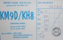
OC-200.jpgOC-200 Swains IslandSwains Island is an atoll in the Tokelau chain. The island is subject to an ongoing territorial dispute between Tokelau and the United States of America, which administers it as part of American Samoa.[2][3] Owned by the Jennings family and used as a copra plantation, Swains Island has a population of 17 Tokelauans, who harvest the island's coconuts. The land area is 1.5 square kilometres (0.58 sq mi).
|
|

OC-201.jpgOC-201 North Island's Coastal IslandsWaiheke Island is the most populated and second-largest island in the Hauraki Gulf of New Zealand. Its ferry terminal in Matiatia Bay at the western end is 21.5 km (13.4 mi) from the central-city terminal in Auckland. Waiheke is the second-largest island in the gulf, after Great Barrier Island, and is the most populated island in the gulf, with 9,250 permanent residents.
|
|
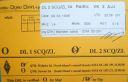
OC-201R.jpgOC-201 North Island's Coastal IslandsWaiheke Island is the most populated and second-largest island in the Hauraki Gulf of New Zealand. Its ferry terminal in Matiatia Bay at the western end is 21.5 km (13.4 mi) from the central-city terminal in Auckland. Waiheke is the second-largest island in the gulf, after Great Barrier Island, and is the most populated island in the gulf, with 9,250 permanent residents.
|
|
| 478 files on 12 page(s) |
 |
|
|
|
|
|
8 | |
|
|
|
 Contact
