Oceania Islands IOTA QSL Album
|
|
|

OC-105.jpgOC-105 Cagayan de Sulu groupMapun is an island municipality in the Sulu Sea on the south-western extreme of the Philippines, located very close to Sabah, Malaysia. The people inhabiting the island are known as Jama Mapun or "people of Mapun". Their dialect is Pullun Mapun, which means "Mapun language".
|
|

OC-105R.jpgOC-105 Cagayan de Sulu groupMapun is an island municipality in the Sulu Sea on the south-western extreme of the Philippines, located very close to Sabah, Malaysia. The people inhabiting the island are known as Jama Mapun or "people of Mapun". Their dialect is Pullun Mapun, which means "Mapun language".
|
|
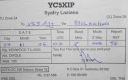
OC-106.jpgOC-106 Natuna Besar IslandsGreat Natuna Island or just Natuna is the main island of the Middle Natuna Archipelago, which is part of the Riau Islands Province, Indonesia. It is also called Great Bunguran Island. The area of Great Natuna is 1,720 km². The highest point is Mount Ranai at 1,035 metres.
|
|
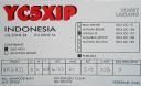
OC-107.jpgOC-107 Lingga IslandsThe Lingga Regency are a group of islands in Indonesia, located south of Singapore, along both sides of the equator, off the eastern coast of Riau Province on Sumatra island. They are south of the populated Riau Archipelago, known for the industrial island of Batam and the tourist-frequented island of Bintan, although the Lingga Islands themselves are rarely visited due to the infrequent local transportation.
|
|

OC-108.jpgOC-108 Anambas IslandsAnambas Islands Regency is a small archipelago of Indonesia, located 150 nautical miles northeast of Batam Island in the North Natuna Sea between the Malaysian mainland to the west and the island of Borneo to the east.
|
|

OC-108R.jpgOC-108 Anambas IslandsAnambas Islands Regency is a small archipelago of Indonesia, located 150 nautical miles northeast of Batam Island in the North Natuna Sea between the Malaysian mainland to the west and the island of Borneo to the east.
|
|
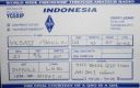
OC-109R.jpgOC-109 Natuna Selatan Islands;Subi Besar IslandsThe Natuna Regency is an archipelago of 272 islands located in the south part of the South China Sea in the Natuna Sea. It is part of the larger Tudjuh Archipelago, off the northwest coast of Borneo. Administratively, the islands (including the central Bunguran Islands and various outliers) constitute a regency within the Riau Islands Province of Indonesia and are the northernmost non-disputed island group of Indonesia.
|
|
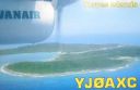
OC-110.jpgOC-110 Torres IslandsThe Torres Islands are in the Torba Province of Vanuatu, the northernmost island group in the country. The chain of islands that make up this micro-archipelago straddle the broader cultural boundary that distinguishes Island Melanesia from several Polynesian outliers located in the neighbouring Solomon Islands. To the north is Temotu Province of the Solomon Islands, to the south Espiritu Santo, and to the southeast the Banks Islands. To the west, in the ocean, is the deep Torres Trench, the subduction zone between the Australian and Pacific Plates.
|
|

OC-110R.jpgOC-110 Torres IslandsThe Torres Islands are in the Torba Province of Vanuatu, the northernmost island group in the country. The chain of islands that make up this micro-archipelago straddle the broader cultural boundary that distinguishes Island Melanesia from several Polynesian outliers located in the neighbouring Solomon Islands. To the north is Temotu Province of the Solomon Islands, to the south Espiritu Santo, and to the southeast the Banks Islands. To the west, in the ocean, is the deep Torres Trench, the subduction zone between the Australian and Pacific Plates.
|
|

OC-111A.jpgOC-111 Shepherd IslandsThe Shepherd Islands (coordinates 16.8°S 168.5°ECoordinates: 16.8°S 168.5°E) are a group of islands lying between the larger islands of Epi and Éfaté, in the Shefa province of Vanuatu. They were named by Captain Cook after Anthony Shepherd, a British astronomer and friend of Cook. In the 2009 census the population numbered 3634. The Shepherd Islands are quite densely populated. There is little economic activity although fishing is very good.
|
|

OC-111R.jpgOC-111 Shepherd IslandsThe Shepherd Islands (coordinates 16.8°S 168.5°ECoordinates: 16.8°S 168.5°E) are a group of islands lying between the larger islands of Epi and Éfaté, in the Shefa province of Vanuatu. They were named by Captain Cook after Anthony Shepherd, a British astronomer and friend of Cook. In the 2009 census the population numbered 3634. The Shepherd Islands are quite densely populated. There is little economic activity although fishing is very good.
|
|

oc-112.jpgOC-112 Conway ReefConway Reef, known since 1976 by its Fijian name Ceva-I-Ra Reef, is a coral reef of atoll type 450 km southwest of the Fiji Islands and part of the Republic of Fiji. It is 2.5 km long in an east-west direction. On the middle of the reef is a small sand cay, 1.8 meters high and about 320 metres long and 73 metres wide, with a land area of two hectares. A stranded wreck of a coaster lies 240 metres south of the centre of the cay, and the wreck of a fishing vessel (Sang Sheng 168) lies on the northeast end
|
|

oc-112r.jpgOC-112 Conway ReefConway Reef, known since 1976 by its Fijian name Ceva-I-Ra Reef, is a coral reef of atoll type 450 km southwest of the Fiji Islands and part of the Republic of Fiji. It is 2.5 km long in an east-west direction. On the middle of the reef is a small sand cay, 1.8 meters high and about 320 metres long and 73 metres wide, with a land area of two hectares. A stranded wreck of a coaster lies 240 metres south of the centre of the cay, and the wreck of a fishing vessel (Sang Sheng 168) lies on the northeast end
|
|

OC-113a.jpgOC-113 Actaeon groupThe Acteon Group (Groupe Actéon) is a rather isolated and uninhabited subgroup in the far southeast of the Tuamotu atoll group in French Polynesia. It is located about 1,400 km (870 mi) east-southeast of Tahiti at latitude: 21° 17' 60 S, longitude: 136° 29' W.
|
|

OC-113AR.jpgOC-113 Actaeon groupThe Acteon Group (Groupe Actéon) is a rather isolated and uninhabited subgroup in the far southeast of the Tuamotu atoll group in French Polynesia. It is located about 1,400 km (870 mi) east-southeast of Tahiti at latitude: 21° 17' 60 S, longitude: 136° 29' W.
|
|

OC-114.jpgOC-114 Raivavae IslandRaivavae is one of the Austral Islands in French Polynesia. Its total land area including offshore islets is 17.9 km2 (6.9 sq mi).[1]:205 At the 2017 census it had a population of 903. The island is of volcanic origin, and rises to 437 metres (1,434 ft) elevation at Mont Hiro.
|
|

OC-114R.jpgOC-114 Raivavae IslandRaivavae is one of the Austral Islands in French Polynesia. Its total land area including offshore islets is 17.9 km2 (6.9 sq mi).[1]:205 At the 2017 census it had a population of 903. The island is of volcanic origin, and rises to 437 metres (1,434 ft) elevation at Mont Hiro.
|
|

OC-115.jpgOC-115 Trobriand IslandsThe Trobriand Islands are a 450-square-kilometre (174-square-mile) archipelago of coral atolls off the east coast of New Guinea. They are part of the nation of Papua New Guinea and are in Milne Bay Province. Most of the population of 12,000 indigenous inhabitants live on the main island of Kiriwina, which is also the location of the government station, Losuia.
|
|

OC-115R.jpgOC-115 Trobriand IslandsThe Trobriand Islands are a 450-square-kilometre (174-square-mile) archipelago of coral atolls off the east coast of New Guinea. They are part of the nation of Papua New Guinea and are in Milne Bay Province. Most of the population of 12,000 indigenous inhabitants live on the main island of Kiriwina, which is also the location of the government station, Losuia.
|
|

OC-116.jpgOC-116 D'Entrecasteaux IslandsD'Entrecasteaux Islands are situated near the eastern tip of New Guinea in the Solomon Sea in Milne Bay Province of Papua New Guinea. The group spans a distance of 160 km (99 mi), has a total land area of approximately 3,100 km2 (1,197 sq mi) and is separated from the Papua New Guinea mainland by the 30 km (19 mi) wide Ward Hunt Strait in the north and the 18 km (11 mi) wide Goschen Strait in the south. D'Entrecasteaux Islands show signs of volcanism.
|
|
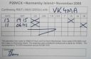
OC-116R.jpgOC-116 D'Entrecasteaux IslandsD'Entrecasteaux Islands are situated near the eastern tip of New Guinea in the Solomon Sea in Milne Bay Province of Papua New Guinea. The group spans a distance of 160 km (99 mi), has a total land area of approximately 3,100 km2 (1,197 sq mi) and is separated from the Papua New Guinea mainland by the 30 km (19 mi) wide Ward Hunt Strait in the north and the 18 km (11 mi) wide Goschen Strait in the south. D'Entrecasteaux Islands show signs of volcanism.
|
|

oc-117.jpgOC-117 Louisiade ArchipelagoThe Louisiade Archipelago is a string of ten larger volcanic islands frequently fringed by coral reefs, and 90 smaller coral islands in Papua New Guinea. It is located 200km southeast of New Guinea, stretching over more than 160 kilometres (99 mi) and spread over an ocean area of 26,000 square kilometres (10,000 sq mi) between the Solomon Sea to the north and the Coral Sea to the south. The aggreg land area of the islands is about 1,871 square kilometres (722 sq mi) with Vanatinai (Tagula) being the largest
|
|

oc-117r.jpgOC-117 Louisiade ArchipelagoThe Louisiade Archipelago is a string of ten larger volcanic islands frequently fringed by coral reefs, and 90 smaller coral islands in Papua New Guinea. It is located 200km southeast of New Guinea, stretching over more than 160 kilometres (99 mi) and spread over an ocean area of 26,000 square kilometres (10,000 sq mi) between the Solomon Sea to the north and the Coral Sea to the south. The aggreg land area of the islands is about 1,871 square kilometres (722 sq mi) with Vanatinai (Tagula) being the largest
|
|

OC-118.jpgOC-118 Hoorn IslandsThe Hoorn Islands (also Futuna Islands) are one of the two island groups of which the French overseas collectivity (collectivité d'outre-mer, or COM) of Wallis and Futuna is geographically composed. The aggregate area is 115 km², and the population 4,873 (census of 2003).
Geographically, there are two islands: Futuna Island (in the northwest) (83 km², pop. 4871), Alofi Island (in the southeast) (32 km², pop. 2)
|
|

OC-118R.jpgOC-118 Hoorn IslandsThe Hoorn Islands (also Futuna Islands) are one of the two island groups of which the French overseas collectivity (collectivité d'outre-mer, or COM) of Wallis and Futuna is geographically composed. The aggregate area is 115 km², and the population 4,873 (census of 2003).
Geographically, there are two islands: Futuna Island (in the northwest) (83 km², pop. 4871), Alofi Island (in the southeast) (32 km², pop. 2)
|
|

OC-119.jpgOC-119 Jolo groupJolo (Tausūg: Sūg) is a volcanic island in the southwest Philippines and is the primary island of the province of Sulu wherein its capital of the same name is situated. It is located in the Sulu Archipelago, between Borneo and Mindanao, and has a population of approximately 500,000 people. The island is the location of the Jolo Group of Volcanoes, and contains numerous volcanic cones and craters, including the active Bud Dajo cinder cone.
|
|

OC-120.jpgOC-120 Cuyo IslandsThe Cuyo Archipelago or Cuyo Islands, is a group of about 45 islands lying to the northeast of the Philippines island of Palawan.] It lies south of Mindoro and between Northern Palawan and Panay. It is centered on the largest island of the archipelago, Cuyo Island, with an area of 22 square miles (57 km2) and is about 9 miles (14 km) long.
|
|

OC-120R.jpgOC-120 Cuyo IslandsThe Cuyo Archipelago or Cuyo Islands, is a group of about 45 islands lying to the northeast of the Philippines island of Palawan.] It lies south of Mindoro and between Northern Palawan and Panay. It is centered on the largest island of the archipelago, Cuyo Island, with an area of 22 square miles (57 km2) and is about 9 miles (14 km) long.
|
|

oc-121.jpgOC-121 Mamanuca group;MamanuthaThe Mamanuca Islands (Fijian: [mamaˈnuða]) of Fiji are a volcanic archipelago lying to the west of Nadi and to the south of the Yasawa Islands. The group, a popular tourist destination, consists of about 20 islands, but about seven of these are covered by the Pacific Ocean at high tide. One of the islands, Monuriki, was made famous as the anonymous island that featured in the 2000 Robert Zemeckis film, Cast Away,
|
|

oc-121r.jpgOC-121 Mamanuca group;MamanuthaThe Mamanuca Islands (Fijian: [mamaˈnuða]) of Fiji are a volcanic archipelago lying to the west of Nadi and to the south of the Yasawa Islands. The group, a popular tourist destination, consists of about 20 islands, but about seven of these are covered by the Pacific Ocean at high tide. One of the islands, Monuriki, was made famous as the anonymous island that featured in the 2000 Robert Zemeckis film, Cast Away,
|
|

OC-122.jpgOC-122 Tambelan IslandsTambelan archipelago is a group of islands off the west coast of West Kalimantan, Indonesia, just north of the equator. The archipelago is located on the north opening of Karimata Strait which separates Borneo and Belitung island.
|
|

OC-122R.jpgOC-122 Tambelan IslandsTambelan archipelago is a group of islands off the west coast of West Kalimantan, Indonesia, just north of the equator. The archipelago is located on the north opening of Karimata Strait which separates Borneo and Belitung island.
|
|

OC-123.jpgOC-123 Niuafo'ou IslandNiuafoʻou (meaning: many new coconuts) is the most northerly island in the kingdom of Tonga. It is a volcanic rim island with an area of 15 km2 (5.8 sq mi) and a population of 650 in 2006. The Niuafoʻou language is spoken on the island.
|
|

OC-123R.jpgOC-123 Niuafo'ou IslandNiuafoʻou (meaning: many new coconuts) is the most northerly island in the kingdom of Tonga. It is a volcanic rim island with an area of 15 km2 (5.8 sq mi) and a population of 650 in 2006. The Niuafoʻou language is spoken on the island.
|
|

OC-124.jpgOC-124 Palmerston AtollPalmerston Island is a coral atoll in the Cook Islands in the Pacific Ocean about 500 km northwest of Rarotonga. 62 people live on Palmerston, all but three descended from English sailor William Marsters.
|
|
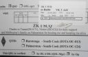
OC-124R.jpgOC-124 Palmerston AtollPalmerston Island is a coral atoll in the Cook Islands in the Pacific Ocean about 500 km northwest of Rarotonga. 62 people live on Palmerston, all but three descended from English sailor William Marsters.
|
|

OC-125.jpgOC-125 Semirara IslandsSemirara Island is located in the central west of the Philippines archipeleago and has an area of 55 square kilometres (21 sq mi), and is home to the Panian Mine, a vast open-pit coal mine in operation since 1999, and the Unong Mine (in production from 1984 to 2000).
|
|

OC-125R.jpgOC-125 Semirara IslandsSemirara Island is located in the central west of the Philippines archipeleago and has an area of 55 square kilometres (21 sq mi), and is home to the Panian Mine, a vast open-pit coal mine in operation since 1999, and the Unong Mine (in production from 1984 to 2000).
|
|
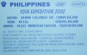
oc-126.jpgOC-126 Lubang IslandsLubang Island is the largest island in the Lubang Group of Islands, an archipelago which lies to the northwest of the northern end of Mindoro in the Philippines. The Lubang Islands are about 150 kilometres (93 mi) southwest of Manila. There are seven islands in the group,
|
|
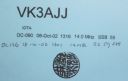
OC-126R.jpgOC-126 Lubang IslandsLubang Island is the largest island in the Lubang Group of Islands, an archipelago which lies to the northwest of the northern end of Mindoro in the Philippines. The Lubang Islands are about 150 kilometres (93 mi) southwest of Manila. There are seven islands in the group,
|
|
| 478 files on 12 page(s) |
 |
|
|
5 | |
|
|
|
|
|
|
 Contact
