Oceania Islands IOTA QSL Album
|
|
|

OC-080.jpgOC-080 Suwarrow Atoll;Suvorov AtollSuwarrow (also called Suvorov, Suvarou, or Suvarov) is an island in the northern group of the Cook Islands in the south Pacific Ocean. It is about 1,300 kilometres (810 mi) south of the equator and 930 kilometres (580 mi) north-northwest of the capital island of Rarotonga. Every five years, the Cook Islands government advertises for the Suwarrow island nature reserve caretaker position. The position is staffed between April and October by two persons.
|
|

OC-081.jpgOC-081 - JARVIS ISLANDJarvis Island; formerly known as Bunker Island or Bunker's Shoal, is an uninhabited 4.5 km2 (1.7 sq mi) coral island located in the South Pacific Ocean, about halfway between Hawaii and the Cook Islands. The US claimed it in the 19th century and mined it for guano. In the 20th century, it was the subject of a small settlement. It was attacked during WW2 and evacuated, leaving some buildings and a day beacon. In modern times, it is managed as a nature reserve.
|
|

OC-081R.jpgOC-081 - JARVIS ISLANDJarvis Island; formerly known as Bunker Island or Bunker's Shoal, is an uninhabited 4.5 km2 (1.7 sq mi) coral island located in the South Pacific Ocean, about halfway between Hawaii and the Cook Islands. The US claimed it in the 19th century and mined it for guano. In the 20th century, it was the subject of a small settlement. It was attacked during WW2 and evacuated, leaving some buildings and a day beacon. In modern times, it is managed as a nature reserve.
|
|

OC-082.jpgOC-082 Penrhyn Atoll;Tongareva AtollPenrhyn (also called Tongareva, MÄngarongaro, Hararanga, and Te Pitaka) is an island in the northern group of the Cook Islands in the south Pacific Ocean. The northernmost island in the group, it is located at 1,365 km (848 mi) north-north-east of the capital island of Rarotonga, 9 degrees south of the equator. Its nearest neighbours are Rakahanga, and Manihiki, approximately 350 kilometres (220 mi) to the southwest.
|
|
OC-082R.jpgOC-082 Penrhyn Atoll;Tongareva AtollPenrhyn (also called Tongareva, MÄngarongaro, Hararanga, and Te Pitaka) is an island in the northern group of the Cook Islands in the south Pacific Ocean. The northernmost island in the group, it is located at 1,365 km (848 mi) north-north-east of the capital island of Rarotonga, 9 degrees south of the equator. Its nearest neighbours are Rakahanga, and Manihiki, approximately 350 kilometres (220 mi) to the southwest.
|
|

OC-083.jpgOC-083 Aitutaki groupAitutaki, also traditionally known as Araʻura and Utataki, is one of the Cook Islands, north of Rarotonga. It has a population of approximately 2,000. Aitutaki is the second most visited island of the Cook Islands. The main village is Arutanga (Arutunga) on the west side.
|
|

oc-083r.jpgOC-083 Aitutaki groupAitutaki, also traditionally known as Araʻura and Utataki, is one of the Cook Islands, north of Rarotonga. It has a population of approximately 2,000. Aitutaki is the second most visited island of the Cook Islands. The main village is Arutanga (Arutunga) on the west side.
|
|

OC-084.jpgOC-084 Fanning and Washington IslandsTabuaeran or Tahanea, known in English as Fanning Atoll, is an atoll that is part of the Line Islands of the central Pacific Ocean and part of Kiribati. The land area is 33.73 square kilometres, and the population in 2010 was 1,960. The maximum elevation is about 3 m above high tide.
|
|

oc-085.jpgOC-085 Palmyra AtollPalmyra Atoll is one of the Northern Line Islands, located almost due south of the Hawaiian Islands, roughly one-third of the way between Hawaii and American Samoa. The nearest continent is almost 3,355 miles to the northeast. The atoll is 4.6 sq mi, and it is located in the equatorial Northern Pacific Ocean.
|
|

OC-086.JPGOC-086 Northern Mariana IslandsThe Northern Mariana Islands, officially the Commonwealth of the Northern Mariana Islands is an insular area and commonwealth of the United States consisting of 14 islands in the northwestern Pacific Ocean. The CNMI includes the 14 northernmost islands in the Mariana Archipelago except the southernmost island of the chain, Guam, which is a separate U.S. territory.
|
|

OC-087.jpgOC-087 Enewetak Atoll;Eniwetok AtollEnewetak Atoll is a large coral atoll of 40 islands in the Pacific Ocean and with its 664 people (as of 2011) forms a legislative district of the Ralik Chain of the Marshall Islands. With a land area total less than 5.85 square kilometres (2.26 sq mi), it is no higher than 5 meters and surrounds a deep central lagoon, 80 kilometres (50 mi) in circumference. It is the second-westernmost atoll of the Ralik Chain and is 305 kilometres (190 mi) west from Bikini Atoll.
|
|

OC-087R.jpgOC-087 Enewetak Atoll;Eniwetok AtollEnewetak Atoll is a large coral atoll of 40 islands in the Pacific Ocean and with its 664 people (as of 2011) forms a legislative district of the Ralik Chain of the Marshall Islands. With a land area total less than 5.85 square kilometres (2.26 sq mi), it is no higher than 5 meters and surrounds a deep central lagoon, 80 kilometres (50 mi) in circumference. It is the second-westernmost atoll of the Ralik Chain and is 305 kilometres (190 mi) west from Bikini Atoll.
|
|

OC-088.jpgOC-088 Borneo (East Malaysia / Brunei / Indonesia Kalimantan)Borneo is the third-largest island in the world and the largest in Asia. At the geographic centre of Maritime Southeast Asia, in relation to major Indonesian islands, it is located north of Java, west of Sulawesi, and east of Sumatra. The island is politically divided among three countries: Malaysia and Brunei in the north, and Indonesia to the south.
|
|
OC-089.jpgOC-089 Baker and Howland IslandsHowland and Baker islands are two uninhabited U.S. atolls in the Equatorial Pacific that are located close to one another. Both islands are wildlife refuges, the larger of which is Howland Island. The pair of islands may also be referred to as Baker and Howland Islands. They are both part of the larger political territory of the United States Minor Outlying Islands and they are also both part of the larger geographic grouping of the Phoenix Islands. Each is a National Wildlife Refuge
|
|

OC-090A.jpgOC-090 Calamian groupThe Calamian Islands or Calamianes is a group of islands in the Philippine province of Palawan. Busuanga Island hosts the largest town, Coron, in the Calamian Islands.
|
|
OC-090R.JPGOC-090 Calamian groupThe Calamian Islands or Calamianes is a group of islands in the Philippine province of Palawan. Busuanga Island hosts the largest town, Coron, in the Calamian Islands.
|
|
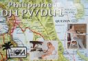
OC-091.jpgOC-091 Polillo IslandsPolillo is an island in the northeastern region of the Philippine archipelago. It is separated from Luzon Island by the Polillo Strait and forms the northern side of Lamon Bay. As of the 2010 Philippine Census, the island is home to 64,802 individuals
|
|

OC-091R.jpgOC-091 Polillo IslandsPolillo is an island in the northeastern region of the Philippine archipelago. It is separated from Luzon Island by the Polillo Strait and forms the northern side of Lamon Bay. As of the 2010 Philippine Census, the island is home to 64,802 individuals
|
|
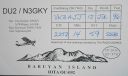
OC-092.jpgOC-092 Babuyan IslandsThe Babuyan Islands, is an archipelago in the Philippines, located in the Luzon Strait north of the main island of Luzon and south of Taiwan via Bashi Channel to Luzon Strait. The archipelago consists of five major islands and their surrounding smaller islands. These main islands are, counterclockwise starting from northeast, Babuyan, Calayan, Dalupiri, Fuga, and Camiguin. The Babuyan Islands are separated from Luzon by the Babuyan Channel
|
|

OC-093.jpgOC-093 Batanes groupThe Batanes group is located approximately 162 kilometres (101 mi) north of the Luzon mainland and about 190 kilometres (120 miles) south of Taiwan, separated from the Babuyan Islands of Cagayan Province by the Balintang Channel, and from Taiwan by the Bashi Channel. The entire province is listed in the UNESCO tentative list for inscription in the World Heritage List.
|
|

OC-094.jpgOC-094 Disappointment IslandsThe Disappointment Islands are a subgroup of the Tuamotu Archipelago in French Polynesia. They are located towards the northeast, away from the main Tuamotu group. They are a small group of coral islands, which includes the island of Tepoto and the atoll of Napuka. These islands are arid, and are not especially conducive to human habitation.
|
|

OC-094R.jpgOC-094 Disappointment IslandsThe Disappointment Islands are a subgroup of the Tuamotu Archipelago in French Polynesia. They are located towards the northeast, away from the main Tuamotu group. They are a small group of coral islands, which includes the island of Tepoto and the atoll of Napuka. These islands are arid, and are not especially conducive to human habitation.
|
|

OC-095.jpgOC-095 Lau groupThe Lau Islands of Fiji are situated in the southern Pacific Ocean, just east of the Koro Sea. Of this chain of about sixty islands and islets, about thirty are inhabited. The Lau Group covers a land area of 188 square miles (487 square km), and had a population of 10,683 at the most recent census in 2007. While most of the northern Lau Group are high islands of volcanic origin, those of the south are mostly carbonate low islands.
|
|
OC-095R.jpgOC-095 Lau groupThe Lau Islands of Fiji are situated in the southern Pacific Ocean, just east of the Koro Sea. Of this chain of about sixty islands and islets, about thirty are inhabited. The Lau Group covers a land area of 188 square miles (487 square km), and had a population of 10,683 at the most recent census in 2007. While most of the northern Lau Group are high islands of volcanic origin, those of the south are mostly carbonate low islands.
|
|

OC-096.jpgOC-096 Kingman Reef (deleted)DescriptionKingman Reef is a largely submerged, uninhabited triangular-shaped reef, 9.5 nautical miles east-west and 5 nmi north-south, located in the North Pacific Ocean, roughly halfway between the Hawaiian Islands and American Samoa.
|
|

OC-096R.jpgOC-096 Kingman Reef (deleted)DescriptionKingman Reef is a largely submerged, uninhabited triangular-shaped reef, 9.5 nautical miles east-west and 5 nmi north-south, located in the North Pacific Ocean, roughly halfway between the Hawaiian Islands and American Samoa.
|
|

OC-097.jpgOC-097 Samoa IslandsThe Samoan Islands are an archipelago covering 3,030 km2 (1,170 sq mi) in the central South Pacific, forming part of Polynesia and the wider region of Oceania. Administratively, the archipelago comprises all of Samoa and most of American Samoa (apart from Swains Island, which is part of the Tokelau Islands). The two Samoan jurisdictions are separated by 64 km (40 mi) of ocean. The population of the Samoan Islands is approximately 250,000
|
|
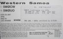
OC-097R.jpgOC-097 Samoa IslandsThe Samoan Islands are an archipelago covering 3,030 km2 (1,170 sq mi) in the central South Pacific, forming part of Polynesia and the wider region of Oceania. Administratively, the archipelago comprises all of Samoa and most of American Samoa (apart from Swains Island, which is part of the Tokelau Islands). The two Samoan jurisdictions are separated by 64 km (40 mi) of ocean. The population of the Samoan Islands is approximately 250,000
|
|

OC-098.jpgOC-098 Pukapuka Atoll;Danger IslandsPukapuka, formerly Danger Island, is a coral atoll in the northern group of the Cook Islands in the Pacific Ocean. It is one of most remote islands of the Cook Islands, situated about 1,140 kilometres (708 miles) northwest of Rarotonga. On this small island, an ancient culture and distinct language has been maintained over many centuries.
|
|

OC-098R.jpgOC-098 Pukapuka Atoll;Danger IslandsPukapuka, formerly Danger Island, is a coral atoll in the northern group of the Cook Islands in the Pacific Ocean. It is one of most remote islands of the Cook Islands, situated about 1,140 kilometres (708 miles) northwest of Rarotonga. On this small island, an ancient culture and distinct language has been maintained over many centuries.
|
|
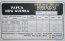
OC-099.jpgOC-099 Tabar IslandsTabar Island is the main island of the Tabar Islands and forms part of the New Ireland Province. It is located approximately 900 km north east of Port Moresby and about 24 km northeast of the province's main island New Ireland. The island is of volcanic origin and has an area of about 110 km² with a length of about 20 km and about 9 km wide. The highest altitude is approximately 400 m above sea level. Tabar Island is the largest and southernmost island in the archipelago.
|
|

OC-100.jpgOC-100 Nendo IslandNendo is the largest of the Santa Cruz Islands, located in the Temotu province of the Solomon Islands. Nendö is 40 km (25 mi.) long and 22 km (14 mi.) wide. Its land area is 505.5 km² (195 sq. mi.). The highest point on the island is 549 m (1,801 ft.) above sea level. Nendö's population is somewhat over 5000
|
|

OC-100R.jpgOC-100 Nendo IslandNendo is the largest of the Santa Cruz Islands, located in the Temotu province of the Solomon Islands. Nendö is 40 km (25 mi.) long and 22 km (14 mi.) wide. Its land area is 505.5 km² (195 sq. mi.). The highest point on the island is 549 m (1,801 ft.) above sea level. Nendö's population is somewhat over 5000
|
|

oc-101.jpgOC-101 Feni IslandsThe Feni Islands are an island group in Papua New Guinea, located east of New Ireland, at 4°4′20.35″S 153°37′57.03″ECoordinates: 4°4′20.35″S 153°37′57.03″E. It is a part of the Bismarck Archipelago. The largest island of the group is Ambitle, the other island is Babase Island.
|
|
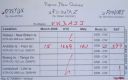
oc-101r.jpgOC-101 Feni IslandsThe Feni Islands are an island group in Papua New Guinea, located east of New Ireland, at 4°4′20.35″S 153°37′57.03″ECoordinates: 4°4′20.35″S 153°37′57.03″E. It is a part of the Bismarck Archipelago. The largest island of the group is Ambitle, the other island is Babase Island.
|
|

oc-102.jpgOC-102 Tanga IslandsThe Tanga Islands are an island group in Papua New Guinea, located north-east of New Ireland and part of the Bismarck Archipelago.Tanga is made up of four main islands—Boeng, Maledok, Lif and Tefa—and a number of smaller, uninhabited islands.
|
|

oc-102r.jpgOC-102 Tanga IslandsThe Tanga Islands are an island group in Papua New Guinea, located north-east of New Ireland and part of the Bismarck Archipelago.Tanga is made up of four main islands—Boeng, Maledok, Lif and Tefa—and a number of smaller, uninhabited islands.
|
|
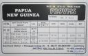
OC-103.jpgOC-103 St Matthias groupThe St Matthias Islands (also known as the Mussau islands) are a small archipelago group of islands in the Bismarck Archipelago, in northern Papua New Guinea. They are within New Ireland Province. There are at least 10 islands. The largest and most northerly is Mussau.
|
|

OC-104.jpgOC-104 Banks IslandsThe Banks Islands (in Bislama Bankis) are a group of islands in northern Vanuatu. Together with the Torres Islands to the northwest, they make up the northernmost province of Torba. The group lies about 40 km (25 mi) north of Maewo, and includes Gaua and Vanua Lava, two of the 13 largest islands in Vanuatu. In 2009, the islands supported a population of 8,533 on a land area of 780 km².
|
|

OC-104R.jpgOC-104 Banks IslandsThe Banks Islands (in Bislama Bankis) are a group of islands in northern Vanuatu. Together with the Torres Islands to the northwest, they make up the northernmost province of Torba. The group lies about 40 km (25 mi) north of Maewo, and includes Gaua and Vanua Lava, two of the 13 largest islands in Vanuatu. In 2009, the islands supported a population of 8,533 on a land area of 780 km².
|
|
| 478 files on 12 page(s) |
 |
|
4 | |
|
|
|
|
|
|
|
 Contact

