North America Islands IOTA QSL Album
|
|
|
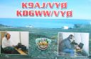
na-159.jpgNA-159 Nunavut (King George Islands) groupThe King George Islands are an archipelago in the southeast part of Hudson Bay, Canada
|
|
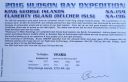
na-159r.jpgNA-159 Nunavut (King George Islands) groupThe King George Islands are an archipelago in the southeast part of Hudson Bay, Canada
|
|

na-160.jpgNA-160 Honduras Cortes / Atlantida / Colon Department groupThe Cayos Cochinos or Cochinos Cays consist of two small islands and 13 more small coral cays situated 30 kilometres northeast of La Ceiba on the northern shores of Honduras. Although geographically separate, they belong to the Bay Islands department and are part of Roatán municipality.
|
|

na-161.jpgNA-161 Alaska Hoonah-Angoon Census Area North groupPleasant Island is the largest island in the Icy Strait between northern Chichagof Island and the mainland of the Alaska Panhandle. It lies southeast of the mainland city of Gustavus and southwest of the mainland community of Excursion Inlet. Pleasant Island has a land area of 49.192 km² (18.993 sq mi), had no population at the 2000 census, and is reported to be uninhabited as of 2012
|
|

na-163.jpgNA-163 Mexico Baja California State East groupIsla Ãngel de la Guarda, also called Archangel Island, is a large island in the Gulf of California east of BahÃa de los Ãngeles in northwestern Mexico, separated from the Baja California Peninsula by the Canal de Ballenas. It is the second largest of the eleven Midriff Islands or Islas Grandes.
|
|

na-163r.jpgNA-163 Mexico Baja California State East groupIsla Ãngel de la Guarda, also called Archangel Island, is a large island in the Gulf of California east of BahÃa de los Ãngeles in northwestern Mexico, separated from the Baja California Peninsula by the Canal de Ballenas. It is the second largest of the eleven Midriff Islands or Islas Grandes.
|
|

na-164.jpgNA-164 Mexico Baja California Sur State North West groupIsla Ascuncion is on the Pacific Coast in the central part of Baja California, Mexico near the town of Punta Ascuncion.
|
|

na-164r.jpgNA-164 Mexico Baja California Sur State North West groupIsla Ascuncion is on the Pacific Coast in the central part of Baja California, Mexico near the town of Punta Ascuncion.
|
|
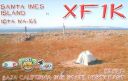
na-165.jpgNA-165 Mexico Baja California Sur State North East groupIslas Santa Inez is an island in the Gulf of California east of the Baja California Peninsula. The island is uninhabited and is part of the Mulegé Municipality in the Mexican state of Baja California Sur.
|
|

na-165r.jpgNA-165 Mexico Baja California Sur State North East groupIslas Santa Inez is an island in the Gulf of California east of the Baja California Peninsula. The island is uninhabited and is part of the Mulegé Municipality in the Mexican state of Baja California Sur.
|
|
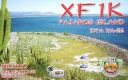
na-166.jpgNA-166 Mexico Sonora State South groupPajaros Island is located 5 km south of the town of Guaymas on the eastern side of the Gulf of California. It has very steep cliffs and is covered by cacti
|
|

na-166r.jpgNA-166 Mexico Sonora State South groupPajaros Island is located 5 km south of the town of Guaymas on the eastern side of the Gulf of California. It has very steep cliffs and is covered by cacti
|
|
na-167.jpgNA-167 Mexico Sonora State North groupEl Pelicano Island is located in the mouth of the Colorado river on the Pacific coast of Mexico. The island is uninhabited
|
|

na-167r.jpgNA-167 Mexico Sonora State North groupEl Pelicano Island is located in the mouth of the Colorado river on the Pacific coast of Mexico. The island is uninhabited
|
|
na-168.jpgNA-168 Louisiana State South East (Lafourche to Plaquemines Parish) groupGrand Isle (French: Grande-ÃŽle) is a town in Jefferson Parish, Louisiana, United States, located on a barrier island of the same name in the Gulf of Mexico. The island is at the mouth of Barataria Bay where it meets the gulf. As of the 2010 census, the town's resident population was 1,296
|
|

na-169.jpgNA-169 Washington State West groupWaadah Island is an island situated in the Strait of Juan de Fuca, just north of Neah Bay in northwestern Clallam County, Washington, United States. The island has a land area of 164,940 square meters and has no human population.
|
|

na-169r.jpgNA-169 Washington State West groupWaadah Island is an island situated in the Strait of Juan de Fuca, just north of Neah Bay in northwestern Clallam County, Washington, United States. The island has a land area of 164,940 square meters and has no human population.
|
|

na-170.jpgNA-170 Panama San Blas Province groupGaigirgordub, called El Porvenir (Spanish pronunciation: [el poɾ.βeˈniɾ]) until July 1, 2016, is the capital of the Panamanian comarca (indigenous territory) of Guna Yala. The settlement is located on a small island and contains a landing strip, a museum (the Museo de la Nación Guna, or Museum of the Guna Nation), a hotel, government offices, and an artisans' cooperative. There is also a small beach.
|
|

na-170r.jpgNA-170 Panama San Blas Province groupGaigirgordub, called El Porvenir (Spanish pronunciation: [el poɾ.βeˈniɾ]) until July 1, 2016, is the capital of the Panamanian comarca (indigenous territory) of Guna Yala. The settlement is located on a small island and contains a landing strip, a museum (the Museo de la Nación Guna, or Museum of the Guna Nation), a hotel, government offices, and an artisans' cooperative. There is also a small beach.
|
|

na-171.jpgNA-171 Mexico Sinaloa State groupIsla de Venados (Deer Island) is a small island off the coast of Mazatlan, Mexico
|
|

na-171r.jpgNA-171 Mexico Sinaloa State groupIsla de Venados (Deer Island) is a small island off the coast of Mazatlan, Mexico
|
|
na-172.jpgNA-172 Mexico North Slope Borough North groupThe Cooper Islands (ca. 52°54′56″N 173°14′17″E) are a group of small islands located 1.6 km (1 mi) off the northeast coast of Attu Island. They extend 0.48 km (0.3 mi) into the Bering Sea.
|
|
na-172r.jpgNA-172 Mexico North Slope Borough North groupThe Cooper Islands (ca. 52°54′56″N 173°14′17″E) are a group of small islands located 1.6 km (1 mi) off the northeast coast of Attu Island. They extend 0.48 km (0.3 mi) into the Bering Sea.
|
|
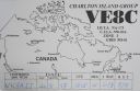
na-173.jpgNA-173 Nunavut (Hudson Bay - Quebec Coast) South groupCharlton Island is an uninhabited island located in James Bay, Qikiqtaaluk Region, Nunavut, Canada. Located northwest of Rupert Bay, it has an area of 308 km2 (119 sq mi).
|
|
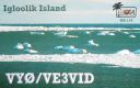
na-174.jpgNA-174 Nunavut (Foxe Basin) groupIgloolik Island is a small island in the Qikiqtaaluk Region of Nunavut, Canada. It is located in the Foxe Basin, very close to the Melville Peninsula (and to a lesser degree, Baffin Island), and it is often thought to be a part of the peninsula. It forms part of the Canadian Arctic Archipelago. There is only one community on the island, also named Igloolik.
|
|

na-174r.jpgNA-174 Nunavut (Foxe Basin) groupIgloolik Island is a small island in the Qikiqtaaluk Region of Nunavut, Canada. It is located in the Foxe Basin, very close to the Melville Peninsula (and to a lesser degree, Baffin Island), and it is often thought to be a part of the peninsula. It forms part of the Canadian Arctic Archipelago. There is only one community on the island, also named Igloolik.
|
|

na-175.jpgNA-175 Nunavut (Kitikmeot Region) West Centre groupThe Couper Islands are an island group located inside western Coronation Gulf, south of Victoria Island, in the Kitikmeot Region, Nunavut, Canada.
|
|

na-175r.jpgNA-175 Nunavut (Kitikmeot Region) West Centre groupThe Couper Islands are an island group located inside western Coronation Gulf, south of Victoria Island, in the Kitikmeot Region, Nunavut, Canada.
|
|

na-176.jpgNA-176 Quebec Province (St Lawrence Gulf) Centre groupThe Mingan Archipelago is an archipelago located east of Quebec, Canada. It consists of a chain of about 40 islands.
|
|
na-176r.jpgNA-176 Quebec Province (St Lawrence Gulf) Centre groupThe Mingan Archipelago is an archipelago located east of Quebec, Canada. It consists of a chain of about 40 islands.
|
|

na-177.jpgNA-177 Quebec Province (Gaspe Peninsula) groupBonaventure Island is a Canadian island in the Gulf of St. Lawrence located 3.5 kilometres off the southern coast of Quebec's Gaspé Peninsula, 5 kilometres southeast of the village of Percé. Roughly circular in shape, it has an area measuring 4.16 square kilometres.
|
|
na-177r.jpgNA-177 Quebec Province (Gaspe Peninsula) groupBonaventure Island is a Canadian island in the Gulf of St. Lawrence located 3.5 kilometres off the southern coast of Quebec's Gaspé Peninsula, 5 kilometres southeast of the village of Percé. Roughly circular in shape, it has an area measuring 4.16 square kilometres.
|
|
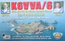
na-178.jpgNA-178 California State Centre (Sonoma to Santa Cruz County) groupThe Farallon Islands, or Farallones (from the Spanish farallón meaning "pillar" or "sea cliff"), are a group of islands and sea stacks in the Gulf of the Farallones, off the coast of San Francisco, California, United States. The islands are also sometimes referred to by mariners as the Devil's Teeth Islands, in reference to the many treacherous underwater shoals in their vicinity.[2] The islands lie 30 miles (48 km) outside the Golden Gate and 20 miles (32 km) south of Point Reyes, and are visible from the mainland on clear days.
|
|

na-178r.jpgNA-178 California State Centre (Sonoma to Santa Cruz County) groupThe Farallon Islands, or Farallones (from the Spanish farallón meaning "pillar" or "sea cliff"), are a group of islands and sea stacks in the Gulf of the Farallones, off the coast of San Francisco, California, United States. The islands are also sometimes referred to by mariners as the Devil's Teeth Islands, in reference to the many treacherous underwater shoals in their vicinity.[2] The islands lie 30 miles (48 km) outside the Golden Gate and 20 miles (32 km) south of Point Reyes, and are visible from the mainland on clear days.
|
|
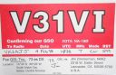
na-180.jpgNA-180 Belize Stann Creek / Toledo District groupSouthwater Cay is located in Belize. Located right on top of the barrier reef, it offers excellent diving and snorkeling right off the beach in a stunning tropical setting.
|
|

na-181.jpgNA-181 Canada British Columbia Province (Estevan group)Trutch Island is an island on the North Coast of British Columbia, Canada. It is one of the northernmost of the Estevan Group of islands and like other islands in the group was named for a Lieutenant-Governor of British Columbia,
|
|

na-181r.jpgNA-181 Canada British Columbia Province (Estevan group)Trutch Island is an island on the North Coast of British Columbia, Canada. It is one of the northernmost of the Estevan Group of islands and like other islands in the group was named for a Lieutenant-Governor of British Columbia,
|
|

na-182.jpgNA-182 Canada NWT (Inuvik Region) East groupGreen Island is a rocky island in the mouth of Fortune Bay, Newfoundland. It is located about 9.5 kilometres west of the Burin Peninsula of Newfoundland and 11 kilometres east of Langlade Island in Saint-Pierre and Miquelon.
|
|
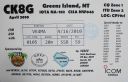
na-182r.jpgNA-182 Canada NWT (Inuvik Region) East groupGreen Island is a rocky island in the mouth of Fortune Bay, Newfoundland. It is located about 9.5 kilometres west of the Burin Peninsula of Newfoundland and 11 kilometres east of Langlade Island in Saint-Pierre and Miquelon.
|
|

na-183.jpgNA-183 Mexico Guerrero State groupThe island of La Roqueta is located in the southern part of the coast of the state of Guerrero, in front of the Acapulco bay of the port of the same name.
|
|
| 382 files on 10 page(s) |
 |
|
|
|
|
7 | |
|
|
 Contact
