Europe Islands IOTA QSL Album (all 192 islands confirmed)
|
|
|

EU-167.jpgEU-167 Portugal Baixo Alentejo Province groupPessegueiro Island (Portuguese: Ilha do Pessegueiro), literally island of the Peachtree, is a small island/islet located along the southwest coast of the civil parish of Porto Covo in the municipality of Sines. The island and the adjacent coast are part of Southwest Alentejo and Vicentine Coast Natural Park, but Pessegueiro island is also notable for the 15th-16th century fort located at its centre and Roman ruins along the coast.
|
|
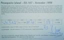
EU-167R.jpgEU-167 Portugal Baixo Alentejo Province groupPessegueiro Island (Portuguese: Ilha do Pessegueiro), literally island of the Peachtree, is a small island/islet located along the southwest coast of the civil parish of Porto Covo in the municipality of Sines. The island and the adjacent coast are part of Southwest Alentejo and Vicentine Coast Natural Park, but Pessegueiro island is also notable for the 15th-16th century fort located at its centre and Roman ruins along the coast.
|
|
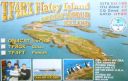
EU-168.jpgEU-168 Iceland's Coastal IslandsFlatey is an island of the western islands, a cluster of about forty large and small islands and islets located in Breiðafjörður on the northwestern part of Iceland. Flatey and its surrounding islands are, as a creation, believed to have forged from under the weight of a great glacier during the previous Ice age.
|
|
EU-168R.jpgEU-168 Iceland's Coastal IslandsFlatey is an island of the western islands, a cluster of about forty large and small islands and islets located in Breiðafjörður on the northwestern part of Iceland. Flatey and its surrounding islands are, as a creation, believed to have forged from under the weight of a great glacier during the previous Ice age.
|
|

EU-169.jpgEU-169 Albania groupSazan is an island inside the Mediterranean Sea in southern Albania. It is the largest island in Albania and strategically located between the Strait of Otranto and the entrance to the Bay of Vlorë, forming the border between the Adriatic and Ionian Sea.
|
|

EU-169R.jpgEU-169 Albania groupSazan is an island inside the Mediterranean Sea in southern Albania. It is the largest island in Albania and strategically located between the Strait of Otranto and the entrance to the Bay of Vlorë, forming the border between the Adriatic and Ionian Sea.
|
|

EU-170.jpgEU-170 Croatia Dalmatia North groupPag is a Croatian island in the Adriatic Sea. It’s known for its barren, moonlike landscape, lace production and Pag cheese. Pebble and sand beaches ring the island. The 15th-century Church of St. George was part of Pag town’s defensive walls.
|
|

EU-171.jpgEU-171 Denmark Jylland North groupThe North Jutlandic Island is in the northernmost part of Denmark and of Jutland. The area was not surrounded by water until a storm in February 1825, which caused a connection between the North Sea and the fjord Limfjorden.
|
|
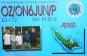
EU-172.jpgEU-172 Denmark Jylland East and Fyn groupÆrø is a narrow Danish island in the Baltic Sea. Ærø measures roughly 20 km from northwest to southeast and varies in width from around 4 to 8 km. There are three small towns on the island: the largest is Marstal with a population of 2,266. Ærøskøbing has 925 inhabitants and Søby 496. Fourteen villages and a number of farms complete the island's pattern of settlement.
|
|

EU-172R.jpgEU-172 Denmark Jylland East and Fyn groupÆrø is a narrow Danish island in the Baltic Sea. Ærø measures roughly 20 km from northwest to southeast and varies in width from around 4 to 8 km. There are three small towns on the island: the largest is Marstal with a population of 2,266. Ærøskøbing has 925 inhabitants and Søby 496. Fourteen villages and a number of farms complete the island's pattern of settlement.
|
|

EU-173.jpgEU-173 Finland Lansi-Suomi (Pori) Province groupSandström reef is an island like that about 4 kilometers from mainland (loc KP01RH, OH county Luvia, OHC 147). It is located about 20 kilometers south of city of Pori on southwest coast of Finland. The island does not have a historical significance and there has never been regular settlement. The size of the island is only about 100x50 meters.
|
|

EU-173R.jpgEU-173 Finland Lansi-Suomi (Pori) Province groupSandström reef is an island like that about 4 kilometers from mainland (loc KP01RH, OH county Luvia, OHC 147). It is located about 20 kilometers south of city of Pori on southwest coast of Finland. The island does not have a historical significance and there has never been regular settlement. The size of the island is only about 100x50 meters.
|
|
EU-174.jpgEU-174 Greece Makedonia / Thraki Region groupThasos or Thassos is a Greek island, geographically part of the North Aegean Sea, but administratively part of the Kavala regional unit. It is the northernmost major Greek island, and 12th largest by area. Thasos is also the name of the largest town of the island (officially known as Limenas Thasou, "Port of Thasos"), situated at the northern side, opposite the mainland and about 10 kilometres (6 miles) from Keramoti.
|
|

EU-174R.jpgEU-174 Greece Makedonia / Thraki Region groupThasos or Thassos is a Greek island, geographically part of the North Aegean Sea, but administratively part of the Kavala regional unit. It is the northernmost major Greek island, and 12th largest by area. Thasos is also the name of the largest town of the island (officially known as Limenas Thasou, "Port of Thasos"), situated at the northern side, opposite the mainland and about 10 kilometres (6 miles) from Keramoti.
|
|

EU-175.jpgEU-175 Central Azores groupTerceira is an volcanic island in the Azores archipelago, in the middle of the North Atlantic Ocean. It is one of the larger islands of the archipelago, with a population of 56,000 inhabitants in an area of approximately 396.75 square kilometres.
|
|

EU-176.jpgEU-176 Sweden Gavleborg County groupKlacksörarna, is an uninhabited island in Gävleborg County close to the south eastern coast of Sweden in the Baltic Sea.
|
|

EU-176R.jpgEU-176 Sweden Gavleborg County groupKlacksörarna, is an uninhabited island in Gävleborg County close to the south eastern coast of Sweden in the Baltic Sea.
|
|

EU-177.jpgEU-177 Sweden Sodermanland / Ostergotland County groupUtö is a small island in the East of Stockholm archipelago, known for its nature. Utö has the oldest iron-ore mines in Sweden. A landmark of Utö is its windmill, which is over 200 years old, and from which there is a good view of the bay Mysingen. On the island of Ålö - connected to Utö with a bridge - there is a popular restaurant with entertainment during the summer.
|
|

EU-177R.jpgEU-177 Sweden Sodermanland / Ostergotland County groupUtö is a small island in the East of Stockholm archipelago, known for its nature. Utö has the oldest iron-ore mines in Sweden. A landmark of Utö is its windmill, which is over 200 years old, and from which there is a good view of the bay Mysingen. On the island of Ålö - connected to Utö with a bridge - there is a popular restaurant with entertainment during the summer.
|
|

EU-178F.jpgEU-178 Estonia Parnumaa County / Saaremaa County South groupManilaid is a 1.87 km2 (0.72 sq mi) Estonian islet in the Gulf of Riga, located between the island of Kihnu and the mainland's Tõstamaa peninsula. Together with the neighbouring smaller uninhabited islets Sorgu and Annilaid, Manilaid forms the village of Manija. On January 1, 2011, Manilaid's population was 47. Manilaid has a ferry connection with the Munalaiu harbour on the mainland. In the winter, when the Gulf of Riga is covered with ice, the island is reachable by ice bridge.
|
|

EU-178r.jpgEU-178 Estonia Parnumaa County / Saaremaa County South groupManilaid is a 1.87 km2 (0.72 sq mi) Estonian islet in the Gulf of Riga, located between the island of Kihnu and the mainland's Tõstamaa peninsula. Together with the neighbouring smaller uninhabited islets Sorgu and Annilaid, Manilaid forms the village of Manija. On January 1, 2011, Manilaid's population was 47. Manilaid has a ferry connection with the Munalaiu harbour on the mainland. In the winter, when the Gulf of Riga is covered with ice, the island is reachable by ice bridge.
|
|

EU-179.jpgEU-179 Ukraine Black Sea Coast groupKalanchakskiye islands, located in Karkinits'ka bay, Black sea, Located in the province of Khersons'ka Oblast , in the southern part of the country, 500 km south of Kiev, Ukraine
|
|

EU-179R.jpgEU-179 Ukraine Black Sea Coast groupKalanchakskiye islands, located in Karkinits'ka bay, Black sea, Located in the province of Khersons'ka Oblast , in the southern part of the country, 500 km south of Kiev, Ukraine
|
|

EU-180F.jpgEU-180 Ukraine Black Sea Coast groupTuzla Island, is a sandy islet in the form of a spit located in the middle of the Strait of Kerch between the Kerch Peninsula in the west and the Taman Peninsula in the east. The Strait of Kerch connects the Sea of Azov and the Black Sea. Administratively, Tuzla is part of Kerch in eastern Crimea.
|
|

EU-180r.jpgEU-180 Ukraine Black Sea Coast groupTuzla Island, is a sandy islet in the form of a spit located in the middle of the Strait of Kerch between the Kerch Peninsula in the west and the Taman Peninsula in the east. The Strait of Kerch connects the Sea of Azov and the Black Sea. Administratively, Tuzla is part of Kerch in eastern Crimea.
|
|

EU-181.jpgEU-181 Bulgaria groupSt. Peter Island is a Bulgarian island in the Black Sea, with an area of 0.025 square kilometres (0.010 square miles) and a height of 9 metres (30 feet) above sea level. Also known as Bird Island, it is located in the Bay of Sozopol, close to the St. Ivan and St. Cyricus Islands. As it was not mentioned in any sources until the mid-19th century, it is presumed to have separated from the larger St. Ivan Island (which is a few hundred meters to the west) as a consequence of some kind of natural phenomenon around that time
|
|

EU-181R.jpgEU-181 Bulgaria groupSt. Peter Island is a Bulgarian island in the Black Sea, with an area of 0.025 square kilometres (0.010 square miles) and a height of 9 metres (30 feet) above sea level. Also known as Bird Island, it is located in the Bay of Sozopol, close to the St. Ivan and St. Cyricus Islands. As it was not mentioned in any sources until the mid-19th century, it is presumed to have separated from the larger St. Ivan Island (which is a few hundred meters to the west) as a consequence of some kind of natural phenomenon around that time
|
|

EU-182.jpgEU-182 Ukraine Black Sea Coast groupOchakovskiy Island, Ukrainian Danube Biosphere Reserve., Danube Delta down the Ankudinovo Branch (near Vylkove, Odessa Oblast, Ukraine)
|
|

EU-182R.jpgEU-182 Ukraine Black Sea Coast groupOchakovskiy Island, Ukrainian Danube Biosphere Reserve., Danube Delta down the Ankudinovo Branch (near Vylkove, Odessa Oblast, Ukraine)
|
|

EU-183.jpgEU-183 Romania Sacalinu Mare IslandSacalin Island is a newly formed island in the Black Sea, right off the coast of the Romanian Danube Delta, off the Sfântu Gheorghe branch. Initially Sacalin was made up of two smaller islands, Sacalinu Mare and Sacalinu Mic. In time, however, the two merged into one continuous landmass.
|
|

EU-183R.jpgEU-183 Romania Sacalinu Mare IslandSacalin Island is a newly formed island in the Black Sea, right off the coast of the Romanian Danube Delta, off the Sfântu Gheorghe branch. Initially Sacalin was made up of two smaller islands, Sacalinu Mare and Sacalinu Mic. In time, however, the two merged into one continuous landmass.
|
|

EU-184.jpgEU-184 Finland Oulu Province groupHailuoto is located on an island of the same name opposite the city of Oulu in the Gulf of Bothnia. A ferry operates regularly between Hailuoto and Oulunsalo. In winter an official ice road connects the island to the mainland.
|
|

EU-184R.jpgEU-184 Finland Oulu Province groupHailuoto is located on an island of the same name opposite the city of Oulu in the Gulf of Bothnia. A ferry operates regularly between Hailuoto and Oulunsalo. In winter an official ice road connects the island to the mainland.
|
|

EU-185.jpgEU-185 Russia Black Sea Coast groupKrupinin island located in the northern part of the Taman Bay of the Black Sea. Administratively it belongs to the Krasnodar Territory of Russia. The island is formed of limestone and sand.
|
|

EU-185R.jpgEU-185 Russia Black Sea Coast groupKrupinin island located in the northern part of the Taman Bay of the Black Sea. Administratively it belongs to the Krasnodar Territory of Russia. The island is formed of limestone and sand.
|
|

EU-186.jpgEU-186 Turkey groupImbros or İmroz, officially changed to Gökçeada since 29 July 1970, is the largest island of Turkey and the seat of Gökçeada District of Çanakkale Province. It is located in the Aegean Sea, at the entrance of Saros Bay and is also the westernmost point of Turkey.
|
|

EU-186R.jpgEU-186 Turkey groupImbros or İmroz, officially changed to Gökçeada since 29 July 1970, is the largest island of Turkey and the seat of Gökçeada District of Çanakkale Province. It is located in the Aegean Sea, at the entrance of Saros Bay and is also the westernmost point of Turkey.
|
|
EU-187.jpgEU-187 Crete's Coastal IslandsChrissi is an uninhabited Greek island approximately 15 kilometres south of Crete close to Ierapetra in the South Cretan Sea. Approximately 700 metres east of the island is the island of Mikronisi. Administratively these islands fall within the Ierapetra municipality in Lasithi.
|
|

EU-187R.jpgEU-187 Crete's Coastal IslandsChrissi is an uninhabited Greek island approximately 15 kilometres south of Crete close to Ierapetra in the South Cretan Sea. Approximately 700 metres east of the island is the island of Mikronisi. Administratively these islands fall within the Ierapetra municipality in Lasithi.
|
|

EU-188.jpgEU-188 Russia Pechorskoye Sea Coast West groupSengeyskiy Island is an uninhabited island located in the Barent Sea just offshore from the small settlement of Sengeyskiy, Russia
|
|
|
|
 Contact

