Europe Islands IOTA QSL Album (all 192 islands confirmed)
|
|
|

eu-048r.jpgEU-048 France Bretagne (Morbihan) Region groupBelle-Île, Belle-Île-en-Mer, or Belle Isle is a French island off the coast of Brittany in the département of Morbihan, and the largest of Brittany's islands. It is 14 kilometres (8.7 miles) from the Quiberon peninsula. The island measures 17 by 9 kilometres (10.6 by 5.6 miles) and has an average altitude of 40 metres (130 feet). The area is about 84 square kilometres (32 square miles).
|
|
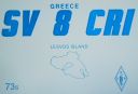
eu-049.jpgEU-049 Greece North Aegean Islands (Voreio Aigaio)Lesbos is an island located in the northeastern Aegean Sea. It has an area of 1,633 km2 (631 sq mi) with 320 kilometres (199 miles) of coastline, making it the third largest island in Greece. It is separated from Turkey by the narrow Mytilini Strait.
|
|
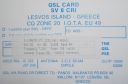
eu-049r.jpgEU-049 Greece North Aegean Islands (Voreio Aigaio)Lesbos is an island located in the northeastern Aegean Sea. It has an area of 1,633 km2 (631 sq mi) with 320 kilometres (199 miles) of coastline, making it the third largest island in Greece. It is separated from Turkey by the narrow Mytilini Strait.
|
|
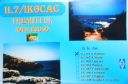
eu-050.jpgEU-050 Italy Puglia (Foggia) Region groupThe Isole Tremiti are an archipelago in the Adriatic Sea, north of the Gargano Peninsula. They constitute a comune of Italy's Province of Foggia and form part of the Gargano national park. The name of the islands relates to their seismic hazard, with a history of earthquakes in the area: tremiti means "tremors".
|
|

eu-050r.jpgEU-050 Italy Puglia (Foggia) Region groupThe Isole Tremiti are an archipelago in the Adriatic Sea, north of the Gargano Peninsula. They constitute a comune of Italy's Province of Foggia and form part of the Gargano national park. The name of the islands relates to their seismic hazard, with a history of earthquakes in the area: tremiti means "tremors".
|
|

eu-051.jpgEU-051 Italy Ustica IslandUstica is the name of a small island, about 5 kilometres across, situated 52 kilometres north of Capo Gallo, Italy in the Tyrrhenian Sea. Roughly 1,300 people live in the comune of the same name. There is regular ferry service from the island to Palermo, Italy.
|
|

EU-052.jpgEU-052 Greece Ipeiros / Dytiki Ellas Region groupCephalonia or Kefalonia , is the largest of the Ionian Islands in western Greece and the 6th largest island in Greece after Crete, Evoia, Lesbos, Rhodes, and Chios. It is also a separate regional unit of the Ionian Islands region, and the only municipality of the regional unit.
|
|

EU-052R.jpgEU-052 Greece Ipeiros / Dytiki Ellas Region groupCephalonia or Kefalonia , is the largest of the Ionian Islands in western Greece and the 6th largest island in Greece after Crete, Evoia, Lesbos, Rhodes, and Chios. It is also a separate regional unit of the Ionian Islands region, and the only municipality of the regional unit.
|
|

eu-053.jpgEU-053 Finland Market reef Märket is a small 3.3-hectare (8.2-acre) uninhabited skerry in the Baltic Sea between Sweden and Finland (in the area of the autonomous Åland Islands), with a lighthouse as its salient manmade feature. Märket has been divided between the two countries since the Treaty of Fredrikshamn of 1809 defined the border between Sweden and the Russian Empire as going through the middle of the island.
|
|
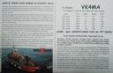
eu-053r.jpgEU-053 Finland Market reef Märket is a small 3.3-hectare (8.2-acre) uninhabited skerry in the Baltic Sea between Sweden and Finland (in the area of the autonomous Åland Islands), with a lighthouse as its salient manmade feature. Märket has been divided between the two countries since the Treaty of Fredrikshamn of 1809 defined the border between Sweden and the Russian Empire as going through the middle of the island.
|
|

EU-054.jpgEU-054 Italy Egadi IslandsThe Aegadian Islands are a group of five small mountainous islands in the Mediterranean Sea off the northwest coast of Sicily, Italy, near the cities of Trapani and Marsala, with a total area of 37.45 square kilometres (14.46 sq mi).
|
|

EU-054R_28229.jpgEU-054 Italy Egadi IslandsThe Aegadian Islands are a group of five small mountainous islands in the Mediterranean Sea off the northwest coast of Sicily, Italy, near the cities of Trapani and Marsala, with a total area of 37.45 square kilometres (14.46 sq mi).
|
|

EU-055.jpgEU-055 Norway Sogn og Fjordane / Hordaland / Rogaland County groupBorøya or Borøy is an island in Tvedestrand municipality in Aust-Agder county, Norway. The 3.4-square-kilometre island lies along the Oksefjorden between the islands of Sandøya and Tverrdalsøya. Some of the villages on the island include Sandvika, Borøkilen, Utgårdstrand, and Snarsund.
|
|

eu-055r.jpgEU-055 Norway Sogn og Fjordane / Hordaland / Rogaland County groupBorøya or Borøy is an island in Tvedestrand municipality in Aust-Agder county, Norway. The 3.4-square-kilometre island lies along the Oksefjorden between the islands of Sandøya and Tverrdalsøya. Some of the villages on the island include Sandvika, Borøkilen, Utgårdstrand, and Snarsund.
|
|
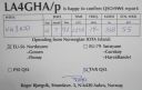
EU-056.jpgEU-056 Norway More og Romsdal County Centre groupIn Haram, Norway you will find the Nordøyane islands. Strung out like pearls on a string, the four islands of Løvsøy, Haramsøy, Flemsøy and Fjørtoft sit just off the coast
|
|

EU-057.jpgEU-057 Germany Mecklenburg-Vorpommern State groupRügen is Germany's largest island by area. It is located off the Pomeranian coast in the Baltic Sea and belongs to the state of Mecklenburg-Western Pomerania.
|
|

EU-057R.jpgEU-057 Germany Mecklenburg-Vorpommern State groupRügen is Germany's largest island by area. It is located off the Pomeranian coast in the Baltic Sea and belongs to the state of Mecklenburg-Western Pomerania.
|
|

EU-058.jpgEU-058 France Provence-Cote d'Azur (Alpes Maritimes) Region groupThe Lérins Islands are a group of four Mediterranean islands off the French Riviera, in Cannes. The two largest islands in this group are the Île Sainte-Marguerite and the Île Saint-Honorat. The smaller Îlot Saint-Ferréol and Îlot de la Tradelière are uninhabited. Administratively, the islands belong to the commune of Cannes.
|
|
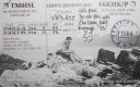
EU-058R.jpgEU-058 France Provence-Cote d'Azur (Alpes Maritimes) Region groupThe Lérins Islands are a group of four Mediterranean islands off the French Riviera, in Cannes. The two largest islands in this group are the Île Sainte-Marguerite and the Île Saint-Honorat. The smaller Îlot Saint-Ferréol and Îlot de la Tradelière are uninhabited. Administratively, the islands belong to the commune of Cannes.
|
|

EU-059.jpgEU-059 Scotland St Kilda IslandSt Kilda is an isolated archipelago situated 64 kilometres (40 mi) west-northwest of North Uist, in the North Atlantic Ocean. It contains the westernmost islands of the Outer Hebrides of Scotland. The largest island is Hirta, whose sea cliffs are the highest in the United Kingdom. Three other islands (Dùn, Soay and Boreray) were also used for grazing and seabird hunting. The islands are administratively a part of the Comhairle nan Eilean Siar local authority area
|
|

EU-060.jpgEU-060 Greece Sterea Ellas Region groupSkyros is an island in Greece, the southernmost of the Sporades, an archipelago in the Aegean Sea. At 209 square kilometres (81 sq mi) it is the largest island of the Sporades, and has a population of about 3,000 (in 2011). It is part of the regional unit of Euvoia.
|
|

EU-060R.jpgEU-060 Greece Sterea Ellas Region groupSkyros is an island in Greece, the southernmost of the Sporades, an archipelago in the Aegean Sea. At 209 square kilometres (81 sq mi) it is the largest island of the Sporades, and has a population of about 3,000 (in 2011). It is part of the regional unit of Euvoia.
|
|
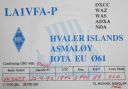
EU-061.jpgEU-061 Norway Vest Agder to Ostfold County groupHvaler is a municipality that is a group of islands in the southwestern part of Østfold County, Norway. The Hvaler archipelago consists of 833 islands, islets, and skerries.
|
|
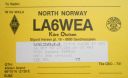
EU-062.jpgEU-062 Norway Nordland / Nord-Trondelag County groupAlsta (historically, Alsten or Alstein) is an island in the municipalities of Alstahaug and Leirfjord in Nordland county, Norway. The island is surrounded by the Vefsnfjorden to the east, the Leirfjorden to the north, and the Alstenfjorden to the south and west. The eastern part of the island is dominated by the Seven Sisters mountain range which has five mountains that are more than 1,000 metres (3,300 ft) tall, while the western part of the island is relatively flat.
|
|
EU-063.jpgEU-063 Spitsbergen's Coastal Islands;Svalbard's Coastal IslandsPrins Karls Forland or Forlandet, occasionally anglicized as Prince Charles Foreland, is an island off the west coast of Oscar II Land on Spitsbergen in the Arctic archipelago of Svalbard, Norway. The entire island and the surrounding sea area constitutes Forlandet National Park.
|
|

EU-063S.jpgEU-063 Spitsbergen's Coastal Islands;Svalbard's Coastal IslandsPrins Karls Forland or Forlandet, occasionally anglicized as Prince Charles Foreland, is an island off the west coast of Oscar II Land on Spitsbergen in the Arctic archipelago of Svalbard, Norway. The entire island and the surrounding sea area constitutes Forlandet National Park.
|
|

EU-064.jpgEU-064 France Pays de la Loire Region groupÎle d'Yeu is an island and commune just off the Vendée coast of western France. The island's two harbours, Port-Joinville in the north and Port de la Meule, located in a rocky inlet of the southern granite coast, are famous for the fishing of tuna and lobster.
|
|

EU-064R.jpgEU-064 France Pays de la Loire Region groupÎle d'Yeu is an island and commune just off the Vendée coast of western France. The island's two harbours, Port-Joinville in the north and Port de la Meule, located in a rocky inlet of the southern granite coast, are famous for the fishing of tuna and lobster.
|
|
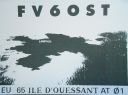
EU-065.jpgEU-065 France Bretagne (Finistere North West) Region groupUshant , French: Ouessant, pronounced [wɛsɑ̃]) is a French island at the south-western end of the English Channel which marks the north-westernmost point of metropolitan France. It belongs to Brittany and is in the traditional region of Leon. Administratively, Ushant is a commune in the Finistère department. It is the only place in Brittany, except the name Brittany itself, with a separate name in English
|
|
EU-065R.jpgEU-065 France Bretagne (Finistere North West) Region groupUshant , French: Ouessant, pronounced [wɛsɑ̃]) is a French island at the south-western end of the English Channel which marks the north-westernmost point of metropolitan France. It belongs to Brittany and is in the traditional region of Leon. Administratively, Ushant is a commune in the Finistère department. It is the only place in Brittany, except the name Brittany itself, with a separate name in English
|
|

EU-066.jpgEU-066 Russia Solovetskiye IslandsThe Solovetsky Islands, or Solovki, are an archipelago located in the Onega Bay of the White Sea, Russia. As an administrative division, the islands are incorporated as Solovetsky District of Arkhangelsk Oblast, Russia.
|
|

EU-067.jpgEU-067 Greece Kyklades (Cyclades)The Cyclades (Greek: Κυκλάδες Kykládes) are Greek islands located in the southern part of the Aegean Sea. The archipelago contains some 2,200 islands, islets and rocks; just 33 islands are inhabited.
|
|

EU-067R.jpgEU-067 Greece Kyklades (Cyclades)The Cyclades (Greek: Κυκλάδες Kykládes) are Greek islands located in the southern part of the Aegean Sea. The archipelago contains some 2,200 islands, islets and rocks; just 33 islands are inhabited.
|
|

EU-068.jpgEU-068 France Bretagne (Finistere South West) Region groupThe Île de Sein is a French island in the Atlantic Ocean, off Finistère, eight kilometres from the Pointe du Raz (raz meaning "water current"), from which it is separated by the Raz de Sein. Its Breton name is Enez Sun. The island, with its neighbouring islets, forms the commune of Île-de-Sein in the Finistère department of Brittany in north-western France. Inhabitants of Île-de-Sein are called in French Sénans.
|
|

EU-068R.jpgEU-068 France Bretagne (Finistere South West) Region groupThe Île de Sein is a French island in the Atlantic Ocean, off Finistère, eight kilometres from the Pointe du Raz (raz meaning "water current"), from which it is separated by the Raz de Sein. Its Breton name is Enez Sun. The island, with its neighbouring islets, forms the commune of Île-de-Sein in the Finistère department of Brittany in north-western France. Inhabitants of Île-de-Sein are called in French Sénans.
|
|

EU-069.jpgEU-069 Spain Columbretes IslandsThe Columbretes Islands (Valencian: Els Columbrets, IPA: [els kolumˈbɾets]) are a group of small uninhabited islets of volcanic origin, in the Mediterranean Sea, 49 kilometres (30 miles) off Oropesa del Mar. Administratively they belong to Castelló de la Plana municipality, Valencian Community, Spain.
|
|
EU-069R.jpgEU-069 Spain Columbretes IslandsThe Columbretes Islands (Valencian: Els Columbrets, IPA: [els kolumˈbɾets]) are a group of small uninhabited islets of volcanic origin, in the Mediterranean Sea, 49 kilometres (30 miles) off Oropesa del Mar. Administratively they belong to Castelló de la Plana municipality, Valencian Community, Spain.
|
|

EU-070.jpgEU-070 France Provence-Cote d'Azur (Var) Region groupPorquerolles, also known as the Île de Porquerolles, is an island in the Îles d'Hyères, Var, Provence-Alpes-Côte d'Azur, France. Its land area is 1,254 hectares and in 2004 its population was about 200. Porquerolles is the largest, most westerly of the three Îles d'Hyères.
|
|
EU-070R.jpgEU-070 France Provence-Cote d'Azur (Var) Region groupPorquerolles, also known as the Île de Porquerolles, is an island in the Îles d'Hyères, Var, Provence-Alpes-Côte d'Azur, France. Its land area is 1,254 hectares and in 2004 its population was about 200. Porquerolles is the largest, most westerly of the three Îles d'Hyères.
|
|

EU-071.jpgEU-071 Iceland Vestmannaeyjar (Westman Islands)Vestmannaeyjar (Western Islands) is an archipelago off Iceland’s south coast, formed by underwater volcanic eruptions. The youngest island, Surtsey, was formed in 1963. Heimaey is the largest and only inhabited island. It has 2 volcanoes, Helgafell and Eldfell.
|
|
|
|
 Contact

