|
|

as-059r.jpgAS-059 Asiatic Russia Sea of Okhotsk Coast groupNedorazumeniya Island is an island on the north coast of the Sea of Okhotsk. It lies on the north side of Taui Bay, between Amakhton Bay to the west and Nagaev Bay to the east. It is about 20 kilometres west of the city of Magadan
|
|

as-060.jpgAS-060 South Korea Cholla-namdo Province groupJeju Island (Korean: ì œì£¼ë„; Hanja: 濟州島; Korean pronunciation: [tÍ¡É•edÍ¡Ê‘udo]) is an island in the Jeju Province of South Korea. The island lies in the Korea Strait, south of the South Jeolla Province.
|
|

as-061.jpgAS-061 Asiatic Russia Ratmanova (Big Diomede) IslandBig Diomede Island "Tomorrow Island" (due to the International Date Line) is the western island of the two Diomede Islands in the middle of the Bering Strait. The island is a part of the Chukotsky District of the Chukotka Autonomous Okrug of Russia. The border separating Russia and the United States runs north-south between the Diomede Islands.
|
|

as-061r.jpgAS-061 Asiatic Russia Ratmanova (Big Diomede) IslandBig Diomede Island or "Tomorrow Island" (due to the International Date Line) is the western island of the two Diomede Islands in the middle of the Bering Strait. The island is a part of the Chukotsky District of the Chukotka Autonomous Okrug of Russia. The border separating Russia and the United States runs north-south between the Diomede Islands.
|
|

as-062.jpgAS-062 Asiatic Russia Habomai IslandsThe Habomai Islands (Russian: Хабомаи (Habomai), Japanese: æ¯èˆžç¾¤å³¶ (Habomai guntÅ) or æ¯èˆžè«¸å³¶ (Habomai shotÅ) are a group of islets in the southernmost Kuril Islands. They are currently under Russian administration, but together with Iturup (Etorofu), Kunashir (Kunashiri), and Shikotan are claimed by Japan.
|
|

AS-064.jpgAS-064 Asiatic Russia Bering Sea Coast Centre groupKaraginsky Island is an island in the Karaginsky Gulf of the Bering Sea. The 40 km-wide strait between the Kamchatka Peninsula and this island is called Litke Strait. Karaginsky Island is a Ramsar site. Even though the island is uninhabited, the Karagin Koryaks have traditionally lived in Karaginskiy Island. Migrant reindeer herders still live in temporary shelters on the island. The island is 101 km long and up to 27 km wide, with an area of 2,404 km².
|
|

AS-064R.jpgAS-064 Asiatic Russia Bering Sea Coast Centre groupKaraginsky Island is an island in the Karaginsky Gulf of the Bering Sea. The 40 km-wide strait between the Kamchatka Peninsula and this island is called Litke Strait. Karaginsky Island is a Ramsar site. Even though the island is uninhabited, the Karagin Koryaks have traditionally lived in Karaginskiy Island. Migrant reindeer herders still live in temporary shelters on the island. The island is 101 km long and up to 27 km wide, with an area of 2,404 km².
|
|

as-065.jpgAS-065 Asiatic Russia Chukchi Sea Coast East groupIdlidlya Island is a small island in the Chukchi Sea. It is close to the coast, being only 2 km away from the shores of the Chukotka Peninsula in the area of the coastal landspits enclosing Neskynpil'gyn Lagoon. This island is only 1 km in length.
|
|

as-065r.jpgAS-065 Asiatic Russia Chukchi Sea Coast East groupIdlidlya Island is a small island in the Chukchi Sea. It is close to the coast, being only 2 km away from the shores of the Chukotka Peninsula in the area of the coastal landspits enclosing Neskynpil'gyn Lagoon. This island is only 1 km in length.
|
|

as-066.jpgAS-066 Asiatic Russia Sea of Japan Coast groupRussky Island is an island in Peter the Great Gulf in the Sea of Japan, in Primorsky Krai, Russia. It is the largest island in the Eugénie Archipelago, separated from the Muravyov-Amursky Peninsula
|
|

as-066r.jpgAS-066 Asiatic Russia Sea of Japan Coast groupRussky Island is an island in Peter the Great Gulf in the Sea of Japan, in Primorsky Krai, Russia. It is the largest island in the Eugénie Archipelago, separated from the Muravyov-Amursky Peninsula
|
|

as-067.jpgAS-067 Japan Uji & Kusagaki IslandsDanjo-guntŠis located 65 km southwest of the GotŠIslands , 130 km west of the Koshikijima Islands and 170 km west of Kyushu. The land area of ​​the archipelago is 4.75 km ². [2] The islands are characterized by their steep terrain profile in which even small islands rise over 100 m.
|
|

as-067r.jpgAS-067 Japan Uji & Kusagaki IslandsDanjo-guntŠis located 65 km southwest of the GotŠIslands , 130 km west of the Koshikijima Islands and 170 km west of Kyushu. The land area of ​​the archipelago is 4.75 km ². [2] The islands are characterized by their steep terrain profile in which even small islands rise over 100 m.
|
|

as-068.jpgAS-068 Asiatic Russia Kara Sea Coast Centre groupThe Mona Islands or Mohn Islands (Russian: ОÑтрова Мона) is a group of a few scattered small islands covered with tundra vegetation. They are located in the Kara Sea, about 30 km north of the western coast of the Taymyr Peninsula in Siberia, Russia.
|
|

as-068r.jpgAS-068 Asiatic Russia Kara Sea Coast Centre groupThe Mona Islands or Mohn Islands (Russian: ОÑтрова Мона) is a group of a few scattered small islands covered with tundra vegetation. They are located in the Kara Sea, about 30 km north of the western coast of the Taymyr Peninsula in Siberia, Russia.
|
|

as-069.jpgAS-069 Asiatic Russia Iony IslandIony Island is the only island in the Sea of Okhotsk that is located in the open sea. All other islands in the Okhotsk Sea are either coastal islands or they belong to the Kuril island chain.[2][3] It is 1.6 km (1 mi) in length and 850 m (0.53 mi) wide and rises to a height of 165 m (541 ft). The island is barren and conical in shape with sheer cliffs rising to heights of 30 to 45 m (98 to 148 ft).
|
|

as-069r.jpgAS-069 Asiatic Russia Iony IslandIony Island is the only island in the Sea of Okhotsk that is located in the open sea. All other islands in the Okhotsk Sea are either coastal islands or they belong to the Kuril island chain.[2][3] It is 1.6 km (1 mi) in length and 850 m (0.53 mi) wide and rises to a height of 165 m (541 ft). The island is barren and conical in shape with sheer cliffs rising to heights of 30 to 45 m (98 to 148 ft).
|
|

as-070.jpgAS-070 Japan East Siberian Sea Coast East groupGUSMP Island, russian island located in the east of the Siberian Sea
|
|

as-070r.jpgAS-070 Japan East Siberian Sea Coast East groupGUSMP Island, russian island located in the east of the Siberian Sea
|
|

as-071.jpgAS-071 Asiatic Russia Bering Sea Coast North groupArakamchechen Island (Russian: Ðракамчечен; Eskimo–Aleut: Kigini) is an island in the Bering Sea. Arakamchechen lies north of Cape Chaplino, close to the coast of Chukotka. It is separated from the continental shore by an 8 km wide sound. This island is inhabited; the main settlement is Yanrakynnot village. Arakamchechen Island is 32 km long and has a maximum width of 21 km
|
|

as-071r.jpgAS-071 Asiatic Russia Bering Sea Coast North groupArakamchechen Island (Russian: Ðракамчечен; Eskimo–Aleut: Kigini) is an island in the Bering Sea. Arakamchechen lies north of Cape Chaplino, close to the coast of Chukotka. It is separated from the continental shore by an 8 km wide sound. This island is inhabited; the main settlement is Yanrakynnot village. Arakamchechen Island is 32 km long and has a maximum width of 21 km
|
|

as-072.jpgAS-072 Malaysia Perak State groupPangkor Island (Malay: Pulau Pangkor) is a resort island in Manjung District, Perak, Malaysia. It has a population of approximately 25,000. Nearby islands include Pangkor Laut Island, Giam Island (Pulau Giam)[1], Mentagor Island (Pulau Mentagor), Simpan Island (Pulau Simpan) and Tukun Terindak Island (Pulau Tukun Terindak). The major industries of the island are tourism and fishing.
|
|

as-072r.jpgAS-072 Malaysia Perak State groupPangkor Island (Malay: Pulau Pangkor) is a resort island in Manjung District, Perak, Malaysia. It has a population of approximately 25,000. Nearby islands include Pangkor Laut Island, Giam Island (Pulau Giam)[1], Mentagor Island (Pulau Mentagor), Simpan Island (Pulau Simpan) and Tukun Terindak Island (Pulau Tukun Terindak). The major industries of the island are tourism and fishing.
|
|

as-073.jpgAS-073 Malaysia Kelantan / Terengganu State groupRedang Island (Malay: Pulau Redang) is an island in Kuala Nerus District, Terengganu, Malaysia. It is one of the largest islands off the east coast of Peninsular Malaysia. It is famous for its crystal clear waters and white sandy beaches. It is one of nine islands, which form a marine sanctuary park offering snorkeling and diving opportunities for tourists.
|
|

as-073r.jpgAS-073 Malaysia Kelantan / Terengganu State groupRedang Island (Malay: Pulau Redang) is an island in Kuala Nerus District, Terengganu, Malaysia. It is one of the largest islands off the east coast of Peninsular Malaysia. It is famous for its crystal clear waters and white sandy beaches. It is one of nine islands, which form a marine sanctuary park offering snorkeling and diving opportunities for tourists.
|
|

as-074.jpgAS-074 Malaysia Selangor / Negeri Sembilan State groupPulau Ketam is an island located off the coast of Port Klang, Selangor, Malaysia. The island is in the intertidal zone and the chief vegetation is mangrove
|
|

AS-075.jpgAS-075 Macau groupOriginally a sparsely populated collection of coastal islands,[7] the territory has become a major resort city and the top destination for gambling tourism.
|
|

as-076.jpgAS-076 Japan Shikoku IslandShikoku (四国, literally "four provinces") is one of the four main islands of Japan. Shikoku is the smallest (225 km or 139.8 mi long and between 50 and 150 km or 31.1 and 93.2 mi wide) and least populous (3.8 million as of 2015, 3.1%) of the main islands, located south of Honshu and east of Kyushu
|
|

as-076r.jpgAS-076 Japan Shikoku IslandShikoku (四国, literally "four provinces") is one of the four main islands of Japan. Shikoku is the smallest (225 km or 139.8 mi long and between 50 and 150 km or 31.1 and 93.2 mi wide) and least populous (3.8 million as of 2015, 3.1%) of the main islands, located south of Honshu and east of Kyushu
|
|

AS-077.jpgAS-077 Japan Kyushu IslandKyushu (ä¹å·ž KyÅ«shÅ«, literally "Nine Provinces"; Japanese: [kʲɯꜜËɕɯË]) is the third largest island of Japan and most southwesterly of its four main islands.
|
|

AS-078.jpgAS-078 Japan Hokkaido IslandHokkaido is the second largest island of Japan, and the largest and northernmost prefecture. The Tsugaru Strait separates Hokkaido from Honshu. The two islands are connected by the undersea railway Seikan Tunnel.
|
|
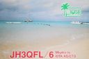
AS-079.jpgAS-079 Japan Miyako IslandsThe Miyako Islands are a group of islands in Okinawa Prefecture, Japan, east of the Yaeyama Islands. They are situated between the Ryukyu Islands and Taiwan.
|
|

AS-079R.jpgAS-079 Japan Miyako IslandsThe Miyako Islands are a group of islands in Okinawa Prefecture, Japan, east of the Yaeyama Islands. They are situated between the Ryukyu Islands and Taiwan.
|
|

AS-080.jpgAS-080 South Korea Ch'ungch'ong-namdo Province groupAnmyeondo (Korean: Hangul 안면ë„, Hanja å®‰çœ å³¶) is an island in Taean county, South Chungcheong Province, South Korea. Originally a peninsula, Yeonguijeong Kim Yuk ordered the flooding of the area between Changgiri (Anmyeoneup) and Sinonri (Nammyeon) to protect tax sent to Hanyang (now Seoul) from plunder by Japanese pirates. In 1970, the Anmyeongyo bridge (length 208.5 metres) was constructed to connect the island to the mainland.[1]
|
|

AS-080R.jpgAS-080 South Korea Ch'ungch'ong-namdo Province groupAnmyeondo (Korean: Hangul 안면ë„, Hanja å®‰çœ å³¶) is an island in Taean county, South Chungcheong Province, South Korea. Originally a peninsula, Yeonguijeong Kim Yuk ordered the flooding of the area between Changgiri (Anmyeoneup) and Sinonri (Nammyeon) to protect tax sent to Hanyang (now Seoul) from plunder by Japanese pirates. In 1970, the Anmyeongyo bridge (length 208.5 metres) was constructed to connect the island to the mainland.[1]
|
|

AS-081.jpgAS-081 South Korea Kyongsang-bukto / Kyongsang-namdo Province groupKadok island is South Korea's third largest and is located near the city of Busan
|
|

AS-081R.jpgAS-081 South Korea Kyongsang-bukto / Kyongsang-namdo Province groupKadok island is South Korea's third largest and is located near the city of Busan
|
|

AS-082.jpgAS-082 Asiatic Russia Laptev Sea Coast Centre groupBrusneva Island (Russian: ОÑтров БруÑнева, Ostrov Brusneva), is a small island in the Laptev Sea. It is located off the eastern side of the Lena delta in the Tiksi Bay, only 5 km ENE of Tiksi. Its length is 2.3 km and its maximum breadth less than 1 km. The name of this island is also spelt as "Brusnova" in some maps.
|
|

AS-082R.jpgAS-082 Asiatic Russia Laptev Sea Coast Centre groupBrusneva Island (Russian: ОÑтров БруÑнева, Ostrov Brusneva), is a small island in the Laptev Sea. It is located off the eastern side of the Lena delta in the Tiksi Bay, only 5 km ENE of Tiksi. Its length is 2.3 km and its maximum breadth less than 1 km. The name of this island is also spelt as "Brusnova" in some maps.
|
|

AS-083.jpgAS-083 Asiatic Russia Kara Sea Coast East groupBely Island is a relatively large island in the Kara Sea off the tip of the Yamal Peninsula, Siberia, Russia. Close to the island's northwest tip, there is the Russian Experiment Station Popov Station.
|
|
| 1466 files on 37 page(s) |
 |
|
|
|
|
|
|
9 | |
|
|
|
|
|
|
|
|
|
|
 Contact
