|
|

na-235.jpgNA-235 Alaska Semidi IslandsThe Semidi Islands are a group of islands of the state of Alaska, United States, lying offshore in the Gulf of Alaska. The islands are part of Kodiak Island Borough and are located southwest of Kodiak Island, about halfway between the Alaska Peninsula mainland and Chirikof Island. The largest islands of the group are Aghiyuk Island and Chowiet Island. The island group has a total land area of 30.178 km² (11.652 sq mi) and is uninhabited.
|
|

na-235r.jpgNA-235 Alaska Semidi IslandsThe Semidi Islands are a group of islands of the state of Alaska, United States, lying offshore in the Gulf of Alaska. The islands are part of Kodiak Island Borough and are located southwest of Kodiak Island, about halfway between the Alaska Peninsula mainland and Chirikof Island. The largest islands of the group are Aghiyuk Island and Chowiet Island. The island group has a total land area of 30.178 km² (11.652 sq mi) and is uninhabited.
|
|

na-236.jpgNA-236 Alaska Sanak IslandsThe Sanak Islands are a subgroup of the Fox Islands group of islands, located in the Aleutians East Borough of Alaska. Located in the Gulf of Alaska, they are in the Aleutian Islands archipelago. The Sanak Islands have a total land area of 157.617 km² (60.856 sq mi) and are unpopulated.
|
|

na-236r.jpgNA-236 Alaska Sanak IslandsThe Sanak Islands are a subgroup of the Fox Islands group of islands, located in the Aleutians East Borough of Alaska. Located in the Gulf of Alaska, they are in the Aleutian Islands archipelago. The Sanak Islands have a total land area of 157.617 km² (60.856 sq mi) and are unpopulated.
|
|

na-239.jpgNA-239 Alaska Northern Alaska Peninsula East groupThe Seal Islands are a group of 12/+ islands in the Bering Sea, trending northeast 7 miles (11 km), close to the shores of Bristol Bay, Alaska, 33 miles (53 km) southwest of Port Heiden, Alaska Airfield; Bristol Bay Low
|
|

na-239r.jpgNA-239 Alaska Northern Alaska Peninsula East groupThe Seal Islands are a group of 12/+ islands in the Bering Sea, trending northeast 7 miles (11 km), close to the shores of Bristol Bay, Alaska, 33 miles (53 km) southwest of Port Heiden, Alaska Airfield; Bristol Bay Low
|
|
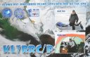
na-240.jpgNA-240 Alaska Bethel Census Area groupPingurbek Island is located near the native village of Kipnuk in south central Alaska
|
|

na-240r.jpgNA-240 Alaska Bethel Census Area groupPingurbek Island is located near the native village of Kipnuk in south central Alaska
|
|
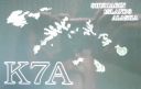
na-241.jpgNA-241 Alaska Kusilvak Census Area groupNeragon Island is located in the Bering Sea nearby the settlement of Scammon Bay, Alaska
|
|

na-241r.jpgNA-241 Alaska Kusilvak Census Area groupNeragon Island is located in the Bering Sea nearby the settlement of Scammon Bay, Alaska
|
|

na-242.jpgNA-242 Alaska North Slope Borough West groupPoint lay Barrier Island is located in the far north of Alaska near the settlement of Point lay on the Chukchi Sea coast.
|
|

na-242r.jpgNA-242 Alaska North Slope Borough West groupPoint lay Barrier Island is located in the far north of Alaska near the settlement of Point lay on the Chukchi Sea coast.
|
|

na-246.jpgNA-246 Mexico Tamaulipas State groupLarga Island is located in the Laguna Madre region of Tamaulipas State. Mexico. It is a low island made of sand and sea shells
|
|

na-246r.jpgNA-246 Mexico Tamaulipas State groupLarga Island is located in the Laguna Madre region of Tamaulipas State. Mexico. It is a low island made of sand and sea shells
|
|

na-247.jpgNA-247 Sint Maarten's Coastal IslandsPelikan Key is a small, rocky and uninhabited island nearby the island of St Maarten, in the Carribean sea
|
|

na-247r.jpgNA-247 Sint Maarten's Coastal IslandsPelikan Key is a small, rocky and uninhabited island nearby the island of St Maarten, in the Carribean sea
|
|

na-248.jpgNA-248 Canada NWT / Nunavut (Melville Island) groupMelville Island is an uninhabited island of the Canadian Arctic Archipelago with an area of 42,149 km2 (16,274 sq mi). It is the 33rd largest island in the world and Canada's eighth largest island. Melville Island is shared by the Northwest Territories, which is responsible for the western half of the island, and Nunavut, which is responsible for the eastern half. The border runs along the 110th meridian west. The mountains on Melville Island, some of the largest in the western Canadian Arctic, reach heights of 1,000 m (3,300 ft). There are two subnational pene-exclaves that lie west of the 110th meridian and form part of the Northwest Territories. These can only be reached by land from Nunavut or boat from the Northwest Territories.
|
|

na-248r.jpgNA-248 Canada NWT / Nunavut (Melville Island) groupMelville Island is an uninhabited island of the Canadian Arctic Archipelago with an area of 42,149 km2 (16,274 sq mi). It is the 33rd largest island in the world and Canada's eighth largest island. Melville Island is shared by the Northwest Territories, which is responsible for the western half of the island, and Nunavut, which is responsible for the eastern half. The border runs along the 110th meridian west. The mountains on Melville Island, some of the largest in the western Canadian Arctic, reach heights of 1,000 m (3,300 ft). There are two subnational pene-exclaves that lie west of the 110th meridian and form part of the Northwest Territories. These can only be reached by land from Nunavut or boat from the Northwest Territories.
|
|

NA-249.jpgNA-249 Puerto Rico's Coastal IslandsIsla Culebra (Spanish pronunciation: [kuˈleβɾa], Snake Island) is an island-municipality of Puerto Rico and geographically part of the Virgin Islands. It is located approximately 17 miles (27 km) east of the Puerto Rican mainland, 12 miles (19 km) west of St. Thomas and 9 miles (14 km) north of Vieques. Culebra is spread over 5 wards and Culebra Pueblo (Dewey), the downtown area and the administrative center of the city. Residents of the island are known as Culebrenses. With a population of 1,818 as of the latest census, it is Puerto Rico's least populous municipality.
|
|
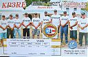
NA-249R.jpgNA-249 Puerto Rico's Coastal IslandsIsla Culebra (Spanish pronunciation: [kuˈleβɾa], Snake Island) is an island-municipality of Puerto Rico and geographically part of the Virgin Islands. It is located approximately 17 miles (27 km) east of the Puerto Rican mainland, 12 miles (19 km) west of St. Thomas and 9 miles (14 km) north of Vieques. Culebra is spread over 5 wards and Culebra Pueblo (Dewey), the downtown area and the administrative center of the city. Residents of the island are known as Culebrenses. With a population of 1,818 as of the latest census, it is Puerto Rico's least populous municipality.
|
|

na-250.jpgNA-250 Yakutat Borough groupKhantaak Island lies of the south east shore of Yakutat Bay, Alaska. The island is 6 miles long and is 1.8 miles north west of Yakutat
|
|

na-250r.jpgNA-250 Yakutat Borough groupKhantaak Island lies of the south east shore of Yakutat Bay, Alaska. The island is 6 miles long and is 1.8 miles north west of Yakutat
|
|
oa4ahor~0.jpg
|
|
oa4aho~0.jpg
|
|
oa4aop.jpg
|
|
oa4aopr.jpg
|
|

oa4ayx.jpg
|
|

oa4ayxr.jpg
|
|

oa4bqh.jpg
|
|

oa4bs.jpg
|
|

oa4bsr.jpg
|
|
oa4cit.jpg
|
|
oa4citr.jpg
|
|

oa4cpi.jpg
|
|

oa4cpir.jpg
|
|

oa4cpy.jpg
|
|

oa4djw.jpg
|
|

oa4dw.jpg
|
|

oa4ed.jpg
|
|

oa4fo.jpg
|
|
| 1466 files on 37 page(s) |
 |
|
|
|
|
|
|
|
|
26 | |
|
|
|
|
|
|
|
|
 Contact
