|
|
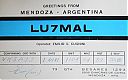
lu7mal.jpg
|
|

lu7og.jpg
|
|
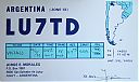
lu7td.jpg
|
|

lu8adx.jpg
|
|
lu8aqe.jpg
|
|
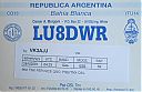
lu8dwr.jpg
|
|

lu8ebi.jpg
|
|

lu8ebir.jpg
|
|
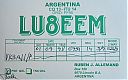
lu8eem.jpg
|
|

lu8eeq.jpg
|
|
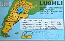
lu8hli.jpg
|
|
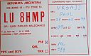
lu8hmp.jpg
|
|

lu8ig.jpg
|
|

lu8wbk.jpg
|
|
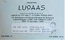
lu9aas.jpg
|
|

lu9ebp.jpg
|
|
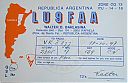
lu9faa.jpg
|
|
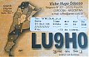
lu9ho.jpg
|
|

lu9hs.jpg
|
|

lw2dfm.jpg
|
|
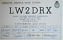
lw2drx.jpg
|
|

lw2eu.jpg
|
|

lw3dhb.jpg
|
|

lw3dn.jpg
|
|

lw6evt.jpg
|
|

lw6evtr.jpg
|
|

NA-012_28129.jpgNA-012 Costa Rica Coco's IslandCocos Island (Spanish: Isla del Coco) is an island in the Pacific Ocean administered by Costa Rica, approximately 550 km (342 mi; 297 nmi) southwest of the Costa Rican mainland. It is the southernmost point on the North American continent if outer islands are included. The entirety of Cocos Island has been designated a Costa Rican National Park since 1978, and has no permanent inhabitants other than Costa Rican park rangers.
|
|

NA-012_28229.jpgNA-012 Costa Rica Coco's IslandCocos Island (Spanish: Isla del Coco) is an island in the Pacific Ocean administered by Costa Rica, approximately 550 km (342 mi; 297 nmi) southwest of the Costa Rican mainland. It is the southernmost point on the North American continent if outer islands are included. The entirety of Cocos Island has been designated a Costa Rican National Park since 1978, and has no permanent inhabitants other than Costa Rican park rangers.
|
|

NA-020_28129.jpgNA-020 Aves Island, VenezuelaIsla de Aves (Spanish for "Island of Birds" or "Birds Island"), or Aves Island, is a Caribbean dependency of Venezuela. It has been the subject of numerous territorial disputes. It is part of the Aves Ridge and lies to the west of the Windward Islands chain at 15°40′18″N 63°36′59″W. It is 375 metres (1,230 ft) in length and never more than 50 metres (160 ft) wide, and rises 4 metres (13 ft) above the sea on a calm day.
|
|

NA-020_28229.jpgNA-020 Aves Island, VenezuelaIsla de Aves (Spanish for "Island of Birds" or "Birds Island"), or Aves Island, is a Caribbean dependency of Venezuela. It has been the subject of numerous territorial disputes. It is part of the Aves Ridge and lies to the west of the Windward Islands chain at 15°40′18″N 63°36′59″W. It is 375 metres (1,230 ft) in length and never more than 50 metres (160 ft) wide, and rises 4 metres (13 ft) above the sea on a calm day.
|
|

NA-025.jpgNA-025 The GrenadinesThe Grenadines are a chain of small islands that lie on a line between the larger islands of Saint Vincent and Grenada in the Lesser Antilles. Nine are inhabited, including the mainland Saint Vincent and the Grenadines islands
|
|

NA-054_28129.jpgNA-054 Bahamas Berry IslandsThe Berry Islands are a chain of islands and a district of the Bahamas, covering about thirty square miles of the northwestern part of the Out Islands. The Berry Islands consist of about thirty islands and over one hundred small islands or cays, often referred to as "The Fish Bowl of the Bahamas.
|
|

NA-054_28229.jpgNA-054 Bahamas Berry IslandsThe Berry Islands are a chain of islands and a district of the Bahamas, covering about thirty square miles of the northwestern part of the Out Islands. The Berry Islands consist of about thirty islands and over one hundred small islands or cays, often referred to as "The Fish Bowl of the Bahamas.
|
|

NA-060.jpgNA-060 Honduras Valle / Choluteca Department groupConejo Island, in Spanish Isla Conejo, meaning "rabbit island", is a disputed island between El Salvador and Honduras located in the Gulf of Fonseca
|
|

NA-060R.jpgNA-060 Honduras Valle / Choluteca Department groupConejo Island, in Spanish Isla Conejo, meaning "rabbit island", is a disputed island between El Salvador and Honduras located in the Gulf of Fonseca
|
|

NA-063_28129.jpgNA-063 Sable IslandSable Island (French: île de Sable), literally "island of sand", is a small Canadian island situated 300 km (190 mi) southeast of Halifax, Nova Scotia, and about 175 km (109 mi) southeast of the closest point of mainland Nova Scotia in the Atlantic Ocean. The island is staffed year round by four federal government staff.
|
|

NA-063_28229.jpgNA-063 Sable IslandSable Island (French: île de Sable), literally "island of sand", is a small Canadian island situated 300 km (190 mi) southeast of Halifax, Nova Scotia, and about 175 km (109 mi) southeast of the closest point of mainland Nova Scotia in the Atlantic Ocean. The island is staffed year round by four federal government staff.
|
|
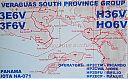
NA-071.jpgNA-071 Panama Chiriqui / Veraguas South Province groupCébaco island is located off the Pacific Coast of the Republic of Panama, in Montijo District, Veraguas Province. The island is located in the Gulf of Montijo and has a small town of approximately 30 homes on the northern coast of the island. Most locals live off commercial fishing
|
|

NA-071R.jpgNA-071 Panama Chiriqui / Veraguas South Province groupCébaco island is located off the Pacific Coast of the Republic of Panama, in Montijo District, Veraguas Province. The island is located in the Gulf of Montijo and has a small town of approximately 30 homes on the northern coast of the island. Most locals live off commercial fishing
|
|
NA-075R.jpgNA-075 British Columbia Province (Gulf Islands) groupPender Island (Saanich: st̕ey̕əs )[2] is one of the Southern Gulf Islands located in the Gulf of Georgia, British Columbia, Canada. Pender Island is approximately 34 km2 (13 sq mi) in area and is home to about 2,250 permanent residents.
|
|
| 1466 files on 37 page(s) |
 |
|
|
|
|
|
|
|
|
24 | |
|
|
|
|
|
|
|
|
 Contact
