|
|

AF-008.jpgAF-008 Crozet IslandsThe Crozet Islands (French: ÃŽles Crozet; or, officially, Archipel Crozet) are a sub-antarctic archipelago of small islands in the southern Indian Ocean. The research station there is staffed by 18 to 30 people (varying by season). They perform meteorological, biological, and geological research, and maintain a seismograph and a geomagnetic observatory (IAGA code: CZT). The Comprehensive Nuclear Test Ban Treaty Organization also has listening equipment on the island.
|
|

AF-009.jpgAF-009 Europa IslandEuropa Island is a 28-square-kilometre (11 sq mi) low-lying tropical atoll in the Mozambique Channel, about a third of the way from southern Madagascar to southern Mozambique. The island had never been inhabited until 1820, when the French family Rosier moved to it. The island officially became a possession of France in 1897. The island today is garrisoned by a detachment from Réunion and has a weather station and is visited by scientists.
|
|

AF-010.jpgAF-010 Bioco (aka Fernando Poo) IslandBioko is an island 32 km (20 mi) off the west coast of Africa, and the northernmost part of the country of Equatorial Guinea. The island is located off Cameroon, in the Bight of Bonny portion of the Gulf of Guinea. The island has a population of 334,463 inhabitants (2015 Census). Located on Punta Europa, west of Malabo, the Alba Gas Plant processes natural gas delivered from offshore production wells.
|
|

AF-010R.jpgAF-010R Bioko (aka Fernando Poo) IslandBioko is an island 32 km (20 mi) off the west coast of Africa, and the northernmost part of the country of Equatorial Guinea. The island is located off Cameroon, in the Bight of Bonny portion of the Gulf of Guinea. The island has a population of 334,463 inhabitants (2015 Census). Located on Punta Europa, west of Malabo, the Alba Gas Plant processes natural gas delivered from offshore production wells.
|
|

AF-011.jpgAF-011 Glorioso IslandsThe Glorioso Islands (Archipel des Glorieuses) are a group of French islands and rocks totaling 5 square kilometres (1,200 acres). They are geographically part of the Comoro Islands between the French overseas region of Mayotte and the nation of Madagascar. Politically they are part of the Scattered Islands in the Indian Ocean in the French Southern and Antarctic Lands, a French overseas territory. In 2012, France founded parc naturel marin des Glorieuses, a marine protected area, to preserve the endangered flora and fauna of the islands.
|
|

AF-011R.jpgAF-011R Glorioso IslandsThe Glorioso Islands (Archipel des Glorieuses) are a group of French islands and rocks totaling 5 square kilometres (1,200 acres). They are geographically part of the Comoro Islands between the French overseas region of Mayotte and the nation of Madagascar. Politically they are part of the Scattered Islands in the Indian Ocean in the French Southern and Antarctic Lands, a French overseas territory. In 2012, France founded parc naturel marin des Glorieuses, a marine protected area, to preserve the endangered flora and fauna of the islands.
|
|

AF-012.jpgAF-012 Juan de Nova IslandJuan de Nova Island also known as Saint-Christophe, is a French tropical island in the narrowest part of the Mozambique Channel, about one-third of the way between Madagascar and Mozambique. It is a low, flat island, 4.4 square kilometres (1.7 sq mi) in size. Anchorage is possible off the northeast of the island which also has a 1,300 metres (4,300 ft) airstrip. Administratively, the island is one of the Scattered islands in the Indian Ocean, a district of the French Southern and Antarctic Lands. The island is garrisoned by French troops from Réunion and has a weather station
|
|

AF-012R.jpgAF-012R Juan de Nova IslandJuan de Nova Island also known as Saint-Christophe, is a French tropical island in the narrowest part of the Mozambique Channel, about one-third of the way between Madagascar and Mozambique. It is a low, flat island, 4.4 square kilometres (1.7 sq mi) in size. Anchorage is possible off the northeast of the island which also has a 1,300 metres (4,300 ft) airstrip. Administratively, the island is one of the Scattered islands in the Indian Ocean, a district of the French Southern and Antarctic Lands. The island is garrisoned by French troops from Réunion and has a weather station
|
|

AF-013.jpgAF-013 MadagascarMadagascar is an island country in the Indian Ocean, approximately 400 kilometres (250 miles) off the coast of East Africa. At 592,800 square kilometres Madagascar is the world's 2nd largest island country. In 2016, the population of Madagascar was estimated at 25 million, up from 2.2 million in 1900.
|
|

AF-014.jpgAF-014 Madeira ArchipelagoMadeira, is one of the two autonomous regions of Portugal (along with the Azores). It is an archipelago situated in the north Atlantic Ocean, southwest of Portugal. Its total population was estimated in 2016 at 289,000. The capital of Madeira is Funchal, which is located on the main island's south coast.
|
|

AF-015.jpgAF-015 Saint Brandon IslandsSaint Brandon, also known as the Cargados Carajos Shoals, is an Indian Ocean archipelago about 430 kilometres (270 mi) northeast of Mauritius consisting of a number of sand banks, shoals and islets. Politically, Saint Brandon is part of the territory of Mauritius and is grouped within the Outer Islands of Mauritius along with Agaléga, The islands are now uninhabited
|
|

AF-016.jpgAF-016 Reunion IslandRéunion is an overseas department and region of France and an island in the Indian Ocean, east of Madagascar and 175 km (109 mi) southwest of Mauritius. As of January 2019, it had a population of 866,506. Reunion is one of the 18 regions of France, with the modified status of overseas region, and an integral part of the republic with the same status as Metropolitan France. Réunion is an outermost region of the European Union and, as an overseas department of France, part of the eurozone
|
|

AF-017.jpgAF-017 Rodrigues IslandRodrigues is a 108-square-kilometre (42 sq mi) autonomous outer island of the Republic of Mauritius in the Indian Ocean, about 560 kilometres (350 mi) east of Mauritius. It is part of the Mascarene Islands which include Mauritius and Réunion. It is of volcanic origin and is surrounded by coral reef. Rodrigues gained autonomous status on 10 December 2002, and it is governed by the Rodrigues Regional Assembly. The capital of the island is Port Mathurin.
|
|

AF-017R.jpgAF-017R Rodrigues IslandRodrigues is a 108-square-kilometre (42 sq mi) autonomous outer island of the Republic of Mauritius in the Indian Ocean, about 560 kilometres (350 mi) east of Mauritius. It is part of the Mascarene Islands which include Mauritius and Réunion. It is of volcanic origin and is surrounded by coral reef. Rodrigues gained autonomous status on 10 December 2002, and it is governed by the Rodrigues Regional Assembly. The capital of the island is Port Mathurin.
|
|

AF-018.jpgAF-018 Pantelleria IslandPantelleria, the ancient Cossyra or Cossura, is an Italian island and comune in the Strait of Sicily in the Mediterranean Sea, 100 km (62 mi) southwest of Sicily and 60 km (37 mi) east of the Tunisian coast.
|
|

AF-018R.jpgAF-018R Pantelleria IslandPantelleria, the ancient Cossyra or Cossura, is an Italian island and comune in the Strait of Sicily in the Mediterranean Sea, 100 km (62 mi) southwest of Sicily and 60 km (37 mi) east of the Tunisian coast.
|
|

AF-019.jpgAF-019 Pelagie Islandsare the three small islands of Lampedusa, Linosa, and Lampione, located in the Mediterranean Sea between Malta and Tunisia, south of Sicily.Geographically, part of the archipelago (Lampedusa and Lampione) belongs to the African continent and it is an Italian maritime exclave in the Tunisian continental shelf;
|
|

AF-019R.jpgAF-019R Pelagie Islandsare the three small islands of Lampedusa, Linosa, and Lampione, located in the Mediterranean Sea between Malta and Tunisia, south of Sicily.Geographically, part of the archipelago (Lampedusa and Lampione) belongs to the African continent and it is an Italian maritime exclave in the Tunisian continental shelf;
|
|

AF-020.jpgAF-020 Bijagos Archipelagoare a group of about 88 islands and islets located in the Atlantic Ocean off the coast of the African nation of Guinea-Bissau
|
|

AF-020R.jpgAF-020R Bijagos Archipelagoare a group of about 88 islands and islets located in the Atlantic Ocean off the coast of the African nation of Guinea-Bissau
|
|

AF-021.jpgAF-021 Prince Edward and Marion IslandsThe Prince Edward Islands are two small islands in the sub-antarctic Indian Ocean that are part of South Africa.
|
|

AF-022.jpgAF-022 St Helena Islandis a volcanic tropical island in the South Atlantic Ocean, 4,000 kilometres (2,500 mi) east of Rio de Janeiro and 1,950 kilometres (1,210 mi) west of the mouth of the Cunene River, which marks the border between Namibia and Angola in southwestern Africa. It is part of the British Overseas Territory of Saint Helena, Ascension and Tristan da Cunha.
|
|

AF-023.jpgAF-023 Sao Tome IslandSão Tomé Island, at 854 km2 (330 sq mi), is the largest island of São Tomé and PrÃncipe and is home in May 2018 to about 193,380 or 96% of the nation's population. The island is divided into six districts. It is located 2 km (1¼ miles) north of the equator.
|
|

AF-024.jpgAF-024 Seychelles Inner IslandsThe Inner Islands which are mostly granitic, cluster mainly around the principal islands of Mahé, Praslin and La Digue, forming the cultural and economic hub of Seychelles
|
|

AF-024R.jpgAF-024 Seychelles Inner IslandsThe Inner Islands which are mostly granitic, cluster mainly around the principal islands of Mahé, Praslin and La Digue, forming the cultural and economic hub of Seychelles
|
|

AF-025.jpgAF-025 Aldabra IslandsAldabra Islands, atoll, one of the world’s largest, in the Indian Ocean about 600 miles (1,000 km) southwest of the Seychelles group, and part of the Republic of the Seychelles
|
|

AF-025R.jpgAF-025 Aldabra IslandsAldabra Islands, atoll, one of the world’s largest, in the Indian Ocean about 600 miles (1,000 km) southwest of the Seychelles group, and part of the Republic of the Seychelles
|
|

AF-026.jpgAF-026 Cosmoledo IslandsCosmoledo Atoll is an atoll of the Aldabra Group and belongs to the Outer Islands of the Seychelles, and is located 1,029 km southwest of the capital, Victoria, on Mahé Island
|
|

AF-026R.jpgAF-026 Cosmoledo IslandsCosmoledo Atoll is an atoll of the Aldabra Group and belongs to the Outer Islands of the Seychelles, and is located 1,029 km southwest of the capital, Victoria, on Mahé Island
|
|

AF-027.jpgAF-027 Mayotte IslandMayotte is part of the Comoros archipelago, located in the northern Mozambique Channel in the Indian Ocean off the coast of Southeast Africa, between northwestern Madagascar and northeastern Mozambique
|
|
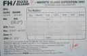
AF-027R.jpgAF-027 Mayotte IslandMayotte is part of the Comoros archipelago, located in the northern Mozambique Channel in the Indian Ocean off the coast of Southeast Africa, between northwestern Madagascar and northeastern Mozambique
|
|

AF-028.jpgAF-028 Socotra (Suqutra)located between the Guardafui Channel and the Arabian Sea, is the largest of four islands in the Socotra archipelago. The territory is officially part of Yemen
|
|

AF-028R.jpgAF-028 Socotra (Suqutra)located between the Guardafui Channel and the Arabian Sea, is the largest of four islands in the Socotra archipelago. The territory is officially part of Yemen
|
|

AF-029.jpgAF-029 Tristan da Cunha Island It is the most remote inhabited archipelago in the world, lying approximately 1,511 miles (2,432 km) off the coast of Cape Town in South Africa, 1,343 miles (2,161 km) from Saint Helena and 2,166 miles (3,486 km) off the coast from the Falkland Islands.
|
|

AF-030.jpgAF-030 Gough Islandis a rugged volcanic island in the South Atlantic Ocean. It is a dependency of Tristan da Cunha and part of the British overseas territory of Saint Helena, Ascension and Tristan da Cunha. It is about 400 km (250 mi) south-east of the Tristan da Cunha archipelago, 2,400 km (1,500 mi) north-east from South Georgia Island, 2,700 km (1,700 mi) west from Cape Town, and over 3,200 km (2,000 mi) from the nearest point of South America. Gough Island is uninhabited except for the personnel of a weather station (usually six people) which the South African National Antarctic Programme has maintained, with British permission, continually on the island since 1956. It is one of the most remote places with a constant human presence.
|
|

AF-030R.jpgAF-030R Gough Islandis a rugged volcanic island in the South Atlantic Ocean. It is a dependency of Tristan da Cunha and part of the British overseas territory of Saint Helena, Ascension and Tristan da Cunha. It is about 400 km (250 mi) south-east of the Tristan da Cunha archipelago, 2,400 km (1,500 mi) north-east from South Georgia Island, 2,700 km (1,700 mi) west from Cape Town, and over 3,200 km (2,000 mi) from the nearest point of South America. Gough Island is uninhabited except for the personnel of a weather station (usually six people) which the South African National Antarctic Programme has maintained, with British permission, continually on the island since 1956. It is one of the most remote places with a constant human presence.
|
|

AF-031.jpgAF-031 Tromelin IslandTromelin Island is a low, flat, island in the Indian Ocean about 500 kilometres (310 mi) north of Réunion, and about 450 kilometres (280 mi) east of Madagascar.
|
|
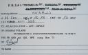
AF-031R.jpgAF-031R Tromelin IslandTromelin Island is a low, flat, island in the Indian Ocean about 500 kilometres (310 mi) north of Réunion, and about 450 kilometres (280 mi) east of Madagascar.
|
|

AF-032.jpgAF-032 Zanzibar IslandUnguja is the main island, (referred to informally as Zanzibar) of the Zanzibar Archipelago in the Indian Ocean, 25–50 kilometres (16–31 mi) off the coast of east Africa. Zanzibar is a semi-autonomous region of Tanzania.
|
|

AF-033.jpgAF-033 Amirante IslandsThe Amirante Islands (Les Amirantes) are a group of coral islands and atolls that belong to the Outer Islands of the Seychelles. They stretch about 155 km from the African Banks (African Islands) in the north to Desnœufs (Isle des Noeufs) in the south, all on the shallow Amirantes Bank
|
|
| 1466 files on 37 page(s) |
2 |  |
|
|
|
|
|
|
|
|
|
|
|
|
|
|
|
|
|
 Contact
