|
|

AS-172.jpgAS-172 Asiatic Russia Sea of Okhotsk Coast North groupMalminskiye Islands
|
|

AS-172R.jpgAS-172 Asiatic Russia Sea of Okhotsk Coast North groupMalminskiye Islands
|
|

AS-173.jpgAS-173 India Tamil Nadu State groupPamban Island, also known as Rameswaram Island, is an island located between peninsular India and Sri Lanka. The island is a part of India and forms the Rameswaram taluk of the Ramanathapuram district of the state of Tamil Nadu. It is the largest island in Tamil Nadu by area
|
|

AS-173R.jpgAS-173 India Tamil Nadu State groupPamban Island, also known as Rameswaram Island, is an island located between peninsular India and Sri Lanka. The island is a part of India and forms the Rameswaram taluk of the Ramanathapuram district of the state of Tamil Nadu. It is the largest island in Tamil Nadu by area
|
|

AS-174.jpgAS-174 Asiatic Russia Chukchi Sea Coast West groupShalaurov Island or Shalaurova Island is a small island in the eastern end of the East Siberian Sea. It is close to the coast, being only 1.2 km away from a headland located west of the estuary of the Pegtymel River. It lies roughly midway between Cape Shelagskiy and Cape Billings in the Chukotka Autonomous Okrug.
|
|

AS-174R.jpgAS-174 Asiatic Russia Chukchi Sea Coast West groupShalaurov Island or Shalaurova Island is a small island in the eastern end of the East Siberian Sea. It is close to the coast, being only 1.2 km away from a headland located west of the estuary of the Pegtymel River. It lies roughly midway between Cape Shelagskiy and Cape Billings in the Chukotka Autonomous Okrug.
|
|
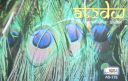
AS-175.jpgAS-175 India Gujarat State West groupBet Dwarka or Shankhodhar is an inhabited island at mouth of Gulf of Kutch situated 3 km off the coast of Okha, Gujarat, India. The island is measured northwest to southeast in 13 km with an average 4 km in east-west direction. It is a strip of sand and stone situated 30 km north of town of Dwarka.
|
|

AS-175R.jpgAS-175 India Gujarat State West groupBet Dwarka or Shankhodhar is an inhabited island at mouth of Gulf of Kutch situated 3 km off the coast of Okha, Gujarat, India. The island is measured northwest to southeast in 13 km with an average 4 km in east-west direction. It is a strip of sand and stone situated 30 km north of town of Dwarka.
|
|

as-176.jpgAS-176 India Gujarat State East groupShiyal Bet, an island located off Pipavav port in Amreli district
|
|

as-176r.jpgAS-176 India Gujarat State East groupShiyal Bet, an island located off Pipavav port in Amreli district
|
|

AS-177.jpgAS-177 India Goa State groupSt George’s Islands consists of three islands between 1.5 and 2.5 miles SSW of Marmagao Head. Grandi Island is the collective name of the two S islands of the group, which are connected by a narrow reef of rock and shingle
|
|

AS-177R.jpgAS-177 India Goa State groupSt George’s Islands consists of three islands between 1.5 and 2.5 miles SSW of Marmagao Head. Grandi Island is the collective name of the two S islands of the group, which are connected by a narrow reef of rock and shingle
|
|

AS-185.jpgAS-185 Vietnam Gulf of Tongking South groupCồn CỠis a rural district of Quảng Trị Province in the North Central Coast region of Vietnam. It is an island and is located 27 km to the east of Mũi Lay. Con Co Island has an area of 2.3 km², the isometric form of hills, the highest peak of 63m
|
|

AS-185R.jpgAS-185 Vietnam Gulf of Tongking South groupCồn CỠis a rural district of Quảng Trị Province in the North Central Coast region of Vietnam. It is an island and is located 27 km to the east of Mũi Lay. Con Co Island has an area of 2.3 km², the isometric form of hills, the highest peak of 63m
|
|

as-189.jpgAS-189 Iran Bushehr Province groupJazireh-ye Shif is a village and island in Howmeh Rural District, in the Central District of Bushehr County, Bushehr Province, Iran. At the 2011 census, its population was 4200, in 521 families
|
|

as-189r.jpgAS-189 Iran Bushehr Province groupJazireh-ye Shif is a village and island in Howmeh Rural District, in the Central District of Bushehr County, Bushehr Province, Iran. At the 2011 census, its population was 4200, in 521 families
|
|

AS-190.jpgAS-190 Saudi Arabia Red Sea Coast North (Tabuk Province) groupAl Dhahrah Island / Tabuk / al-Wajh / Saudi Arabia
|
|

AS-190R.jpgAS-190 Saudi Arabia Red Sea Coast North (Tabuk Province) groupAl Dhahrah Island / Tabuk / al-Wajh / Saudi Arabia
|
|

AS-192.jpgAS-192 Saudi Arabia Red Sea Coast South (Jizan Province) groupHibar Island
|
|

AS-192R.jpgAS-192 Saudi Arabia Red Sea Coast South (Jizan Province) groupHibar Island
|
|

AS-193.jpgAS-193 Saudi Arabia Farasan IslandsFarasan Island is the largest island of the Farasan Islands, in the Red Sea. It is located some 50 km offshore from Jizan, the far southwestern part of Saudi Arabia. It is located at around 16°42′21″N 41°59′0″E. The main town on the island is Farasan.
|
|

AS-193R.jpgAS-193 Saudi Arabia Farasan IslandsFarasan Island is the largest island of the Farasan Islands, in the Red Sea. It is located some 50 km offshore from Jizan, the far southwestern part of Saudi Arabia. It is located at around 16°42′21″N 41°59′0″E. The main town on the island is Farasan.
|
|
AS-199.jpgAS-199 India Andhra Pradesh State South groupNachugunta Island
|
|

AS-199R.jpgAS-199 India Andhra Pradesh State South groupNachugunta Island
|
|
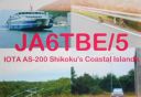
AS-200.jpgAS-200 Japan Shikoku's Coastal Islands
|
|

AS-200R.jpgAS-200 Japan Shikoku's Coastal Islands
|
|

AS-201.jpgAS-201 Turkey Sea of Marmara IslandsBüyükada is the largest of the nine so-called Princes' Islands in the Sea of Marmara, near Istanbul, with an area of about 2 square miles. It is officially a neighbourhood in the Adalar district of Istanbul Province,
|
|

AS-201R.jpgAS-201 Turkey Sea of Marmara IslandsBüyükada is the largest of the nine so-called Princes' Islands in the Sea of Marmara, near Istanbul, with an area of about 2 square miles. It is officially a neighbourhood in the Adalar district of Istanbul Province,
|
|
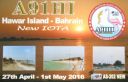
AS-202.jpgAS-202 Bahrein Hawar IslandsThe Hawar Islands are an archipelago of desert islands owned by Bahrain, situated off the west coast of Qatar in the Gulf of Bahrain of the Persian Gulf.
|
|

AS-202R.jpgAS-202 Bahrein Hawar IslandsThe Hawar Islands are an archipelago of desert islands owned by Bahrain, situated off the west coast of Qatar in the Gulf of Bahrain of the Persian Gulf.
|
|

AS-203.jpgAS-203 Asiatic Russia Shelikhova Bay groupDobrzhanskogo Island
|
|

AS-203R.jpgAS-203 Asiatic Russia Shelikhova Bay groupDobrzhanskogo Island
|
|

ce0acoj.jpg
|
|

ce0acojr.jpg
|
|

ce0aea.jpg
|
|

ce0aeeo.jpg
|
|

ce0ae~0.jpg
|
|
ce0an6no.jpg
|
|

ce0an6nor.jpg
|
|

ce0aw4pro.jpg
|
|
| 1466 files on 37 page(s) |
 |
|
|
|
|
|
|
|
|
14 | |
|
|
|
|
|
|
|
|
 Contact
