|
|

AS-106R.jpgAS-106 India Minicoy IslandMinicoy, locally known as Maliku is an island in Lakshadweep, India. Along with Viringili, it is on Maliku atoll, the southernmost atoll of Lakshadweep archipelago. Administratively, it is a census town in the Indian union territory of Lakshadweep
|
|

AS-107.jpgAS-107 Thailand Gulf of Thailand North groupKo Samet is one of the eastern seaboard islands of Thailand. It is in the Gulf of Thailand off the coastline of the Thai province of Rayong, approximately 220 kilometres southeast of Bangkok. Ko Samet is part of the Phe Subdistrict of the Amphoe Mueang Rayong, of Rayong Province.
|
|

AS-108.jpgAS-108 Lebanon groupRamkin (Ramkeen) Island is part of the Palm Islands Nature Reserve consisting of three flat, rocky islands of eroded limestone and the surrounding sea area, located 5.5 kilometres (3.4 mi) offshore and northwest of the city of Mina El Mina, Lebanon, to the west of Tripoli, Lebanon.
|
|

AS-108R.jpgAS-108 Lebanon groupRamkin (Ramkeen) Island is part of the Palm Islands Nature Reserve consisting of three flat, rocky islands of eroded limestone and the surrounding sea area, located 5.5 kilometres (3.4 mi) offshore and northwest of the city of Mina El Mina, Lebanon, to the west of Tripoli, Lebanon.
|
|

AS-109.jpgAS-109 Asiatic Russia Obskaya Gulf groupNarechi Island is located in the Obskaya Gulf, a bay of the Arctic Ocean, located in Northern Russia at the mouth of the Ob River. It is the world's longest estuary
|
|

AS-109R.jpgAS-109 Asiatic Russia Obskaya Gulf groupNarechi Island is located in the Obskaya Gulf, a bay of the Arctic Ocean, located in Northern Russia at the mouth of the Ob River. It is the world's longest estuary
|
|

AS-110.jpgAS-110 Taiwan Tungsha (Pratas) IslandThe Pratas Islands, also known as the Dongsha Islands and Tungsha Islands, are three atolls in the north of the South China Sea. They consist of one island, two coral reefs and two banks, and are located about 170 nautical miles southeast of Hong Kong
|
|

AS-110R.jpgAS-110 Taiwan Tungsha (Pratas) IslandThe Pratas Islands, also known as the Dongsha Islands and Tungsha Islands, are three atolls in the north of the South China Sea. They consist of one island, two coral reefs and two banks, and are located about 170 nautical miles southeast of Hong Kong
|
|

AS-112.jpgAS-112 Oman Al Batinah / Masqat Region groupBetween Barka and Sohar is the Sawadi and Daymaniyat islands. The rocky and windswept Sawadi Islands lie just offshore. The largest of the seven islands lies almost within spitting distance of the beach, a large rocky hump topped by a string of watchtowers, while the other smaller islands lie further out to sea.
|
|

AS-112R.jpgAS-112 Oman Al Batinah / Masqat Region groupBetween Barka and Sohar is the Sawadi and Daymaniyat islands. The rocky and windswept Sawadi Islands lie just offshore. The largest of the seven islands lies almost within spitting distance of the beach, a large rocky hump topped by a string of watchtowers, while the other smaller islands lie further out to sea.
|
|

AS-113.jpgAS-113 Taiwan Matsu IslandsThe Matsu Islands are a minor archipelago of 36 islands and islets in the East China Sea administered as Lienchiang County under streamlined Fujian Province, Republic of China
|
|

AS-113R.jpgAS-113 Taiwan Matsu IslandsThe Matsu Islands are a minor archipelago of 36 islands and islets in the East China Sea administered as Lienchiang County under streamlined Fujian Province, Republic of China
|
|

AS-114.jpgAS-114 Asiatic Russia Sea of Okhotsk Coast South groupChkalov Island, formerly Udd Island, is a coastal island in the southern end of the Sea of Okhotsk. It is located off Schastya Bay, between the shorebound lagoon and the sea. Baydukov Island lies only 2 km off its east-southeast tip. Chkalov Island is long and narrow.
|
|

AS-114R.jpgAS-114 Asiatic Russia Sea of Okhotsk Coast South groupChkalov Island, formerly Udd Island, is a coastal island in the southern end of the Sea of Okhotsk. It is located off Schastya Bay, between the shorebound lagoon and the sea. Baydukov Island lies only 2 km off its east-southeast tip. Chkalov Island is long and narrow.
|
|

AS-115.jpgAS-115 Turkey Antalya Province groupKekova, also named Caravola, is a small Turkish island near Demre district of Antalya province which faces the villages of Kaleköy and Üçağız. Kekova has an area of 4.5 km² and is uninhabited.
|
|
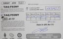
AS-115R.jpgAS-115 Turkey Antalya Province groupKekova, also named Caravola, is a small Turkish island near Demre district of Antalya province which faces the villages of Kaleköy and Üçağız. Kekova has an area of 4.5 km² and is uninhabited.
|
|

AS-116.jpgAS-116 China Huang Yan Island (Scarborough Reef)Scarborough Shoal, also known as Panatag Shoal, Bajo de Masinloc, Huangyan Islets, and Democracy Reef are two rocks in a shoal located between the Macclesfield Bank and Luzon island in the South China Sea. It is a disputed territory claimed by the People's Republic of China, the Republic of China, and the Philippines.
|
|

AS-116R.jpgAS-116 China Huang Yan Island (Scarborough Reef)Scarborough Shoal, also known as Panatag Shoal, Bajo de Masinloc, Huangyan Islets, and Democracy Reef are two rocks in a shoal located between the Macclesfield Bank and Luzon island in the South China Sea. It is a disputed territory claimed by the People's Republic of China, the Republic of China, and the Philippines.
|
|

AS-117.jpgAS-117 Japan Honshu's Coastal Islands WestInnoshima island sits between Mukaishima and Ikuchijima islands. near the city of Hiroshima. It is now linked by bridge to the mainland
|
|

AS-117R.jpgAS-117 Japan Honshu's Coastal Islands WestInnoshima island sits between Mukaishima and Ikuchijima islands. near the city of Hiroshima. It is now linked by bridge to the mainland
|
|

AS-118.jpgAS-118 Kuwait groupFailaka Island (Arabic: Ùيلكا‎ Faylakah / FÄ“laka ; Kuwaiti Arabic: Ùيلچا /fe:lɪt͡ʃə/) is a Kuwaiti Island in the Persian Gulf. The island is 20 km off the coast of Kuwait City in the Persian Gulf. The name "Failaka" is thought to be derived from the ancient Greek φυλάκιο(ν) - fylakio(n) "outpost".
|
|

AS-118R.jpgAS-118 Kuwait groupFailaka Island (Arabic: Ùيلكا‎ Faylakah / FÄ“laka ; Kuwaiti Arabic: Ùيلچا /fe:lɪt͡ʃə/) is a Kuwaiti Island in the Persian Gulf. The island is 20 km off the coast of Kuwait City in the Persian Gulf. The name "Failaka" is thought to be derived from the ancient Greek φυλάκιο(ν) - fylakio(n) "outpost".
|
|

AS-119.jpgAS-119 Oman Musandam Region groupJazīrat Umm al Ghanam is a island and is located in Musandam, Oman. The estimate terrain elevation above seal level is 88 metres
|
|

AS-119R.jpgAS-119 Oman Musandam Region groupJazīrat Umm al Ghanam is a island and is located in Musandam, Oman. The estimate terrain elevation above seal level is 88 metres
|
|

AS-120.jpgAS-120 Cyprus Cyprus's Coastal IslandsAgios Georgios or San Giorgio is a Greek uninhabited island in the entry of Saronic Gulf. It’s the largest uninhabited island of the Saronic Islands with an area of 4.3 km²
|
|

AS-120R.jpgAS-120 Cyprus Cyprus's Coastal IslandsAgios Georgios or San Giorgio is a Greek uninhabited island in the entry of Saronic Gulf. It’s the largest uninhabited island of the Saronic Islands with an area of 4.3 km²
|
|

AS-121.jpgAS-121 Asiatic Russia Nordenshel'da ArchipelagoThe Nordenskiöld Archipelago is a large cluster of islands in the eastern region of the Kara Sea. Its eastern limit lies 120 km (75 mi) west of the Taymyr Peninsula. There are about 90 cold, windswept and desolate islands in this archipelago. Except for two polar stations, one which was permanent in Russky Island between 1935 and 1999 and a temporary one in Tyrtov Island (Tyrtova) (1940-1975), there is no permanent inhabitants
|
|

AS-121R.jpgAS-121 Asiatic Russia Nordenshel'da ArchipelagoThe Nordenskiöld Archipelago is a large cluster of islands in the eastern region of the Kara Sea. Its eastern limit lies 120 km (75 mi) west of the Taymyr Peninsula. There are about 90 cold, windswept and desolate islands in this archipelago. Except for two polar stations, one which was permanent in Russky Island between 1935 and 1999 and a temporary one in Tyrtov Island (Tyrtova) (1940-1975), there is no permanent inhabitants
|
|

AS-122.jpgAS-122 South Korea Kyonggi-do Province West groupBaengnyeong Island is a 45.8-square-kilometre, 8.45-kilometre long and 12.56-kilometre wide island in Ongjin County, Incheon, South Korea, located near the Northern Limit Line
|
|

AS-122R.jpgAS-122 South Korea Kyonggi-do Province West groupBaengnyeong Island is a 45.8-square-kilometre, 8.45-kilometre long and 12.56-kilometre wide island in Ongjin County, Incheon, South Korea, located near the Northern Limit Line
|
|

as-123.jpgAS-123 Turkey Icel / Adana / Hatay Province groupThe 7 hectares (17 acres) islet is located 200 metres (660 ft) off shore from the main land facing a small settlement with the same name. Administratively it is a part of İmamuşağı village of Silifke district which is a part of Mersin Province. It is at 36°16′02″N 33°49′36″E. The distance from the main land to Silifke is 17 kilometres (11 mi) and to Mersin is 100 kilometres (62 mi).
|
|

as-123r.jpgAS-123 Turkey Icel / Adana / Hatay Province groupThe 7 hectares (17 acres) islet is located 200 metres (660 ft) off shore from the main land facing a small settlement with the same name. Administratively it is a part of İmamuşağı village of Silifke district which is a part of Mersin Province. It is at 36°16′02″N 33°49′36″E. The distance from the main land to Silifke is 17 kilometres (11 mi) and to Mersin is 100 kilometres (62 mi).
|
|

AS-124.jpgAS-124 United Arab Emirates Gulf of Oman groupShark Island is located a short boat-ride away from Khorfakkan on Sharjah’s east coast. It lies just out in the bay, tucked behind the port at the southern end of the beach.
|
|

AS-124R.jpgAS-124 United Arab Emirates Gulf of Oman groupShark Island is located a short boat-ride away from Khorfakkan on Sharjah’s east coast. It lies just out in the bay, tucked behind the port at the southern end of the beach.
|
|

AS-125.jpgAS-125 Thailand Gulf of Thailand North East groupKo Chang, one of the largest Thai islands in the Gulf of Thailand, contains dense, steep jungle. Mu Ko Chang National Park, a preserve with hiking trails and waterfalls such as tiered Klong Plu, covers the interior and extends to offshore coral reefs
|
|

AS-125R.jpgAS-125 Thailand Gulf of Thailand North East groupKo Chang, one of the largest Thai islands in the Gulf of Thailand, contains dense, steep jungle. Mu Ko Chang National Park, a preserve with hiking trails and waterfalls such as tiered Klong Plu, covers the interior and extends to offshore coral reefs
|
|

AS-126.jpgAS-126 Thailand Malay Peninsula South West groupKo Tarutao island is the largest island of Tarutao National Marine Park in Satun Province of Thailand, close to Malaysia border. The island is 26 km long and 11 km wide.
|
|

AS-126R.jpgAS-126 Thailand Malay Peninsula South West groupKo Tarutao island is the largest island of Tarutao National Marine Park in Satun Province of Thailand, close to Malaysia border. The island is 26 km long and 11 km wide.
|
|

AS-127.jpgAS-127 Bangladesh Chittagong Region groupHatiya Island is an island in the northern Bay of Bengal, Bangladesh, at the mouth of the Meghna river. The Island falls under Hatiya Upazila of Noakhali District. The island has an area of 371 km².
|
|

AS-128.jpgAS-128 Vietnam Gulf of Thailand groupPhú Quốc is a Vietnamese island off the coast of Cambodia in the Gulf of Thailand. It's known for white-sand beaches and resorts, most of which are along the palm-lined southwest coast. More than half of the island is part of Phú Quốc National Park.
|
|
| 1466 files on 37 page(s) |
 |
|
|
|
|
|
|
|
|
11 | |
|
|
|
|
|
|
|
|
 Contact
