|
|

AS-083R.jpgAS-083 Asiatic Russia Kara Sea Coast East groupBely Island is a relatively large island in the Kara Sea off the tip of the Yamal Peninsula, Siberia, Russia. Close to the island's northwest tip, there is the Russian Experiment Station Popov Station.
|
|

AS-084.jpgAS-084 South Korea Cheju-do Province (Ch'uja Islands) groupThe Chuja Islands are a group of 42 islands in the Jeju Strait, about halfway between Jejudo and the southern coast of Jeollanamdo. Only four islands are inhabited: Sangchuja, which is connected by a bridge to Hachuja, the largest by area; Hoengang; and Chupo. The Chuja Islands are administered by Jeju City
|
|

AS-084R.jpgAS-084 South Korea Cheju-do Province (Ch'uja Islands) groupThe Chuja Islands are a group of 42 islands in the Jeju Strait, about halfway between Jejudo and the southern coast of Jeollanamdo. Only four islands are inhabited: Sangchuja, which is connected by a bridge to Hachuja, the largest by area; Hoengang; and Chupo. The Chuja Islands are administered by Jeju City
|
|
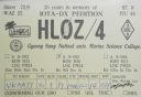
AS-085.jpgAS-085 South Korea Cholla-namdo Province (Soan Islands) group
|
|

AS-086.jpgAS-086 Asiatic Russia Izvestiy TS.I.K IslandsThe archipelago includes two large and two small islands covered with tundra vegetation, shingle and ice. It is located in the Kara Sea, about 150 km from the coast of Siberia and just 45 km north of the nearest island group, the Arkticheskiy Institut Islands. The largest island is Troynoy with a length of 27 km.
|
|

AS-086R.jpgAS-086 Asiatic Russia Izvestiy TS.I.K IslandsThe archipelago includes two large and two small islands covered with tundra vegetation, shingle and ice. It is located in the Kara Sea, about 150 km from the coast of Siberia and just 45 km north of the nearest island group, the Arkticheskiy Institut Islands. The largest island is Troynoy with a length of 27 km.
|
|

AS-087.jpgAS-087 Asiatic Russia Arkticheskogo Instituta IslandsThe Arkticheskiy Institut Islands or Arctic Institute Islands (Russian: ОÑтрова ÐрктичеÑкого инÑтитута) is a compact archipelago of narrow islands covered with tundra vegetation. The islands are located in the Kara Sea, about 173 km (107 mi)north of the coast of Siberia, and just 45 km (28 mi) south of the nearest island group, the Izvesti Tsik Islands.
|
|

AS-087R.jpgAS-087 Asiatic Russia Arkticheskogo Instituta IslandsThe Arkticheskiy Institut Islands or Arctic Institute Islands (Russian: ОÑтрова ÐрктичеÑкого инÑтитута) is a compact archipelago of narrow islands covered with tundra vegetation. The islands are located in the Kara Sea, about 173 km (107 mi)north of the coast of Siberia, and just 45 km (28 mi) south of the nearest island group, the Izvesti Tsik Islands.
|
|

AS-088.jpgAS-088 Qatar groupAl Safliya Island is an island located off the coast of Doha, the capital city of Qatar. The island is located 3 miles north of Ras Abu Aboud. A popular tourist destination among locals, journey by boat from Doha takes roughly 30 to 40 minutes.
|
|

AS-089.jpgAS-089 Asiatic Russia Kara Sea Coast West groupLitke Island s – is a group of islands located to the north and east of the Pakhtusov Islands, the Kara Sea. In its northern part L.I. are closely adjacent to Russky Island. The group includes 20 islands. Almost all of them are rocky with steep cliffs towards the sea.
|
|

AS-089R.jpgAS-089 Asiatic Russia Kara Sea Coast West groupLitke Island s – is a group of islands located to the north and east of the Pakhtusov Islands, the Kara Sea. In its northern part L.I. are closely adjacent to Russky Island. The group includes 20 islands. Almost all of them are rocky with steep cliffs towards the sea.
|
|

AS-090.jpgAS-090 South Korea Kyonggi-do Province (Tokchok Islands) groupThe Island is situated in the Yellow Sea, nearby Incheon
|
|

AS-091.jpgAS-091 Asiatic Russia Sea of Okhotsk Coast groupPtichy Island (Russian: ОÑтров Птичий, Ostrov Ptichy, meaning Bird Island) is a small island in the Sea of Okhotsk. It lies between the southwest point of Bolshoy Shantar and Cape Bol'shoy Dugandzha on the mainland. It is a little over 1.6 km (1 mi) in length and rises to a height of 290 m (951 ft).
|
|

AS-091R.jpgAS-091 Asiatic Russia Sea of Okhotsk Coast groupPtichy Island (Russian: ОÑтров Птичий, Ostrov Ptichy, meaning Bird Island) is a small island in the Sea of Okhotsk. It lies between the southwest point of Bolshoy Shantar and Cape Bol'shoy Dugandzha on the mainland. It is a little over 1.6 km (1 mi) in length and rises to a height of 290 m (951 ft).
|
|

AS-092.jpgAS-092 Asiatic Russia Bering Sea Coast South groupAlyumka Island is located in the Bering Sea off the far eastern point of Asiatic Russian Chukotka region
|
|
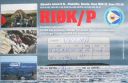
AS-092R.jpgAS-092 Asiatic Russia Bering Sea Coast South groupAlyumka Island is located in the Bering Sea off the far eastern point of Asiatic Russian Chukotka region
|
|

AS-093.jpgAS-093 South Korea Cholla-namdo Province (Huksan Islands) groupThe Huksan Archipelago is located at the south western tip of South Korea. The island group is approx 4 hours by boat from Mok-po City.
|
|

AS-094.jpgAS-094 China Hainan Province (Hainan Island) groupHainan is the smallest and southernmost province of the People's Republic of China (PRC), consisting of various islands in the South China Sea. Hainan Island, separated from Guangdong's Leizhou Peninsula by the Qiongzhou Strait, is the largest and most populous island
|
|

AS-095.jpgAS-095 Asiatic Russia Bering Sea Coast South groupThe island is located in the Avacha bay of the Pacific ocean, not far from the Avacha inlet passage, opposite the Big and the Small Sarannaya bays.
|
|
AS-095R.jpgAS-095 Asiatic Russia Bering Sea Coast South groupThe island is located in the Avacha bay of the Pacific ocean, not far from the Avacha inlet passage, opposite the Big and the Small Sarannaya bays.
|
|
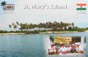
AS-096.jpgAS-096 India Karnataka State groupSt. Mary's Islands, also known as Coconut Island and Thonsepar, are a set of four small islands in the Arabian Sea off the coast of Malpe in Udupi, Karnataka, India. They are known for their distinctive geological formation of columnar basaltic lava.
|
|
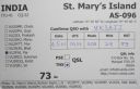
AS-096R.jpgAS-096 India Karnataka State groupSt. Mary's Islands, also known as Coconut Island and Thonsepar, are a set of four small islands in the Arabian Sea off the coast of Malpe in Udupi, Karnataka, India. They are known for their distinctive geological formation of columnar basaltic lava.
|
|

AS-097.jpgAS-097 Malaysia Melaka / Johor State West groupBesar Island (Malay: Pulau Besar), is an island in Mersing District, Johor, Malaysia.The island, which is surrounded by Rawa, Sibu and Tinggi Island, is characterised by quiet, clean beaches of powdery white sand and crystal-clear azure waters
|
|

AS-098.jpgAS-098 Turkey Aydin / Mugla Province groupKara Ada, is a small Turkish island at the entrance of the harbor of Bodrum in the Aegean Sea. It is a popular tourist destination, particularly for yachting
|
|

AS-098R.jpgAS-098 Turkey Aydin / Mugla Province groupKara Ada, is a small Turkish island at the entrance of the harbor of Bodrum in the Aegean Sea. It is a popular tourist destination, particularly for yachting
|
|
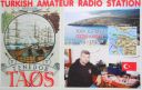
AS-099.jpgAS-099 Turkey Canakkale / Balikesir / Izmir Province groupTenedos, or Bozcaada in Turkish, is an island of Turkey in the northeastern part of the Aegean Sea. Administratively, the island constitutes the Bozcaada district of Çanakkale province. With an area of 39.9 km² it is the third largest Turkish island after Imbros and Marmara.
|
|

AS-099R.jpgAS-099 Turkey Canakkale / Balikesir / Izmir Province groupTenedos, or Bozcaada in Turkish, is an island of Turkey in the northeastern part of the Aegean Sea. Administratively, the island constitutes the Bozcaada district of Çanakkale province. With an area of 39.9 km² it is the third largest Turkish island after Imbros and Marmara.
|
|

AS-100.jpgAS-100 Israel groupAchziv Islands (also Achziv Beach Islands) are a group of small Israel islands in the Mediterranean Sea. Each island is a few hundred square meters in area, with a reef is composed of small limestone blocks.
The islands are part of the Rosh Hanikra Islands Nature Reserve
|
|

AS-100R.jpgAS-100 Israel groupAchziv Islands (also Achziv Beach Islands) are a group of small Israel islands in the Mediterranean Sea. Each island is a few hundred square meters in area, with a reef is composed of small limestone blocks.
The islands are part of the Rosh Hanikra Islands Nature Reserve
|
|

AS-101.jpgAS-101 Thailand Malay Peninsula East groupKo Samui, Thailand’s second largest island, lies in the Gulf of Thailand off the east coast of the Kra Isthmus. It's known for its palm-fringed beaches, coconut groves and dense, mountainous rainforest
|
|

AS-101R.jpgAS-101 Thailand Malay Peninsula East groupKo Samui, Thailand’s second largest island, lies in the Gulf of Thailand off the east coast of the Kra Isthmus. It's known for its palm-fringed beaches, coconut groves and dense, mountainous rainforest
|
|

AS-102.jpgAS-102 Taiwan Kinmen (Quemoy) IslandKinmen 金門 (pronounced Jinmen, literal meaning "golden gate", formerly known as Quemoy) is an outlying island located near the People's Republic of China, but is controlled by the Republic of China on Taiwan. It has a large number of traditional Min style buildings and military sites that are open to tourists
|
|

AS-102R.jpgAS-102 Taiwan Kinmen (Quemoy) IslandKinmen 金門 (pronounced Jinmen, literal meaning "golden gate", formerly known as Quemoy) is an outlying island located near the People's Republic of China, but is controlled by the Republic of China on Taiwan. It has a large number of traditional Min style buildings and military sites that are open to tourists
|
|

AS-103.jpgAS-103 Taiwan P'enghu (Pescadores) IslandsThe Penghu or Pescadores Islands are an archipelago of 90 islands and islets in the Taiwan Strait. The largest city is Magong, located on the largest island, which is also named Magong.
|
|

AS-103R.jpgAS-103 Taiwan P'enghu (Pescadores) IslandsThe Penghu or Pescadores Islands are an archipelago of 90 islands and islets in the Taiwan Strait. The largest city is Magong, located on the largest island, which is also named Magong.
|
|

as-104.jpgAS-104 Asiatic Russia Kara Sea Coast East groupThe Kirov Islands or Sergey Kirov Islands (Russian: ОÑтрова Кирова, Ostrova Kirova or Aрхипелаг Ð¡ÐµÑ€Ð³ÐµÑ ÐšÐ¸Ñ€Ð¾Ð²Ð°, Archipelag Sergeya Kirova) is an island group in the Kara Sea, Russian Federation. It is an archipelago of small islands covered with tundra vegetation located about 140 km from the coast of Siberia and 100 km to the northwest of the Nordenskiöld Archipelago.
|
|

as-104r.jpgAS-104 Asiatic Russia Kara Sea Coast East groupThe Kirov Islands or Sergey Kirov Islands (Russian: ОÑтрова Кирова, Ostrova Kirova or Aрхипелаг Ð¡ÐµÑ€Ð³ÐµÑ ÐšÐ¸Ñ€Ð¾Ð²Ð°, Archipelag Sergeya Kirova) is an island group in the Kara Sea, Russian Federation. It is an archipelago of small islands covered with tundra vegetation located about 140 km from the coast of Siberia and 100 km to the northwest of the Nordenskiöld Archipelago.
|
|

AS-105.jpgAS-105 South Korea Kyonggi-do Province groupJebudo is an island in South Korea, located in Jebu-ri, Seosin-myeon, Hwaseong-si, Gyeonggi-do. It is connected to Songgyo-ri, Seosin-myeon, Hwaseong-si, Keonggi-do by a two-lane road, but it is impassable twice a day for three to four hours, due to the high tide
|
|

AS-105R.jpgAS-105 South Korea Kyonggi-do Province groupJebudo is an island in South Korea, located in Jebu-ri, Seosin-myeon, Hwaseong-si, Gyeonggi-do. It is connected to Songgyo-ri, Seosin-myeon, Hwaseong-si, Keonggi-do by a two-lane road, but it is impassable twice a day for three to four hours, due to the high tide
|
|

AS-106.jpgAS-106 India Minicoy IslandMinicoy, locally known as Maliku is an island in Lakshadweep, India. Along with Viringili, it is on Maliku atoll, the southernmost atoll of Lakshadweep archipelago. Administratively, it is a census town in the Indian union territory of Lakshadweep
|
|
| 1466 files on 37 page(s) |
 |
|
|
|
|
|
|
|
10 | |
|
|
|
|
|
|
|
|
|
 Contact
