Asia Islands IOTA QSL Album
|
|
|

AS-143R.jpgAS-143 China Hainan Province (Xisha Islands) group;Paracel IslandsThe Paracel Islands, also known as Xisha in Chinese and Hoà ng Sa in Vietnamese, is a group of islands, reefs, banks and other maritime features in the South China Sea. It is controlled by the People's Republic of China, and also claimed by Taiwan and Vietnam
|
|

AS-144.jpgAS-144 Myanamar Tenasserim Region South groupMergui (or Myeik) Archipelago lies off the far south coast of Myanmar (formerly Burma). It's comprised of hundreds of islands that have coral reefs and beaches. Lampi Island, in Lampi Marine National Park, is home to the seafaring indigenous Moken people. It's a haven for birds, notably the plain-pouched hornbill, plus marine life like dugongs and turtles. Myeik, a port town, is a gateway to islands close to shore.
|
|

AS-144R.jpgAS-144 Myanamar Tenasserim Region South groupMergui (or Myeik) Archipelago lies off the far south coast of Myanmar (formerly Burma). It's comprised of hundreds of islands that have coral reefs and beaches. Lampi Island, in Lampi Marine National Park, is home to the seafaring indigenous Moken people. It's a haven for birds, notably the plain-pouched hornbill, plus marine life like dugongs and turtles. Myeik, a port town, is a gateway to islands close to shore.
|
|

AS-145.jpgAS-145 Thailand Malay Peninsula South East groupKo Nu (Mouse Island) and Ko Maeo (Cat Island) Beloved in local lore, these islands are situated off Hat Samila in Thailand
|
|

AS-145R.jpgAS-145 Thailand Malay Peninsula South East groupKo Nu (Mouse Island) and Ko Maeo (Cat Island) Beloved in local lore, these islands are situated off Hat Samila in Thailand
|
|

AS-146.jpgAS-146 China Shandong Province North East groupAcclaimed to be the most beautiful island in China, Changdao (or ‘Long Island’) has multiple small reefs and mini islets. Seabirds nest on steep cliffs or between jagged reefs carved by nature to thousands of shapes and forms. Major attractions include the Jiuzhang Cliff, Yueya Bay and Wanniao Island. Location: Long Island Scenic Area, Changdao County, Yantai City
|
|

AS-146R.jpgAS-146 China Shandong Province North East groupAcclaimed to be the most beautiful island in China, Changdao (or ‘Long Island’) has multiple small reefs and mini islets. Seabirds nest on steep cliffs or between jagged reefs carved by nature to thousands of shapes and forms. Major attractions include the Jiuzhang Cliff, Yueya Bay and Wanniao Island. It’s a pure world of nature, paradise for birds. Location: Long Island Scenic Area, Changdao County, Yantai City
|
|

AS-147.jpgAS-147 Japan Hokkaido's Coastal IslandsOkushiri Island is an island in HokkaidÅ, Japan. It has an area of 142.97 square kilometres. The town of Okushiri and the Hiyama Prefectural Natural Park encompass the entire island. It has many pastures, beech tree forests, and a rocky coastline.
|
|

AS-147R.jpgAS-147 Japan Hokkaido's Coastal IslandsOkushiri Island is an island in HokkaidÅ, Japan. It has an area of 142.97 square kilometres. The town of Okushiri and the Hiyama Prefectural Natural Park encompass the entire island. It has many pastures, beech tree forests, and a rocky coastline.
|
|

AS-148.jpgAS-148 South Korea Cholla-bukto Province groupWi Island , Cholla-bukto Province, South Korea
|
|

AS-148R.jpgAS-148 South Korea Cholla-bukto Province groupWi Island , Cholla-bukto Province, South Korea
|
|

AS-149.jpgAS-149 Asiatic Russia Sakhalin's Coastal IslandsMoneron island is located 41 nautical miles (76 km) from Sakhalin's port of Nevelsk and about 30 nautical miles (56 km)[1] directly southwest of Sakhalin Island itself at the northeastern end of the Sea of Japan. It is the only landmass in the whole Tatar Straits. It has no permanent population.
|
|

AS-149R.jpgAS-149 Asiatic Russia Sakhalin's Coastal IslandsMoneron island is located 41 nautical miles (76 km) from Sakhalin's port of Nevelsk and about 30 nautical miles (56 km)[1] directly southwest of Sakhalin Island itself at the northeastern end of the Sea of Japan. It is the only landmass in the whole Tatar Straits. It has no permanent population.
|
|

AS-150.jpgAS-150 China Shandong Province South groupLingshan Island, with a height of 513.6 metres above sea level, is the highest island in Northern China. It’s located in the Yellow Sea, from the southeast of Huangdao District, Qingdao, Shandong Province, China.
|
|

AS-151.jpgAS-151 China Liaoning Province West groupChangxing Island is located in the eastern part of Bohai Sea, off the coast of Wafangdian, Dalian, Liaoning. It is the sixth largest island in Greater China and the largest island north of the Chongming Island on the Yangtze River. Its area is 252.5 square kilometers (97.5 sq mi), running about 30 kilometers (19 mi) east to west and 11 kilometers (6.8 mi) north to south.
|
|

AS-152.jpgAS-152 Asiatic Russia Laptev Sea Coast West groupBolshoy Begichev (Russian: Большой Бегичев) is an island in the Laptev Sea, Russia. The area of the island is 1764 km². Bolshoy Begichev is located within the Khatanga Gulf (Russian: ХатангÑкий залив), splitting the gulf into two straits.
|
|

AS-152R.jpgAS-152 Asiatic Russia Laptev Sea Coast West groupBolshoy Begichev (Russian: Большой Бегичев) is an island in the Laptev Sea, Russia. The area of the island is 1764 km². Bolshoy Begichev is located within the Khatanga Gulf (Russian: ХатангÑкий залив), splitting the gulf into two straits.
|
|
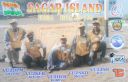
AS-153.jpgAS-153 India West Bengal State groupSagar Island is an island in the Ganges delta, lying on the Continental Shelf of Bay of Bengal about 100 km south of Kolkata.
|
|
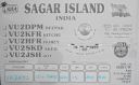
AS-153R.jpgAS-153 India West Bengal State groupSagar Island is an island in the Ganges delta, lying on the Continental Shelf of Bay of Bengal about 100 km south of Kolkata.
|
|
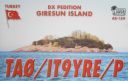
AS-154.jpgAS-154 Turkey Black Sea Coast East groupGiresun Island is a small island that has an area of 4 hectares and lies 1.2 km from the Turkish city of Giresun on the southeastern coast of Black Sea. It is the largest island on the Turkish Black Sea coast.
|
|

AS-154R.jpgAS-154 Turkey Black Sea Coast East groupGiresun Island is a small island that has an area of 4 hectares and lies 1.2 km from the Turkish city of Giresun on the southeastern coast of Black Sea. It is the largest island on the Turkish Black Sea coast.
|
|

AS-155.jpgAS-155 Taiwan Taiwan's Coastal IslandsOrchid Island, also known by other names, is a 45 km² high island off the southeastern coast of Taiwan Island. It is separated from the Batanes of the Philippines by the Bashi Channel of the Luzon Strait. It is governed as Lanyu Township of Taitung County, Taiwan, which also includes the nearby Lesser Orchid Island
|
|

AS-155R.jpgAS-155 Taiwan Taiwan's Coastal IslandsOrchid Island, also known by other names, is a 45 km² high island off the southeastern coast of Taiwan Island. It is separated from the Batanes of the Philippines by the Bashi Channel of the Luzon Strait. It is governed as Lanyu Township of Taitung County, Taiwan, which also includes the nearby Lesser Orchid Island
|
|

AS-156.jpgAS-156 Asiatic Russia Ushakova IslandUshakov Island is located close to the region of permanent sea ice midway between Franz Josef Land and Severnaya Zemlya, at the northern limit of the Kara Sea.[3] This island lies close to the limit of permanent ice; it is desolate and subject to severe Arctic storms. Its total area is 324 square kilometres (125 square miles).
|
|

AS-156R.jpgAS-156 Asiatic Russia Ushakova IslandUshakov Island is located close to the region of permanent sea ice midway between Franz Josef Land and Severnaya Zemlya, at the northern limit of the Kara Sea.[3] This island lies close to the limit of permanent ice; it is desolate and subject to severe Arctic storms. Its total area is 324 square kilometres (125 square miles).
|
|

AS-157.jpgAS-157 Vietnam South China Sea Coast Centre groupHon Tam Island is located offshore the coastal city of Nha Trang
|
|

AS-157R.jpgAS-157 Vietnam South China Sea Coast Centre groupHon Tam Island is located offshore the coastal city of Nha Trang
|
|

AS-158.jpgAS-158 China Liaoning Province East groupChangshan Islands (zh:长山列岛) in the Bohai Sea, north of Penglai. They are known for their sandy beaches and picturesque limestone cliffs
|
|

AS-159.jpgAS-159 Turkey Black Sea Coast West groupKefken Island, in Turkish Kefken Adası, lies off the Black Sea coast of Turkey, a short boat ride from the mainland village of Cebeci in the Kandıra district of Kocaeli Province. It has an area of 21 hectares, and is about four times as long as it is broad.
|
|

AS-159R.jpgAS-159 Turkey Black Sea Coast West groupKefken Island, in Turkish Kefken Adası, lies off the Black Sea coast of Turkey, a short boat ride from the mainland village of Cebeci in the Kandıra district of Kocaeli Province. It has an area of 21 hectares, and is about four times as long as it is broad.
|
|

AS-160.jpgAS-160 China Shandong Province North West groupFurong Island Shandong Province
|
|

AS-160R.jpgAS-160 China Shandong Province North West groupFurong Island Shandong Province
|
|
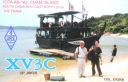
AS-162.jpgAS-162 Vietnam South China Sea Coast North groupThe Cham Islands Cu Lao Cham are off the Central Coast of Vietnam. Approximately 9 nautical miles offshore and to the east of Cua Dai Beach, Hoi An, Quang Nam Province. This covers an area of 235 km² which includes eight islands and surrounding waters. There are eight islands in the "Cham Islands": the largest and only inhabited island Hon Lao (covering an area of 1,317 hectares with a hilltop elevation of 517 m),
|
|

AS-162R.jpgAS-162 Vietnam South China Sea Coast North groupThe Cham Islands Cu Lao Cham are off the Central Coast of Vietnam. Approximately 9 nautical miles offshore and to the east of Cua Dai Beach, Hoi An, Quang Nam Province. This covers an area of 235 km² which includes eight islands and surrounding waters. There are eight islands in the "Cham Islands": the largest and only inhabited island Hon Lao (covering an area of 1,317 hectares with a hilltop elevation of 517 m),
|
|

AS-163.jpgAS-163 Asiatic Russia Laptev Sea Coast East groupMakar Island (ОÑтров Макар) is an island in the Laptev Sea. It is located in the bay of the Yana river, about 30 km from the nearest coast to the south, and 21 km north of the Shelonsky Islands. Administratively Makar Island belongs to the Sakha Republic (Yakutia) of the Russian Federation. There is a Russian Polar Station at Makar Island.
|
|

AS-163R.jpgAS-163 Asiatic Russia Laptev Sea Coast East groupMakar Island (ОÑтров Макар) is an island in the Laptev Sea. It is located in the bay of the Yana river, about 30 km from the nearest coast to the south, and 21 km north of the Shelonsky Islands. Administratively Makar Island belongs to the Sakha Republic (Yakutia) of the Russian Federation. There is a Russian Polar Station at Makar Island.
|
|

AS-164.jpgAS-164 Asiatic Russia East Siberian Sea Coast West groupDerevannyy Island, East Siberian Sea
|
|

AS-164R.jpgAS-164 Asiatic Russia East Siberian Sea Coast West groupDerevannyy Island, East Siberian Sea
|
|

AS-165.jpgAS-165 Myanamar Arakan Region group Apawye Island near Thandwe, Arakan region
|
|

AS-165R.jpgAS-165 Myanamar Arakan Region group Apawye Island near Thandwe, Arakan region
|
|
|
|
 Contact

