Asia Islands IOTA QSL Album
|
|
|

AS-122.jpgAS-122 South Korea Kyonggi-do Province West groupBaengnyeong Island is a 45.8-square-kilometre, 8.45-kilometre long and 12.56-kilometre wide island in Ongjin County, Incheon, South Korea, located near the Northern Limit Line
|
|

AS-122R.jpgAS-122 South Korea Kyonggi-do Province West groupBaengnyeong Island is a 45.8-square-kilometre, 8.45-kilometre long and 12.56-kilometre wide island in Ongjin County, Incheon, South Korea, located near the Northern Limit Line
|
|

as-123.jpgAS-123 Turkey Icel / Adana / Hatay Province groupThe 7 hectares (17 acres) islet is located 200 metres (660 ft) off shore from the main land facing a small settlement with the same name. Administratively it is a part of İmamuşağı village of Silifke district which is a part of Mersin Province. It is at 36°16′02″N 33°49′36″E. The distance from the main land to Silifke is 17 kilometres (11 mi) and to Mersin is 100 kilometres (62 mi).
|
|

as-123r.jpgAS-123 Turkey Icel / Adana / Hatay Province groupThe 7 hectares (17 acres) islet is located 200 metres (660 ft) off shore from the main land facing a small settlement with the same name. Administratively it is a part of İmamuşağı village of Silifke district which is a part of Mersin Province. It is at 36°16′02″N 33°49′36″E. The distance from the main land to Silifke is 17 kilometres (11 mi) and to Mersin is 100 kilometres (62 mi).
|
|

AS-124.jpgAS-124 United Arab Emirates Gulf of Oman groupShark Island is located a short boat-ride away from Khorfakkan on Sharjah’s east coast. It lies just out in the bay, tucked behind the port at the southern end of the beach.
|
|
AS-124R.jpgAS-124 United Arab Emirates Gulf of Oman groupShark Island is located a short boat-ride away from Khorfakkan on Sharjah’s east coast. It lies just out in the bay, tucked behind the port at the southern end of the beach.
|
|

AS-125.jpgAS-125 Thailand Gulf of Thailand North East groupKo Chang, one of the largest Thai islands in the Gulf of Thailand, contains dense, steep jungle. Mu Ko Chang National Park, a preserve with hiking trails and waterfalls such as tiered Klong Plu, covers the interior and extends to offshore coral reefs
|
|

AS-125R.jpgAS-125 Thailand Gulf of Thailand North East groupKo Chang, one of the largest Thai islands in the Gulf of Thailand, contains dense, steep jungle. Mu Ko Chang National Park, a preserve with hiking trails and waterfalls such as tiered Klong Plu, covers the interior and extends to offshore coral reefs
|
|

AS-126.jpgAS-126 Thailand Malay Peninsula South West groupKo Tarutao island is the largest island of Tarutao National Marine Park in Satun Province of Thailand, close to Malaysia border. The island is 26 km long and 11 km wide.
|
|

AS-126R.jpgAS-126 Thailand Malay Peninsula South West groupKo Tarutao island is the largest island of Tarutao National Marine Park in Satun Province of Thailand, close to Malaysia border. The island is 26 km long and 11 km wide.
|
|

AS-127.jpgAS-127 Bangladesh Chittagong Region groupHatiya Island is an island in the northern Bay of Bengal, Bangladesh, at the mouth of the Meghna river. The Island falls under Hatiya Upazila of Noakhali District. The island has an area of 371 km².
|
|

AS-128.jpgAS-128 Vietnam Gulf of Thailand groupPhú Quốc is a Vietnamese island off the coast of Cambodia in the Gulf of Thailand. It's known for white-sand beaches and resorts, most of which are along the palm-lined southwest coast. More than half of the island is part of Phú Quốc National Park.
|
|

AS-128_28229.jpgAS-128 Vietnam Gulf of Thailand groupPhú Quốc is a Vietnamese island off the coast of Cambodia in the Gulf of Thailand. It's known for white-sand beaches and resorts, most of which are along the palm-lined southwest coast. More than half of the island is part of Phú Quốc National Park.
|
|

AS-129.jpgAS-129 China Guangdong Province East groupWailingding Island is an outlying island in Zhuhai. It is located at the opening of the Pearl River with Hongkong visible on the opposite bank.
|
|

AS-130.jpgAS-130 Vietnam South China Sea Coast South groupThe Côn Äảo Islands are an archipelago of Bà Rịa–VÅ©ng Tà u Province, in the Southeast region of Vietnam, and a district of this province.
|
|

AS-130R.jpgAS-130 Vietnam South China Sea Coast South groupThe Côn Äảo Islands are an archipelago of Bà Rịa–VÅ©ng Tà u Province, in the Southeast region of Vietnam, and a district of this province.
|
|

AS-131.jpgAS-131 China Guangdong Province West groupThe islands are situated in the South China Sea, to the south of the opening of the Pearl River estuary and Hong Kong. The archipelago includes several groups of islands. The western group, located south of the Pearl River estuary and Lantau Island, was formerly known to Europeans as the Ladrones, from the Spanish for "thieves". It comprises Greater Wanshan, Guishan, and Wai Dangling Islands and the Zhizhou, Sanmen, and Aizhou groups
|
|

AS-131R.jpgAS-131 China Guangdong Province West groupThe islands are situated in the South China Sea, to the south of the opening of the Pearl River estuary and Hong Kong. The archipelago includes several groups of islands. The western group, located south of the Pearl River estuary and Lantau Island, was formerly known to Europeans as the Ladrones, from the Spanish for "thieves". It comprises Greater Wanshan, Guishan, and Wai Dangling Islands and the Zhizhou, Sanmen, and Aizhou groups
|
|

AS-132.jpgAS-132 Vietnam Gulf of Tongking North groupCát Bà Island is the largest of the 367 islands spanning 260 km2 that comprise the Cat Ba Archipelago, which makes up the southeastern edge of Lan Ha Bay in Northern Vietnam. Cat Ba island has a surface area of 285 km2 and maintains the dramatic and rugged features of Ha Long Bay.
|
|

AS-132R.jpgAS-132 Vietnam Gulf of Tongking North groupCát Bà Island is the largest of the 367 islands spanning 260 km2 that comprise the Cat Ba Archipelago, which makes up the southeastern edge of Lan Ha Bay in Northern Vietnam. Cat Ba island has a surface area of 285 km2 and maintains the dramatic and rugged features of Ha Long Bay.
|
|

AS-133.jpgAS-133 Cambodia groupKoh Puos or Kaoh Puos (Khmer: កោះពស់), Snake Island - named "Île Coudée" (Elbow Island) during the French colonial period) is a small islands in the Gulf of Thailand, located about 0.63 km (0 mi) off the coast of Sihanoukville city in southern Cambodia. It is administered by Sangkat 3 of Mittakpheap District in Sihanoukville Province
|
|

AS-133R.jpgAS-133 Cambodia groupKoh Puos or Kaoh Puos (Khmer: កោះពស់), Snake Island - named "Île Coudée" (Elbow Island) during the French colonial period) is a small islands in the Gulf of Thailand, located about 0.63 km (0 mi) off the coast of Sihanoukville city in southern Cambodia. It is administered by Sangkat 3 of Mittakpheap District in Sihanoukville Province
|
|

AS-134.jpgAS-134 China Hebei / Tianjin Province groupShijiutuo, Hebei is an island to the east of Yuetuo and southeast of Laoyujian in northern China.
|
|

AS-134R.jpgAS-134 China Hebei / Tianjin Province groupShijiutuo, Hebei is an island to the east of Yuetuo and southeast of Laoyujian in northern China.
|
|

AS-135.jpgAS-135 China Jiangsu Province groupPing Island
|
|
AS-135R.jpgAS-135 China Jiangsu Province groupPing Island
|
|

AS-136.jpgAS-136 China Shanghai Province groupThe islands of Shanghai are those under the jurisdiction of the Shanghai municipal government. They comprise three large inhabited islands and a shifting number of smaller, uninhabited ones.
|
|

AS-136R.jpgAS-136 China Shanghai Province groupThe islands of Shanghai are those under the jurisdiction of the Shanghai municipal government. They comprise three large inhabited islands and a shifting number of smaller, uninhabited ones.
|
|

AS-137.jpgAS-137 China Zhejiang Province North groupZhoushan, formerly romanized as Chusan, is an urbanized archipelago with the administrative status of a prefecture-level city in the northeastern Chinese province of Zhejiang. It consists of an archipelago of islands at the southern mouth of Hangzhou Bay, off Ningbo
|
|
AS-137R.jpgAS-137 China Zhejiang Province North groupZhoushan, formerly romanized as Chusan, is an urbanized archipelago with the administrative status of a prefecture-level city in the northeastern Chinese province of Zhejiang. It consists of an archipelago of islands at the southern mouth of Hangzhou Bay, off Ningbo
|
|

AS-138.jpgAS-138 China Fujian Province groupPingtan or Haitan Island is an island off the east coast of Fujian Province, China, south of the complex estuary of the Min River. It is the largest island in Fujian and the fifth-largest island in China
|
|
AS-138R.jpgAS-138 China Fujian Province groupPingtan or Haitan Island is an island off the east coast of Fujian Province, China, south of the complex estuary of the Min River. It is the largest island in Fujian and the fifth-largest island in China
|
|

AS-139.jpgAS-139 China Guangxi Autonomous Region groupWeizhou Island is a Chinese island in the Gulf of Tonkin. The largest island of Guangxi province, Weizhou is west of Leizhou Peninsula, south of Beihai, and east of Vietnam. Administratively, it is part of Weizhou Town, Haicheng District of Beihai City.
|
|

AS-140.jpgAS-140 Bangladesh Khulna / Barisal Region groupBhola Island (also called Dakhin Shahbazpur) is the largest island of Bangladesh with an area of 1441 km². It is most of the land area of Bhola District in Barisal Division. It is situated at the mouth of the Meghna River. There are ferry and launch services from Dhaka and Barisal.The Island is 130 kilometres (81 miles) long and has a population of 1.7 million
|
|
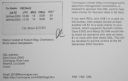
AS-140R.jpgAS-140 Bangladesh Khulna / Barisal Region groupBhola Island (also called Dakhin Shahbazpur) is the largest island of Bangladesh with an area of 1441 km². It is most of the land area of Bhola District in Barisal Division. It is situated at the mouth of the Meghna River. There are ferry and launch services from Dhaka and Barisal.The Island is 130 kilometres (81 miles) long and has a population of 1.7 million
|
|

AS-141.jpgAS-141 China Zhejiang Province South groupDongtou Island is part of “Hundred Island Countyâ€, and is located at the mouth of the Oujiang River, 16 kilometers away from Wenzhou, facing the East China Sea. Composed of 168 islands,with beautiful mountains and unique sea scenery, Dongtou is a seaside tourist resort
|
|
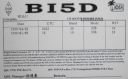
AS-141R.jpgAS-141 China Zhejiang Province South groupDongtou Island is part of “Hundred Island Countyâ€, and is located at the mouth of the Oujiang River, 16 kilometers away from Wenzhou, facing the East China Sea. Composed of 168 islands,with beautiful mountains and unique sea scenery, Dongtou is a seaside tourist resort
|
|

AS-142.jpgAS-142 Asiatic Russia Sea of Okhotsk Coast groupKambalny Island is located in the south east of the Peninsula, near Kambalny cape, in Orkhost Sea. This island, mostly made of rocks and close to sea level, rises to 27 meters in its central part. The island is part of the South Kamchatka Federal Reserve. It is the home of 4 seabird species including 400 couples of tufted puffins.
|
|
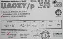
AS-142R.jpgAS-142 Asiatic Russia Sea of Okhotsk Coast groupKambalny Island is located in the south east of the Peninsula, near Kambalny cape, in Orkhost Sea. This island, mostly made of rocks and close to sea level, rises to 27 meters in its central part. The island is part of the South Kamchatka Federal Reserve. It is the home of 4 seabird species including 400 couples of tufted puffins.
|
|
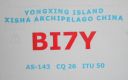
AS-143.jpgAS-143 China Hainan Province (Xisha Islands) group;Paracel IslandsThe Paracel Islands, also known as Xisha in Chinese and Hoà ng Sa in Vietnamese, is a group of islands, reefs, banks and other maritime features in the South China Sea. It is controlled by the People's Republic of China, and also claimed by Taiwan and Vietnam
|
|
|
|
 Contact

