|
|

as-072.jpgAS-072 Malaysia Perak State groupPangkor Island (Malay: Pulau Pangkor) is a resort island in Manjung District, Perak, Malaysia. It has a population of approximately 25,000. Nearby islands include Pangkor Laut Island, Giam Island (Pulau Giam)[1], Mentagor Island (Pulau Mentagor), Simpan Island (Pulau Simpan) and Tukun Terindak Island (Pulau Tukun Terindak). The major industries of the island are tourism and fishing.
|
|

as-072r.jpgAS-072 Malaysia Perak State groupPangkor Island (Malay: Pulau Pangkor) is a resort island in Manjung District, Perak, Malaysia. It has a population of approximately 25,000. Nearby islands include Pangkor Laut Island, Giam Island (Pulau Giam)[1], Mentagor Island (Pulau Mentagor), Simpan Island (Pulau Simpan) and Tukun Terindak Island (Pulau Tukun Terindak). The major industries of the island are tourism and fishing.
|
|

as-073.jpgAS-073 Malaysia Kelantan / Terengganu State groupRedang Island (Malay: Pulau Redang) is an island in Kuala Nerus District, Terengganu, Malaysia. It is one of the largest islands off the east coast of Peninsular Malaysia. It is famous for its crystal clear waters and white sandy beaches. It is one of nine islands, which form a marine sanctuary park offering snorkeling and diving opportunities for tourists.
|
|

as-073r.jpgAS-073 Malaysia Kelantan / Terengganu State groupRedang Island (Malay: Pulau Redang) is an island in Kuala Nerus District, Terengganu, Malaysia. It is one of the largest islands off the east coast of Peninsular Malaysia. It is famous for its crystal clear waters and white sandy beaches. It is one of nine islands, which form a marine sanctuary park offering snorkeling and diving opportunities for tourists.
|
|

as-074.jpgAS-074 Malaysia Selangor / Negeri Sembilan State groupPulau Ketam is an island located off the coast of Port Klang, Selangor, Malaysia. The island is in the intertidal zone and the chief vegetation is mangrove
|
|

AS-075.jpgAS-075 Macau groupOriginally a sparsely populated collection of coastal islands,[7] the territory has become a major resort city and the top destination for gambling tourism.
|
|

as-076.jpgAS-076 Japan Shikoku IslandShikoku (四国, literally "four provinces") is one of the four main islands of Japan. Shikoku is the smallest (225 km or 139.8 mi long and between 50 and 150 km or 31.1 and 93.2 mi wide) and least populous (3.8 million as of 2015, 3.1%) of the main islands, located south of Honshu and east of Kyushu
|
|

as-076r.jpgAS-076 Japan Shikoku IslandShikoku (四国, literally "four provinces") is one of the four main islands of Japan. Shikoku is the smallest (225 km or 139.8 mi long and between 50 and 150 km or 31.1 and 93.2 mi wide) and least populous (3.8 million as of 2015, 3.1%) of the main islands, located south of Honshu and east of Kyushu
|
|

AS-077.jpgAS-077 Japan Kyushu IslandKyushu (ä¹å·ž KyÅ«shÅ«, literally "Nine Provinces"; Japanese: [kʲɯꜜËɕɯË]) is the third largest island of Japan and most southwesterly of its four main islands.
|
|

AS-078.jpgAS-078 Japan Hokkaido IslandHokkaido is the second largest island of Japan, and the largest and northernmost prefecture. The Tsugaru Strait separates Hokkaido from Honshu. The two islands are connected by the undersea railway Seikan Tunnel.
|
|
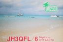
AS-079.jpgAS-079 Japan Miyako IslandsThe Miyako Islands are a group of islands in Okinawa Prefecture, Japan, east of the Yaeyama Islands. They are situated between the Ryukyu Islands and Taiwan.
|
|

AS-079R.jpgAS-079 Japan Miyako IslandsThe Miyako Islands are a group of islands in Okinawa Prefecture, Japan, east of the Yaeyama Islands. They are situated between the Ryukyu Islands and Taiwan.
|
|

AS-080.jpgAS-080 South Korea Ch'ungch'ong-namdo Province groupAnmyeondo (Korean: Hangul 안면ë„, Hanja å®‰çœ å³¶) is an island in Taean county, South Chungcheong Province, South Korea. Originally a peninsula, Yeonguijeong Kim Yuk ordered the flooding of the area between Changgiri (Anmyeoneup) and Sinonri (Nammyeon) to protect tax sent to Hanyang (now Seoul) from plunder by Japanese pirates. In 1970, the Anmyeongyo bridge (length 208.5 metres) was constructed to connect the island to the mainland.[1]
|
|

AS-080R.jpgAS-080 South Korea Ch'ungch'ong-namdo Province groupAnmyeondo (Korean: Hangul 안면ë„, Hanja å®‰çœ å³¶) is an island in Taean county, South Chungcheong Province, South Korea. Originally a peninsula, Yeonguijeong Kim Yuk ordered the flooding of the area between Changgiri (Anmyeoneup) and Sinonri (Nammyeon) to protect tax sent to Hanyang (now Seoul) from plunder by Japanese pirates. In 1970, the Anmyeongyo bridge (length 208.5 metres) was constructed to connect the island to the mainland.[1]
|
|

AS-081.jpgAS-081 South Korea Kyongsang-bukto / Kyongsang-namdo Province groupKadok island is South Korea's third largest and is located near the city of Busan
|
|

AS-081R.jpgAS-081 South Korea Kyongsang-bukto / Kyongsang-namdo Province groupKadok island is South Korea's third largest and is located near the city of Busan
|
|

AS-082.jpgAS-082 Asiatic Russia Laptev Sea Coast Centre groupBrusneva Island (Russian: ОÑтров БруÑнева, Ostrov Brusneva), is a small island in the Laptev Sea. It is located off the eastern side of the Lena delta in the Tiksi Bay, only 5 km ENE of Tiksi. Its length is 2.3 km and its maximum breadth less than 1 km. The name of this island is also spelt as "Brusnova" in some maps.
|
|

AS-082R.jpgAS-082 Asiatic Russia Laptev Sea Coast Centre groupBrusneva Island (Russian: ОÑтров БруÑнева, Ostrov Brusneva), is a small island in the Laptev Sea. It is located off the eastern side of the Lena delta in the Tiksi Bay, only 5 km ENE of Tiksi. Its length is 2.3 km and its maximum breadth less than 1 km. The name of this island is also spelt as "Brusnova" in some maps.
|
|

AS-083.jpgAS-083 Asiatic Russia Kara Sea Coast East groupBely Island is a relatively large island in the Kara Sea off the tip of the Yamal Peninsula, Siberia, Russia. Close to the island's northwest tip, there is the Russian Experiment Station Popov Station.
|
|

AS-083R.jpgAS-083 Asiatic Russia Kara Sea Coast East groupBely Island is a relatively large island in the Kara Sea off the tip of the Yamal Peninsula, Siberia, Russia. Close to the island's northwest tip, there is the Russian Experiment Station Popov Station.
|
|

AS-084.jpgAS-084 South Korea Cheju-do Province (Ch'uja Islands) groupThe Chuja Islands are a group of 42 islands in the Jeju Strait, about halfway between Jejudo and the southern coast of Jeollanamdo. Only four islands are inhabited: Sangchuja, which is connected by a bridge to Hachuja, the largest by area; Hoengang; and Chupo. The Chuja Islands are administered by Jeju City
|
|

AS-084R.jpgAS-084 South Korea Cheju-do Province (Ch'uja Islands) groupThe Chuja Islands are a group of 42 islands in the Jeju Strait, about halfway between Jejudo and the southern coast of Jeollanamdo. Only four islands are inhabited: Sangchuja, which is connected by a bridge to Hachuja, the largest by area; Hoengang; and Chupo. The Chuja Islands are administered by Jeju City
|
|
AS-085.jpgAS-085 South Korea Cholla-namdo Province (Soan Islands) group
|
|

AS-086.jpgAS-086 Asiatic Russia Izvestiy TS.I.K IslandsThe archipelago includes two large and two small islands covered with tundra vegetation, shingle and ice. It is located in the Kara Sea, about 150 km from the coast of Siberia and just 45 km north of the nearest island group, the Arkticheskiy Institut Islands. The largest island is Troynoy with a length of 27 km.
|
|

AS-086R.jpgAS-086 Asiatic Russia Izvestiy TS.I.K IslandsThe archipelago includes two large and two small islands covered with tundra vegetation, shingle and ice. It is located in the Kara Sea, about 150 km from the coast of Siberia and just 45 km north of the nearest island group, the Arkticheskiy Institut Islands. The largest island is Troynoy with a length of 27 km.
|
|

AS-087.jpgAS-087 Asiatic Russia Arkticheskogo Instituta IslandsThe Arkticheskiy Institut Islands or Arctic Institute Islands (Russian: ОÑтрова ÐрктичеÑкого инÑтитута) is a compact archipelago of narrow islands covered with tundra vegetation. The islands are located in the Kara Sea, about 173 km (107 mi)north of the coast of Siberia, and just 45 km (28 mi) south of the nearest island group, the Izvesti Tsik Islands.
|
|

AS-087R.jpgAS-087 Asiatic Russia Arkticheskogo Instituta IslandsThe Arkticheskiy Institut Islands or Arctic Institute Islands (Russian: ОÑтрова ÐрктичеÑкого инÑтитута) is a compact archipelago of narrow islands covered with tundra vegetation. The islands are located in the Kara Sea, about 173 km (107 mi)north of the coast of Siberia, and just 45 km (28 mi) south of the nearest island group, the Izvesti Tsik Islands.
|
|

AS-088.jpgAS-088 Qatar groupAl Safliya Island is an island located off the coast of Doha, the capital city of Qatar. The island is located 3 miles north of Ras Abu Aboud. A popular tourist destination among locals, journey by boat from Doha takes roughly 30 to 40 minutes.
|
|

AS-089.jpgAS-089 Asiatic Russia Kara Sea Coast West groupLitke Island s – is a group of islands located to the north and east of the Pakhtusov Islands, the Kara Sea. In its northern part L.I. are closely adjacent to Russky Island. The group includes 20 islands. Almost all of them are rocky with steep cliffs towards the sea.
|
|

AS-089R.jpgAS-089 Asiatic Russia Kara Sea Coast West groupLitke Island s – is a group of islands located to the north and east of the Pakhtusov Islands, the Kara Sea. In its northern part L.I. are closely adjacent to Russky Island. The group includes 20 islands. Almost all of them are rocky with steep cliffs towards the sea.
|
|

AS-090.jpgAS-090 South Korea Kyonggi-do Province (Tokchok Islands) groupThe Island is situated in the Yellow Sea, nearby Incheon
|
|

AS-091.jpgAS-091 Asiatic Russia Sea of Okhotsk Coast groupPtichy Island (Russian: ОÑтров Птичий, Ostrov Ptichy, meaning Bird Island) is a small island in the Sea of Okhotsk. It lies between the southwest point of Bolshoy Shantar and Cape Bol'shoy Dugandzha on the mainland. It is a little over 1.6 km (1 mi) in length and rises to a height of 290 m (951 ft).
|
|

AS-091R.jpgAS-091 Asiatic Russia Sea of Okhotsk Coast groupPtichy Island (Russian: ОÑтров Птичий, Ostrov Ptichy, meaning Bird Island) is a small island in the Sea of Okhotsk. It lies between the southwest point of Bolshoy Shantar and Cape Bol'shoy Dugandzha on the mainland. It is a little over 1.6 km (1 mi) in length and rises to a height of 290 m (951 ft).
|
|

AS-092.jpgAS-092 Asiatic Russia Bering Sea Coast South groupAlyumka Island is located in the Bering Sea off the far eastern point of Asiatic Russian Chukotka region
|
|
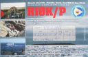
AS-092R.jpgAS-092 Asiatic Russia Bering Sea Coast South groupAlyumka Island is located in the Bering Sea off the far eastern point of Asiatic Russian Chukotka region
|
|

AS-093.jpgAS-093 South Korea Cholla-namdo Province (Huksan Islands) groupThe Huksan Archipelago is located at the south western tip of South Korea. The island group is approx 4 hours by boat from Mok-po City.
|
|

AS-094.jpgAS-094 China Hainan Province (Hainan Island) groupHainan is the smallest and southernmost province of the People's Republic of China (PRC), consisting of various islands in the South China Sea. Hainan Island, separated from Guangdong's Leizhou Peninsula by the Qiongzhou Strait, is the largest and most populous island
|
|

AS-095.jpgAS-095 Asiatic Russia Bering Sea Coast South groupThe island is located in the Avacha bay of the Pacific ocean, not far from the Avacha inlet passage, opposite the Big and the Small Sarannaya bays.
|
|

AS-095R.jpgAS-095 Asiatic Russia Bering Sea Coast South groupThe island is located in the Avacha bay of the Pacific ocean, not far from the Avacha inlet passage, opposite the Big and the Small Sarannaya bays.
|
|
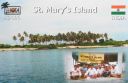
AS-096.jpgAS-096 India Karnataka State groupSt. Mary's Islands, also known as Coconut Island and Thonsepar, are a set of four small islands in the Arabian Sea off the coast of Malpe in Udupi, Karnataka, India. They are known for their distinctive geological formation of columnar basaltic lava.
|
|
| 2622 files on 66 page(s) |
 |
|
|
|
|
|
|
|
|
14 | |
|
|
|
|
|
|
|
|
 Contact

