VK4MA QSL GALLERY VK3AJJ

Gallery of QSL cards for ham radio contacts made by vk4ma / vk3ajj


Home Contact Login
radios.net.au Album list Last uploads Last comments Most viewed Top rated My Favorites Search
Home > IOTA Island QSLs (1091 worked - 1090 confirmed) - I no longer submit QSLs to the IOTA checkpoint as I do not agree with recent rules changes made to this program > Oceania Islands IOTA QSL Album
Click to view full size image

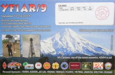
OC-275 West Papua's Coastal Islands South

Pulau Yos Sudarso or Pulau Dolak is an island separated only by the narrow Muli Strait from the main island of New Guinea. It is part of the Merauke Regency, in the Indonesian province of Papua. The island is leaf-shaped, about 165 km (103 mi) long with an area of 11,740 km2 (4,530 sq mi). It was known as Frederik Hendrik Island until 1963. Local and alternative names of the island include Dolok, Kimaam and Kolepom. The island has a pop of 11,000 approx,

Rate this file (No vote yet)